 |
Subsurface Equatorial Pacific Temperatures
APRIL 2011
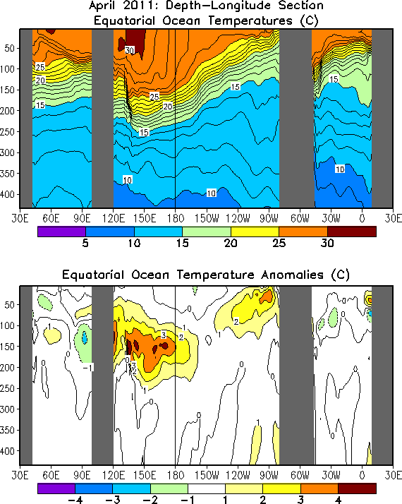
FIGURE T17.
Equatorial depth-longitude
section of ocean temperature (top) and ocean temperature anomalies
(bottom). Contour interval is 1C. Dashed contours in bottom panel
indicate negative anomalies. Data are derived from the NCEP's global
ocean data assimilation system which assimilates oceanic observations
into an oceanic GCM (Behringer, D. W., and Y. Xue, 2004: Evaluation of the global
ocean data assimilation system at NCEP:
The Pacific Ocean. AMS 84th Annual Meeting, Seattle, Washington, 11-15).
Anomalies are departures from the 1981-2010 base period means.
|
 |


