 |
Sea Surface Temperature and Sea Level From Eastern Pacific
GOES Stations
David B. EnField, NOAA/AOML
Instituto Oceanografico de la Armada Guayaquil, Ecuador
Direccion de Hodrografia y Navigacion de la Marina, Callao, PERU
JANUARY 2010
|
Through
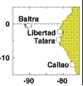
cooperative arrangements with South American institutions, the TOGA
program has maintained a network of nine tide stations and four
meteorological stations in Ecuador, Peru and Chile since the mid
1980's. The stations are maintained by NOAA/AOML and the University of
Hawaii. The hourly data are transmitted to down-link stations via the
GOES satellite in real time and processed. The five-day averages
(pentads) at critical stations give us an effective means of monitoring
coastal conditions with good time resolution and compact data volume.
|
|
The east Pacific warming and higher sea levels that began in December
continue, making this look less like a central Pacific event than it did
before. Strong rains began in Guayaquil in the second week of January,
several weeks after the typical onset period in December. The strong
rains in January may reflect the presence of warmer water off the coast.
|
| |

|
Day of   Sea Sfc Temperature    Sea Level Height (cm)
 Jan     Baltra Talara Callao   Baltra Libertad Callao
------   ------ ------ ------   ------  ------  ------
   3       **    21.8   19.1       **      **    114.7
   8       **    21.5   19.3       **      **    116.1
  13       **    21.8   19.5       **      **    113.3
  18       **    21.2   19.4       **      **    109.2
  23       **    21.6   19.2       **      **    117.5
  28       **    21.1   19.2       **      **    122.1

                       Anomalies
   3       **     2.3    2.8       **      **      4.2
   8       **     1.8    3.0       **      **      5.1
  13       **     1.8    3.1       **      **      1.8
  18       **     1.0    2.9       **      **     -2.8
  23       **     1.2    2.6       **      **      5.1
  28       **     0.5    2.4       **      **      9.4

For further information contact David.Enfield@noaa.gov
 or go to http://www.aoml.noaa.gov/phod/epac/
 ** - Data missing due to hardware failure
|
FIGURE A1.5
Five-day averages of Sea Surface
Temperature (SST, C) and Sea Level Height (SLH, cm) from GOES receiving
stations in Ecuador and Peru. Dashed line and shading show climatology
departures.
|
 |


