|
Introduction
This suite of products examines the season-by-season
and region-by-region variations in 3-month average temperatures and total precipitation observed
in the U.S. during past moderate-to-strong La Niña episodes, and compares
these against a complete 45-year (1952/1953 - 1996/1997) distribution of historical occurrences.
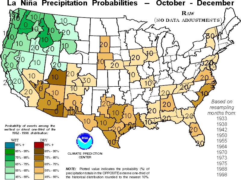
Some of the graphics utilize the actual observed ("raw") data recorded
during past La Niña episodes, and some use historical data that have been
adjusted for temperature and precipitation trends that began in the mid-1960's
extrapolated to 1999/2000. The latter subset of products represents an
attempt to quantitatively account for the combined effects of two significant
climate signals: The La Niña episode, and long-term trends in average temperature
and total precipitation. All of these products are contrasted against a
45-year climatology ending just before the exceptionally strong El Niño episode of 1997-1998.
In terms of appearance, the full suite of products can be divided into
two sets: Maps of conditional probability distributions for the U.S., and
detailed regional statistics. Below, we first describe what is shown in
each of these product subsets, then go on to describe the methods used
to generate the figures.
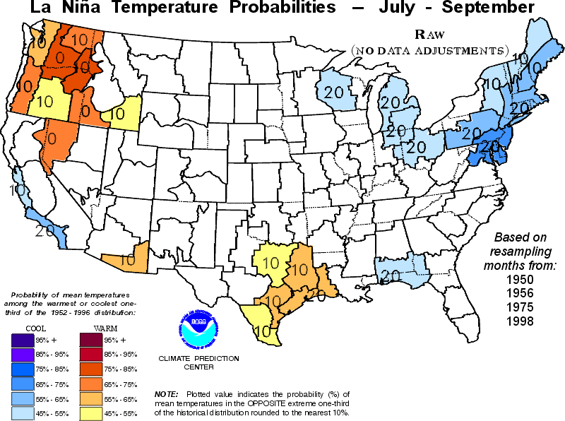
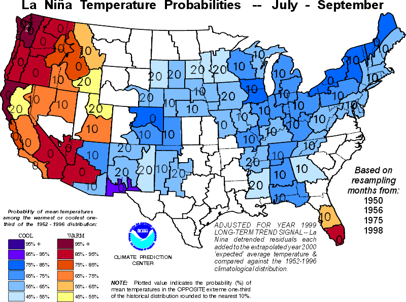
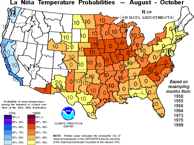
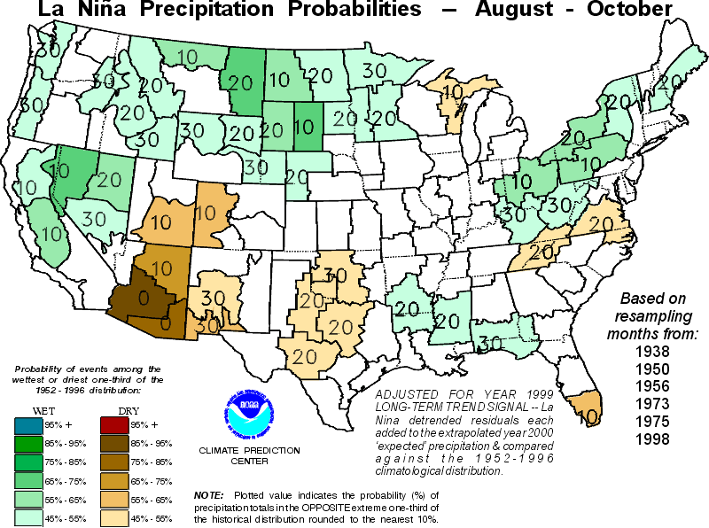
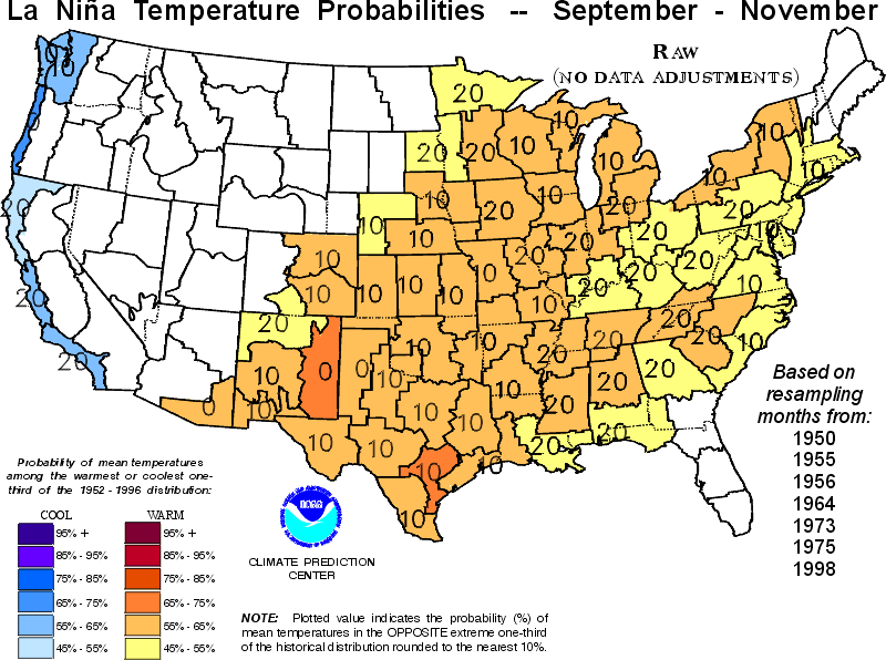
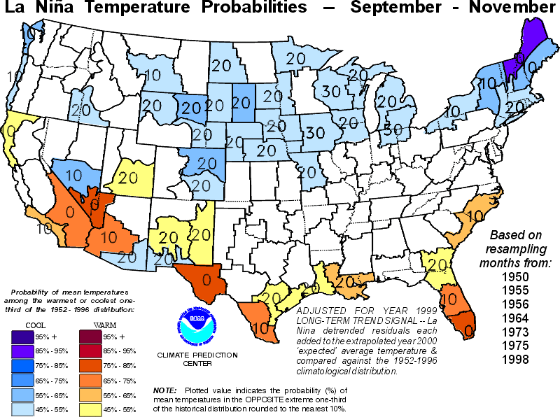
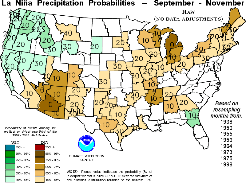
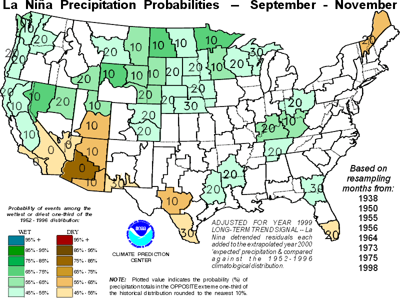
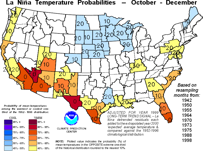
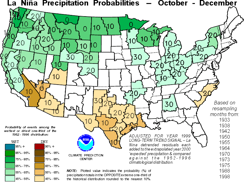
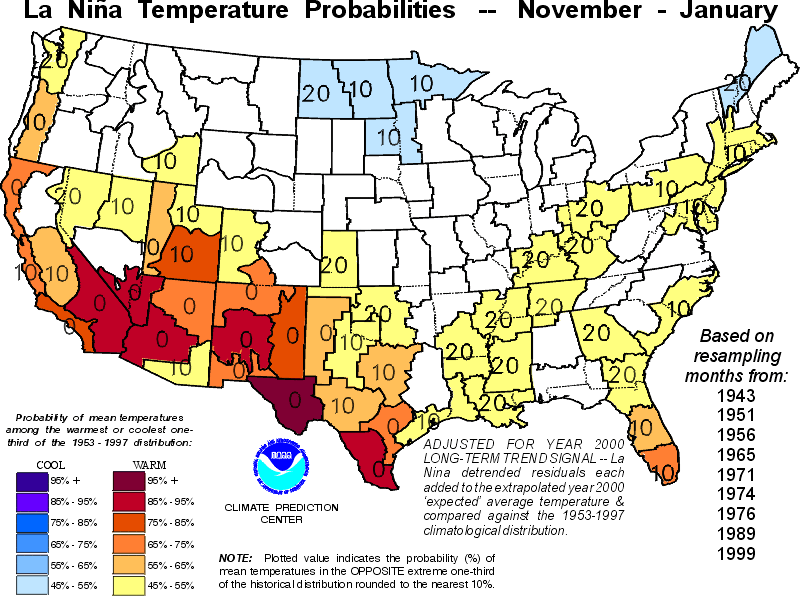
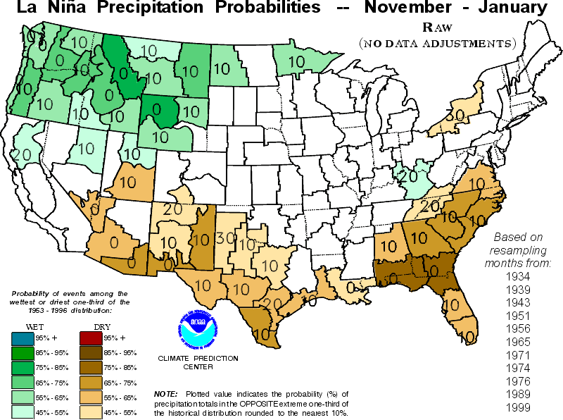
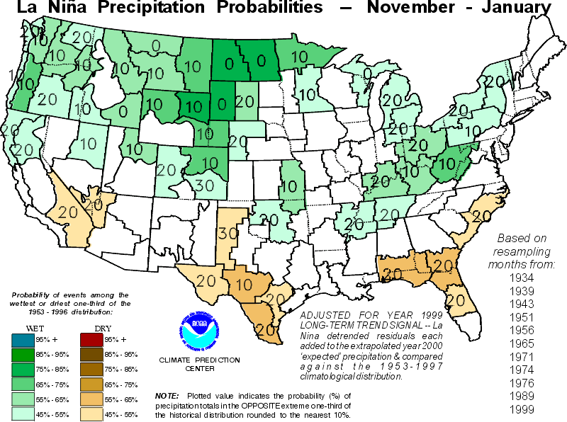
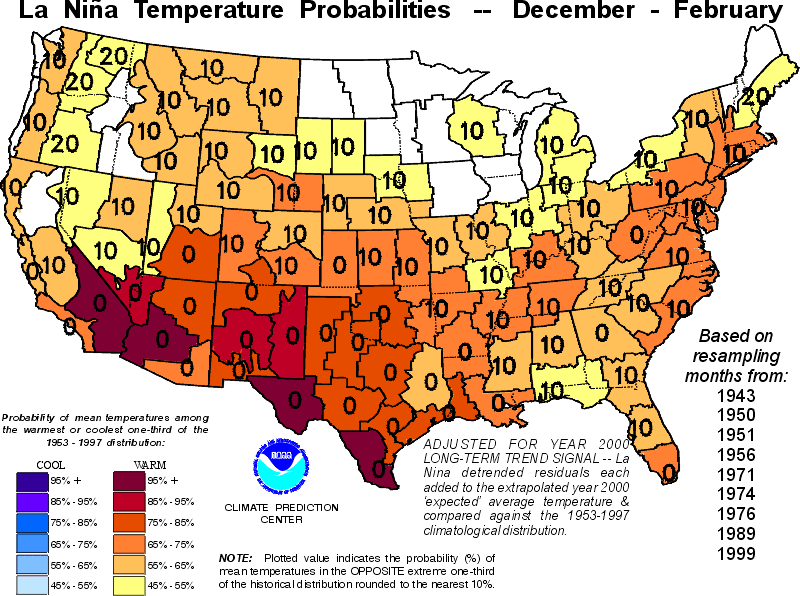
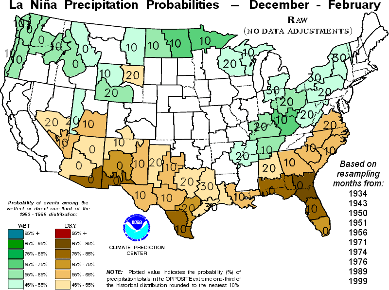
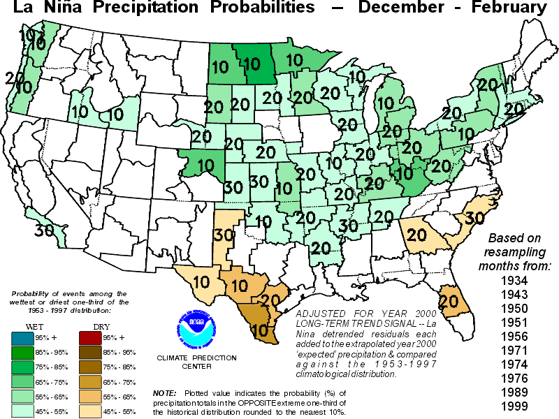
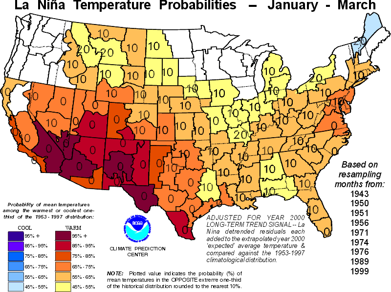
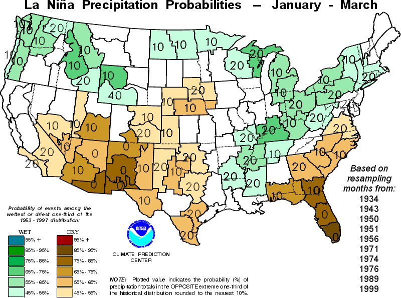
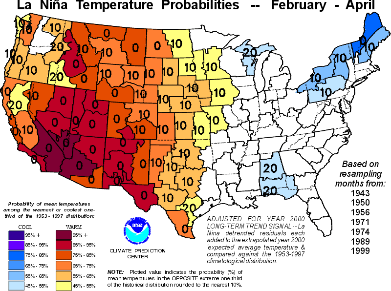
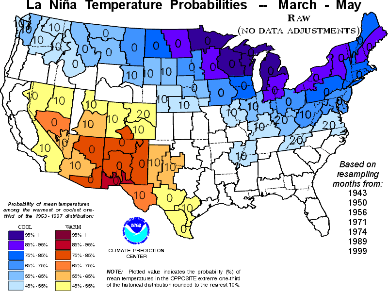
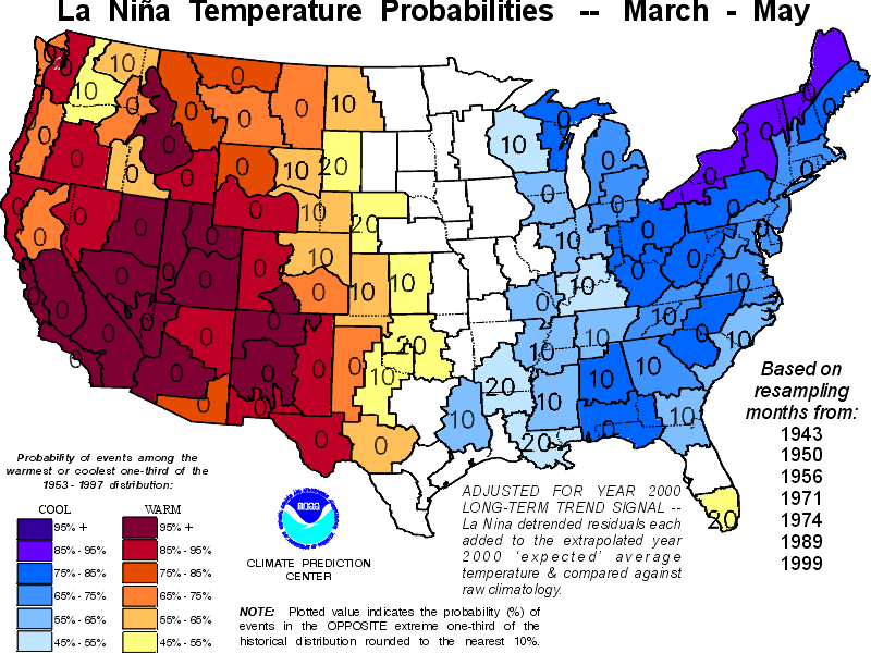
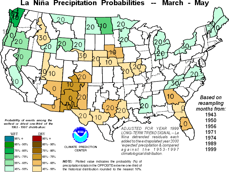
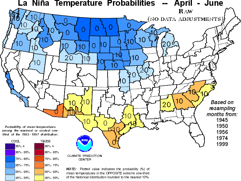
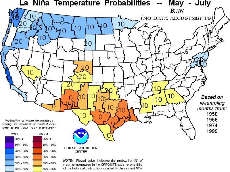
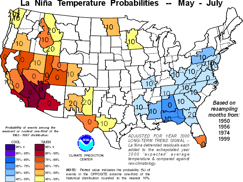
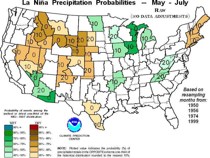
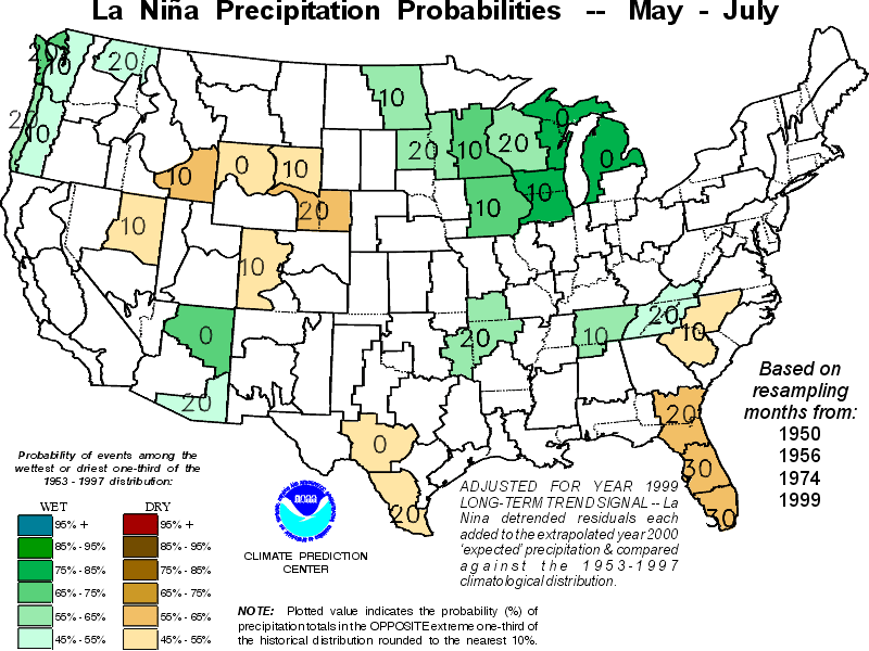
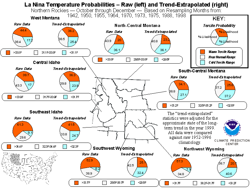
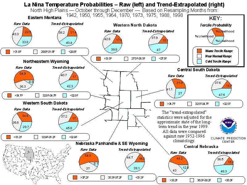
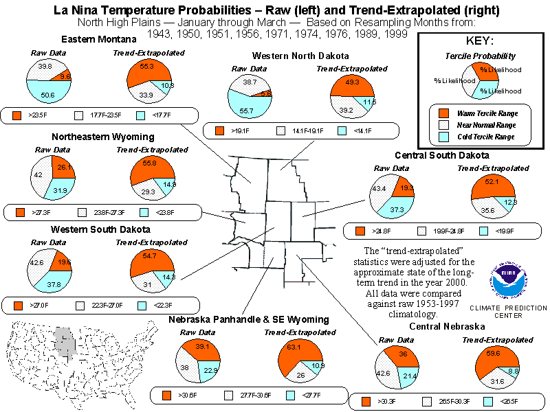
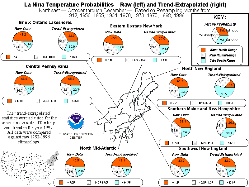
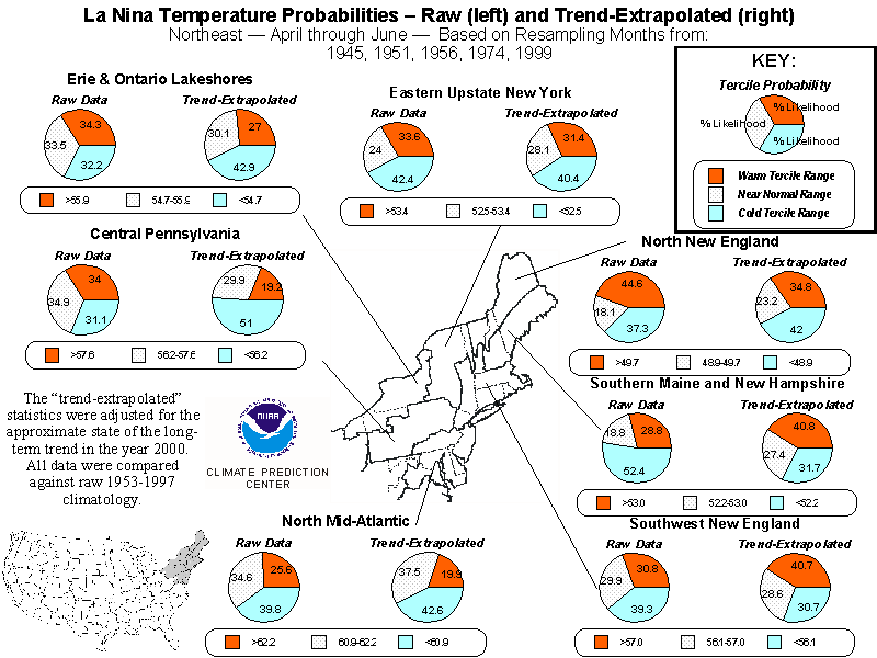
The U.S. Probability Distribution Maps
Probability distribution maps encompassing the contiguous 48 states
are provided for overlapping three-month periods. There are 11 maps (one
for each 3-month period except June - August) showing raw (non-adjusted)
temperature probabilities, 11 showing raw precipitation probabilities,
11 showing trend-adjusted temperature probabilities, and 11 showing trend-adjusted
precipitation probabilities, making a total of 44. In each of these maps,
areally-averaged data dividing the country into 102 climate regions of
approximately equal area were used, and the areas covered by each region
are shaded as a unit.
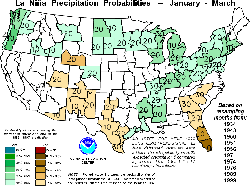
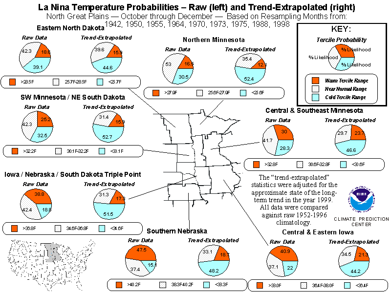
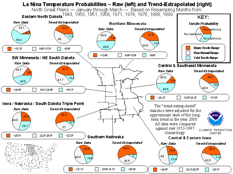
All of these maps show the conditional probabilities that mean temperatures
or total precipitation will rank among the highest and lowest one-third
of the 45-year climatological record (terciles), given a moderate-to-strong
La Niña episode (and also, for the trend-adjusted maps, given the continuation
of long-term trends through the valid period). This information is depicted
only for those regions where the probabilities for the tercile classes
of above, near, and below normal departed sufficiently from a uniform distribution
such that the chances of this departure being an accident were less than
about 10%.
The probability for the class the distribution is skewed towards is
color-coded. For example, when the highest probability in a given region
is for the warmest (wettest) class, this probability is denoted by yellow
and red (green) shades; when the highest probability is for the coldest
(driest) class, it is indicated by blue (brown and orange) shades; etc.
For each shaded climate region on each chart, the probability for the opposite
tercile class (for example, the likelihood for the cold tercile in regions
shaded red) is rounded to the nearest 10% and plotted as a value in the
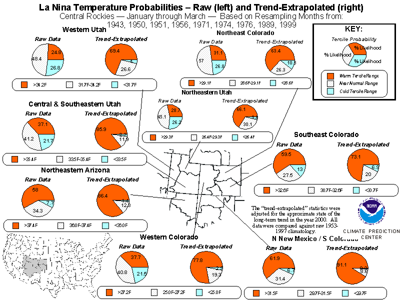
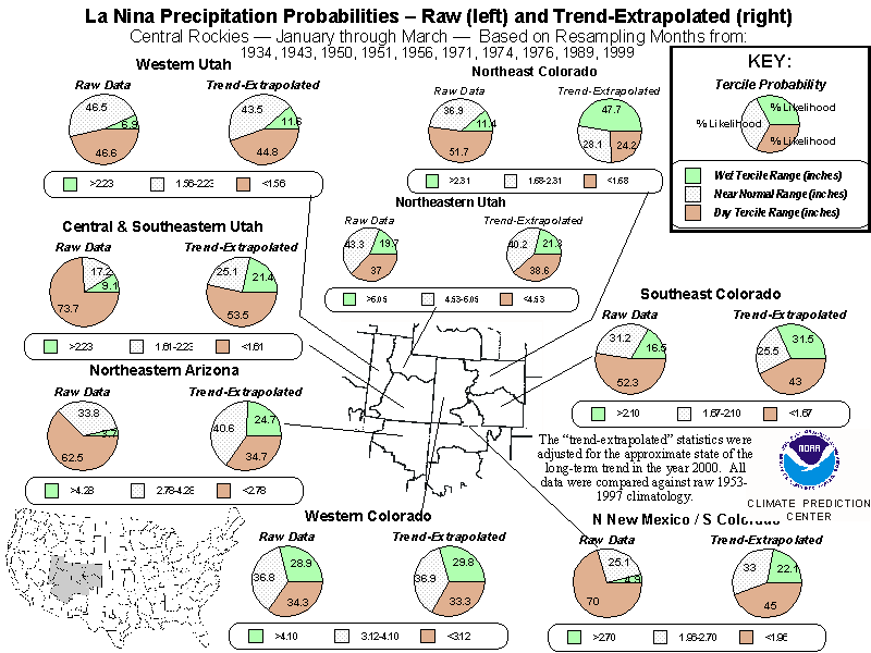
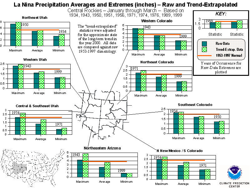
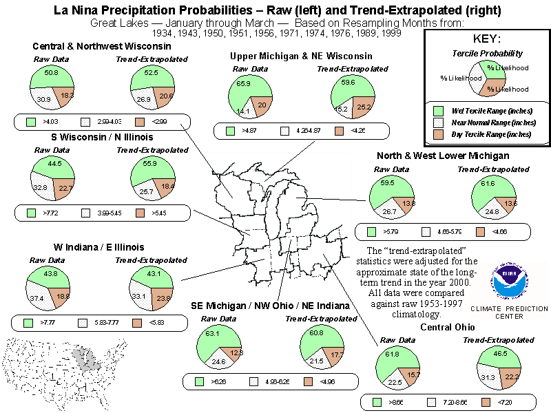
region. As an example, look at the January - March
trend-adjusted temperature probabilities. The climate region in
southeastern Colorado has a moderately dark orange shade and the number
‘10' plotted inside. The shading is in the yellow/red family of colors,
so the distribution is skewed towards the warmer-than-normal class. From
the color key, one can see that the region has a 65% to 75% probability
of recording a January - March mean temperature in the top one-third of
the 1953-1997 distribution. The ‘10' indicates the likelihood of the opposite
tercile rounded to the nearest 10%, so there is a 5% to 15% probability
of a below-normal January-March mean temperature. Finally, by adding the
highest and lowest probabilities in these ranges together and subtracting
the result from 100, one can determine the approximate probability for
the near-normal category, which is 10% to 30%. Exact probabilities for
each class are included in the detailed regional presentations described
next.
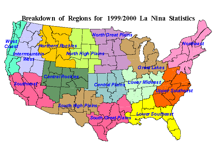
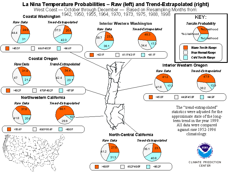
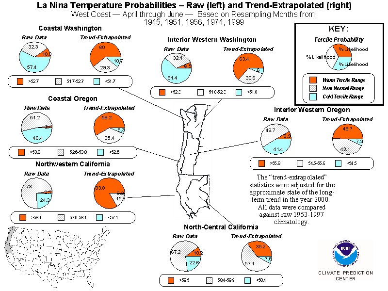
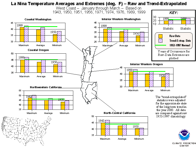
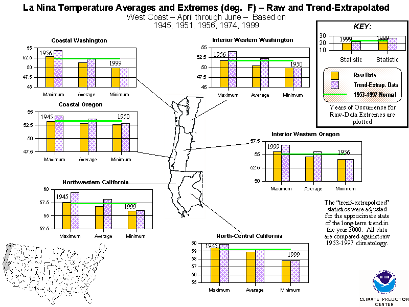
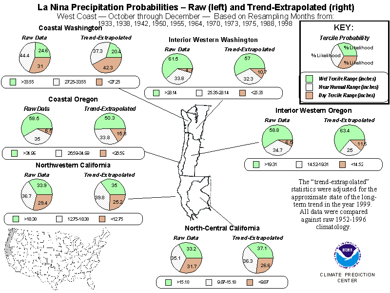
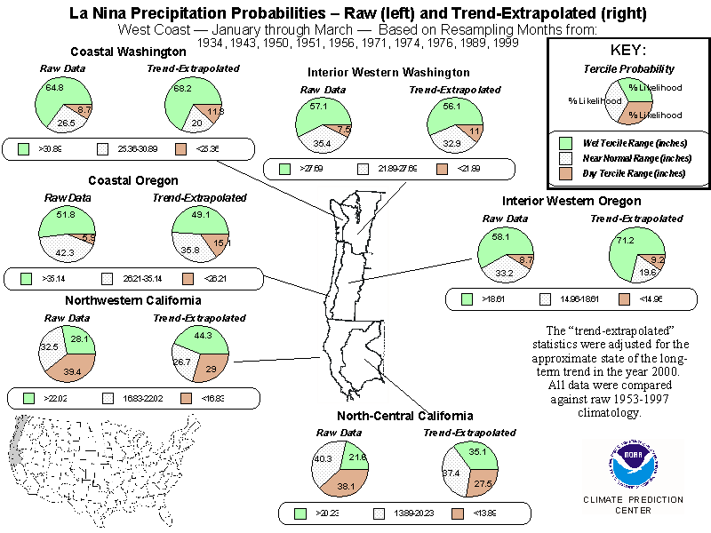
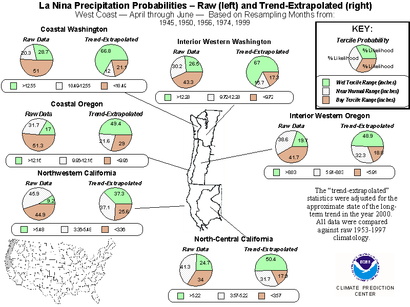
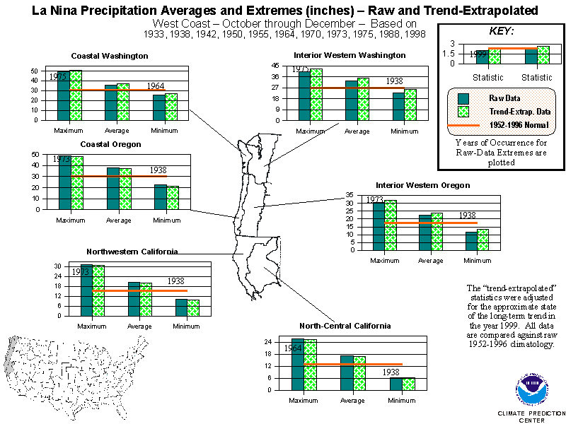
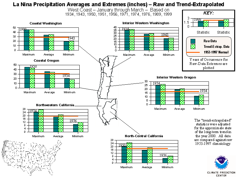
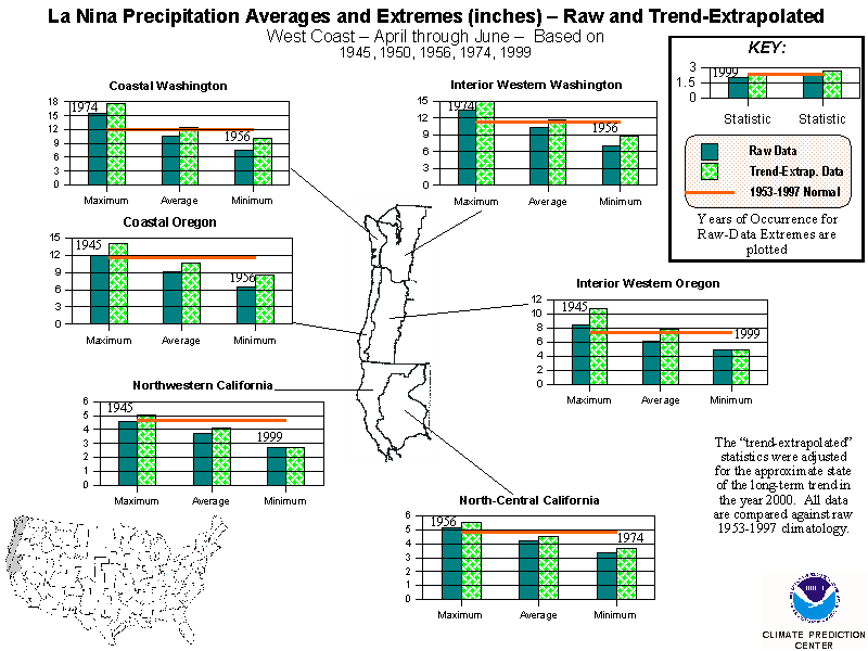
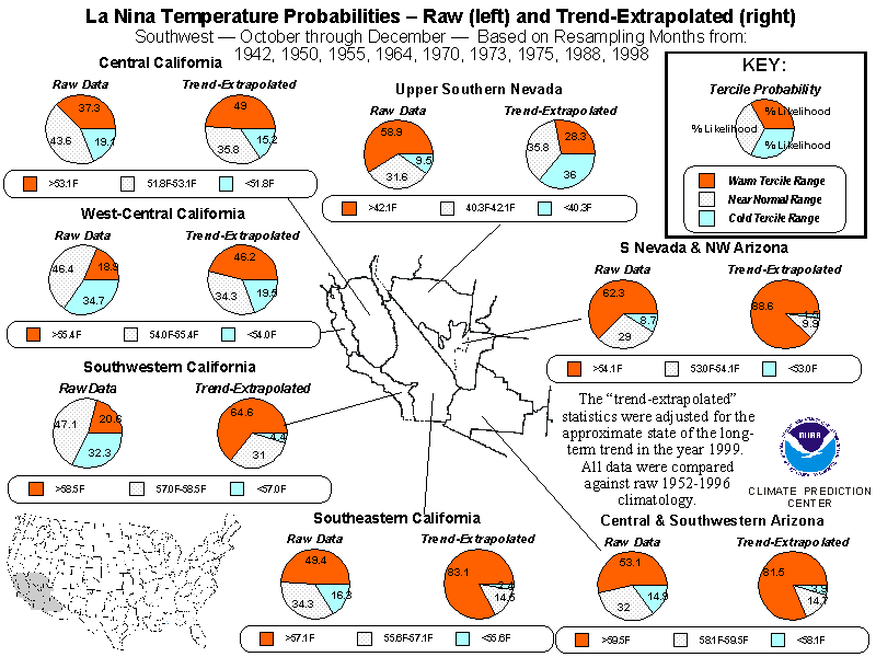
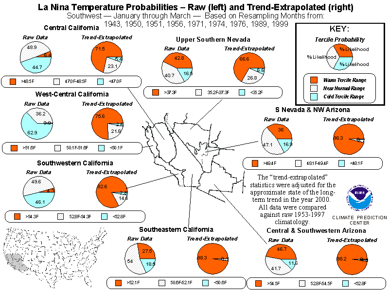
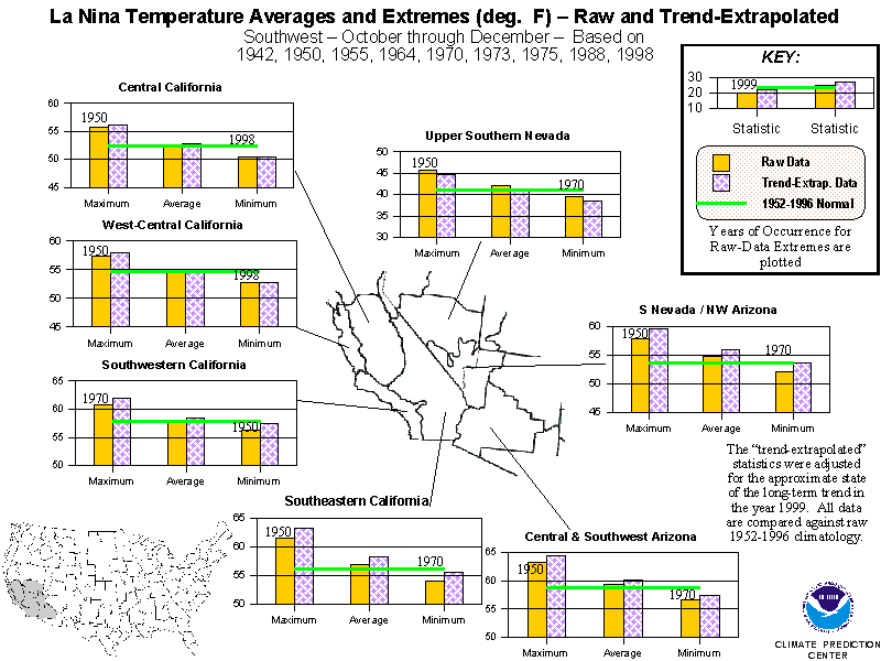
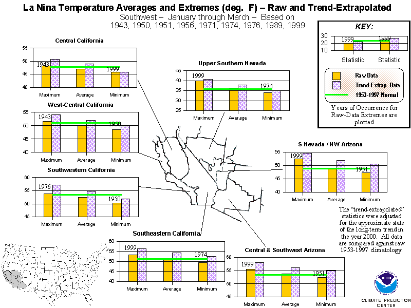
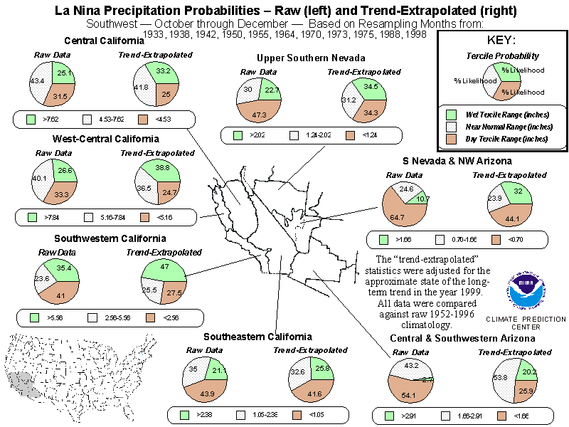
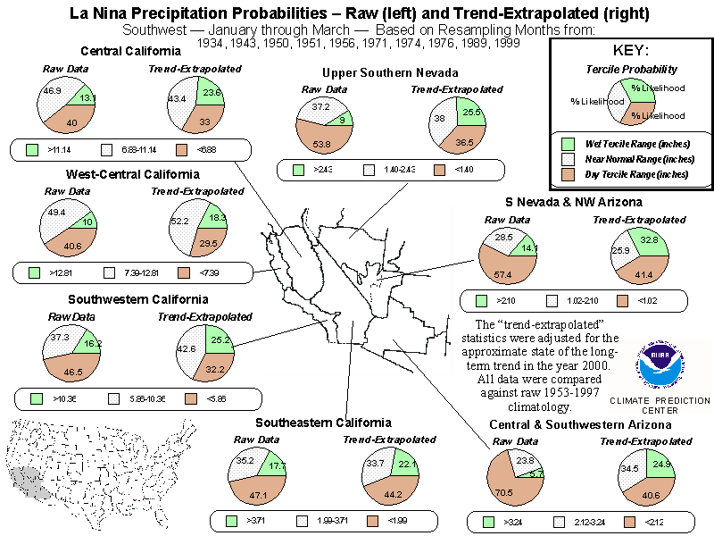
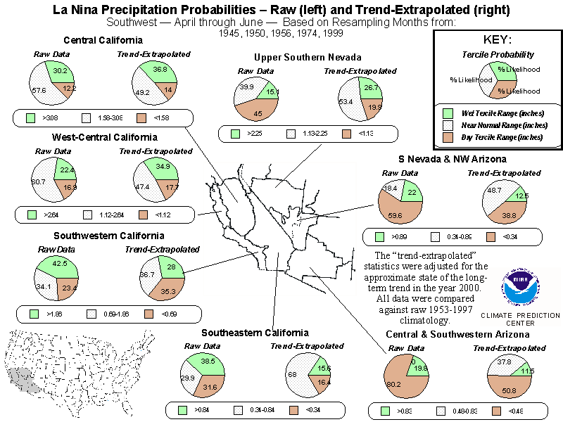
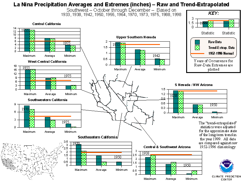
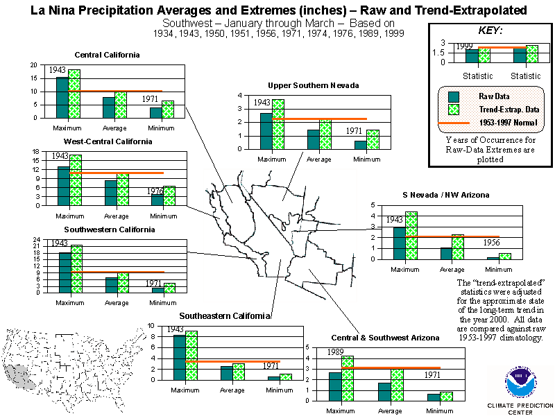
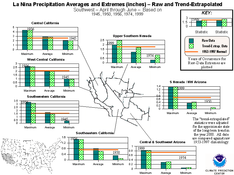
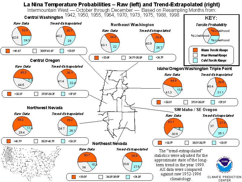
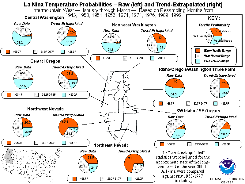
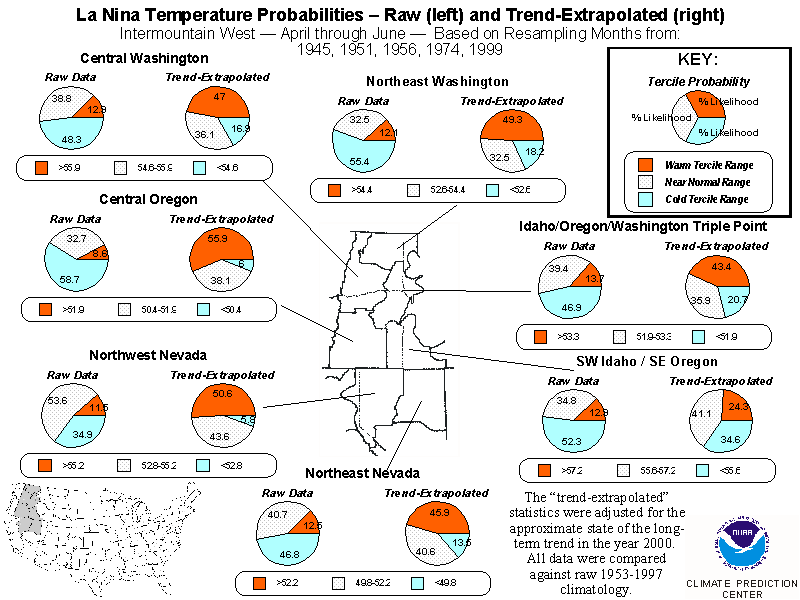
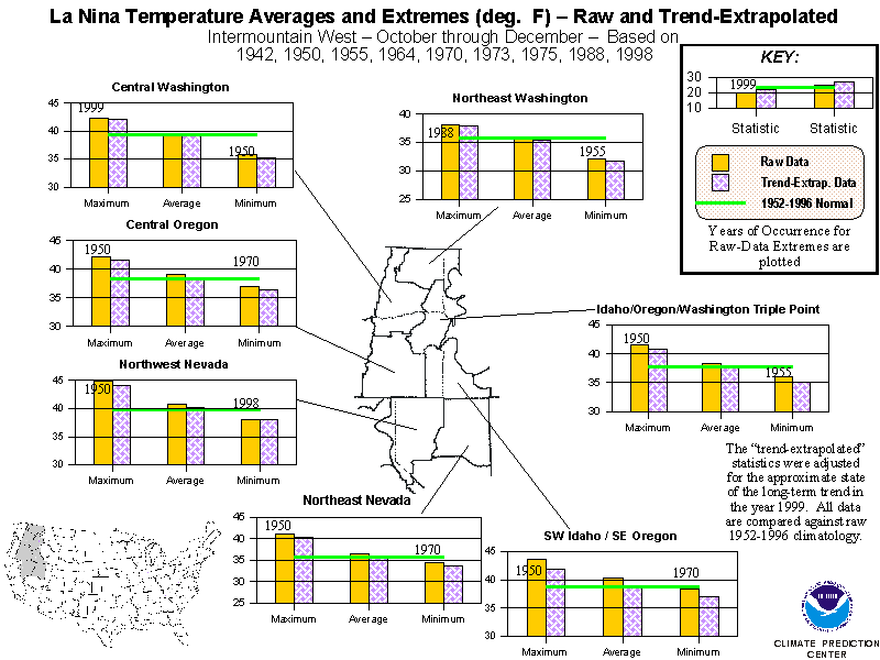
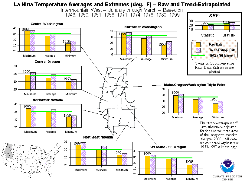
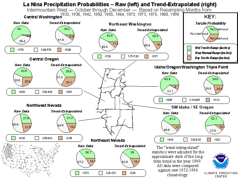
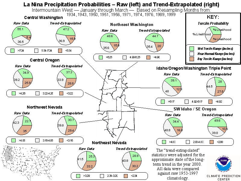
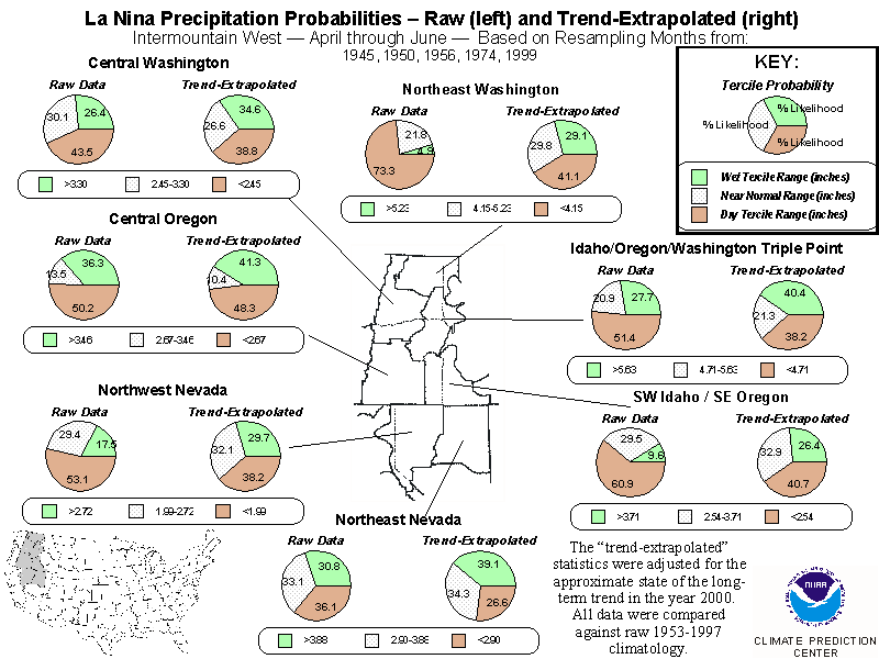
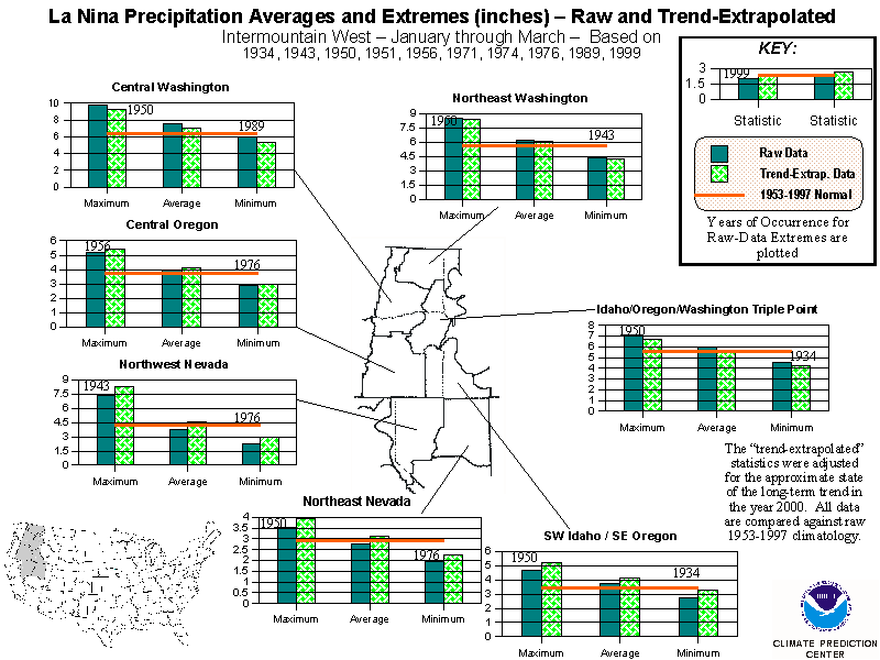
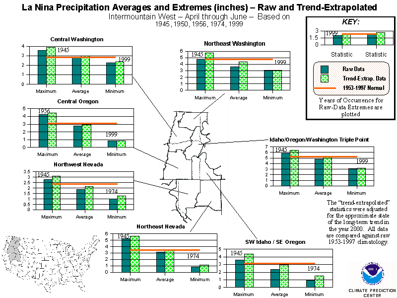
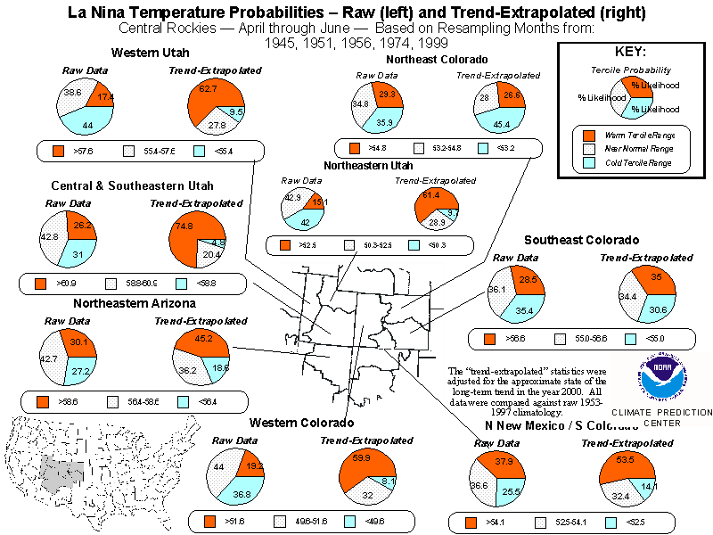
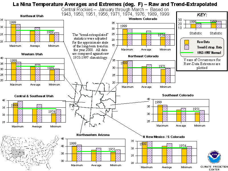
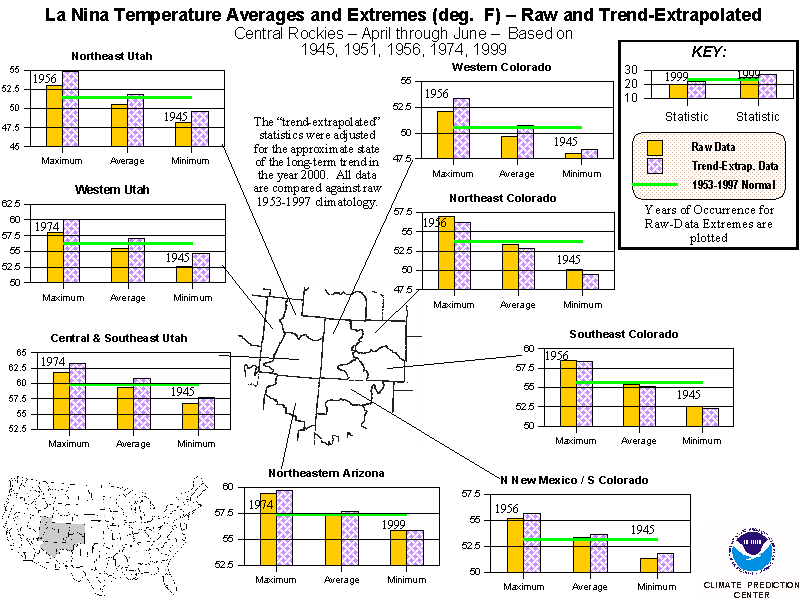
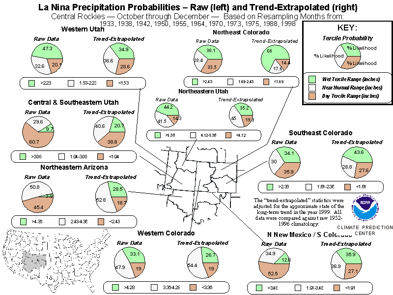
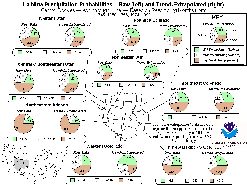
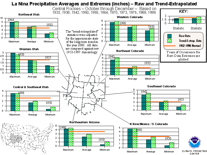
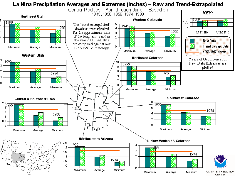
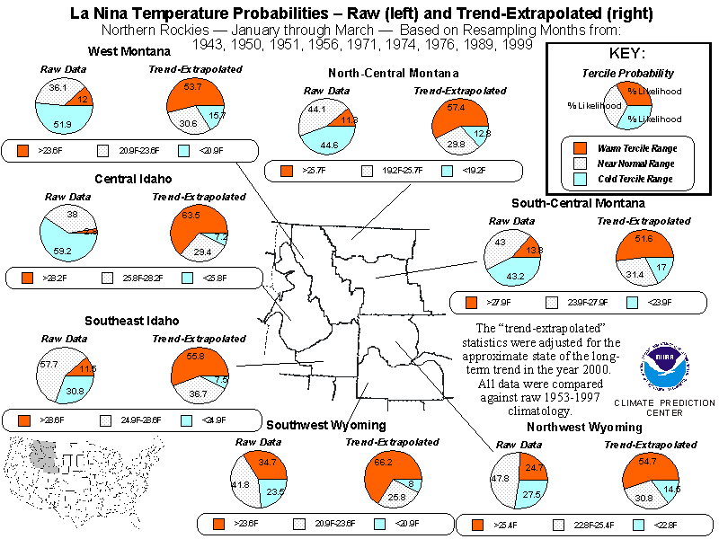
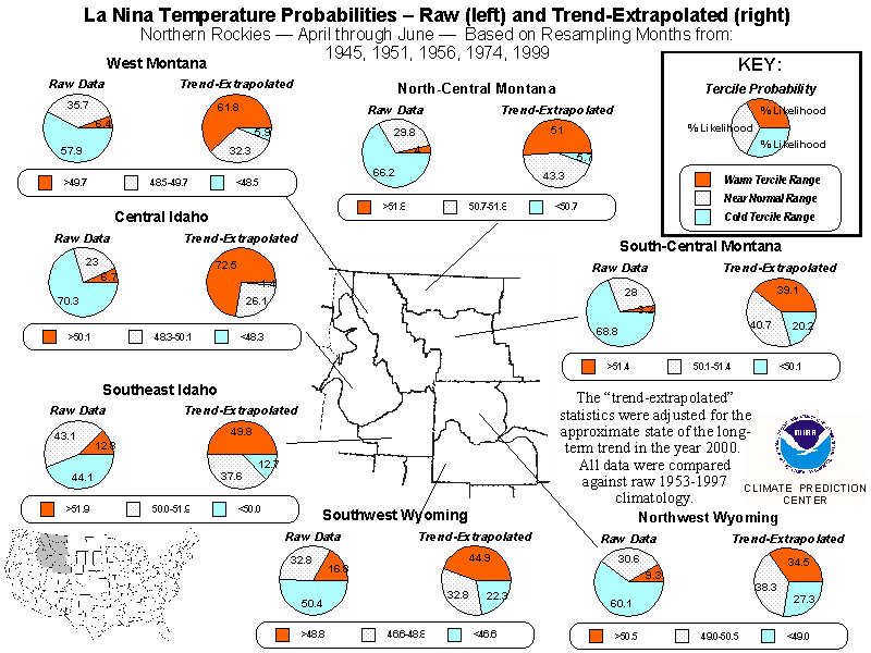
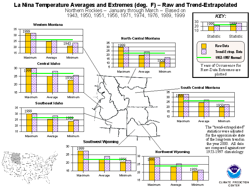
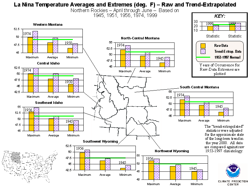
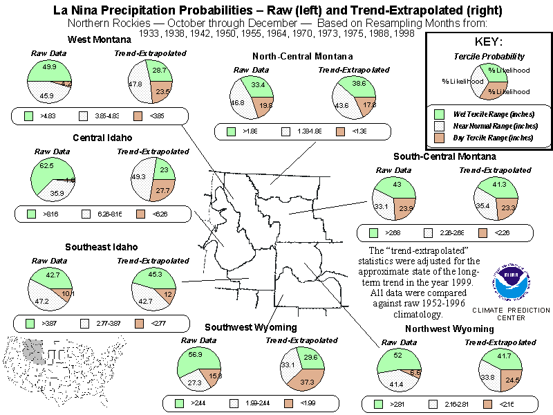
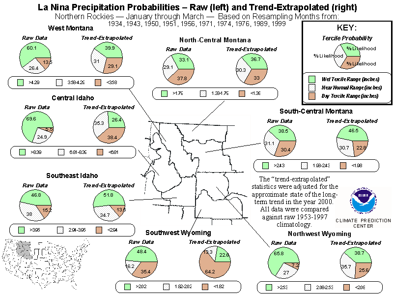
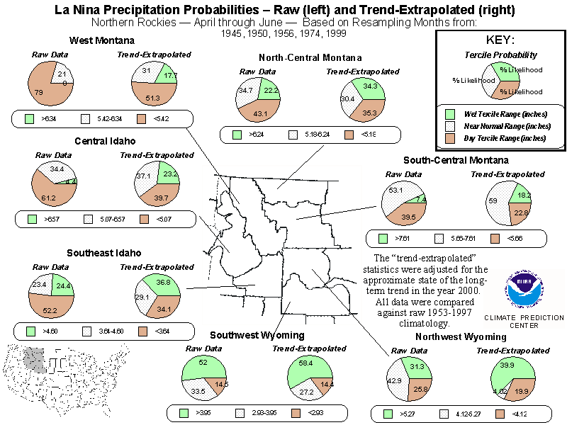
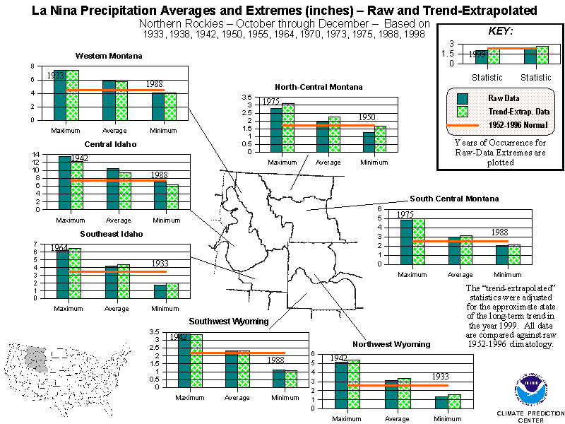
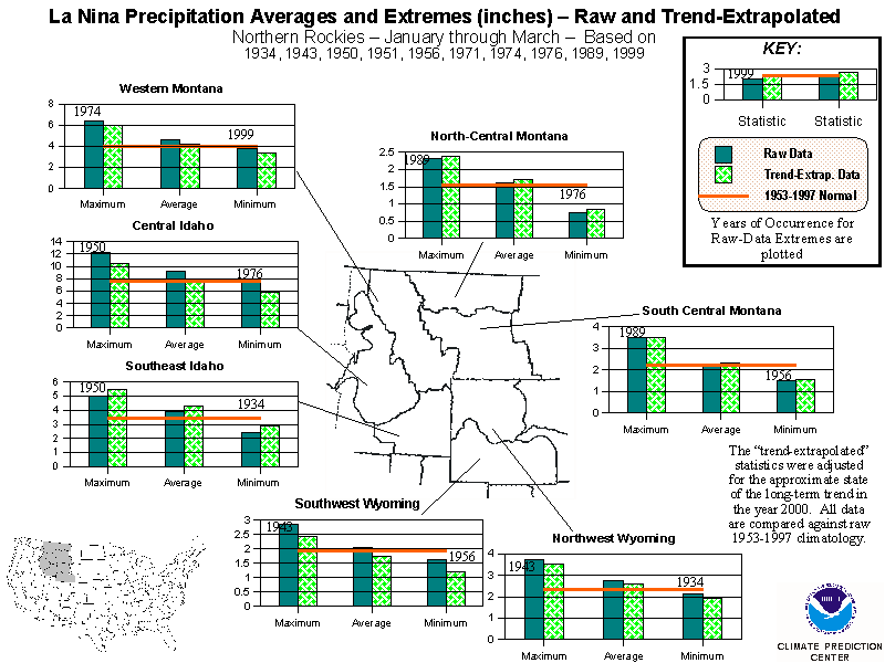
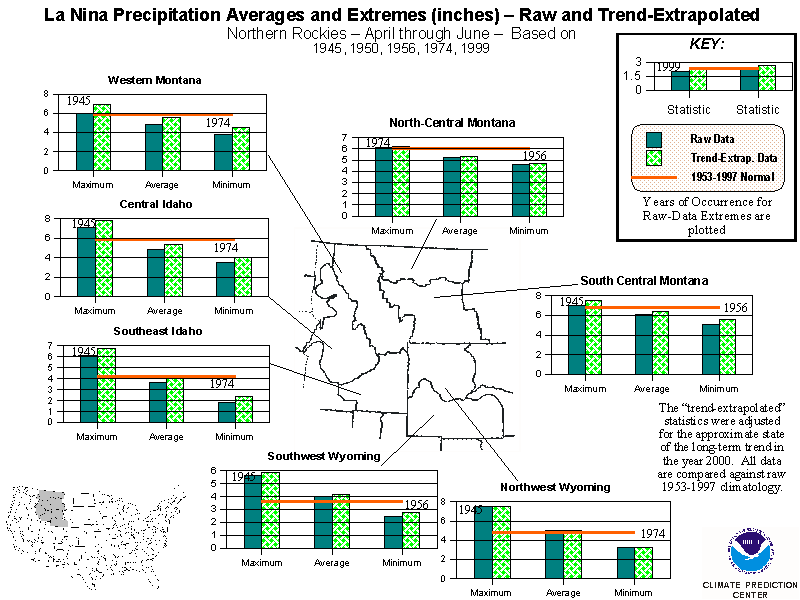
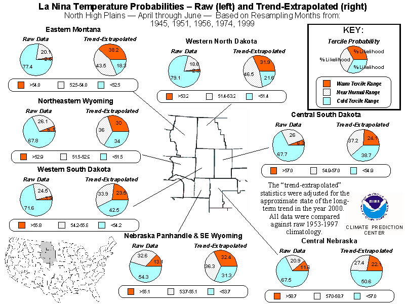
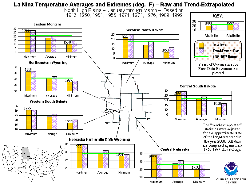
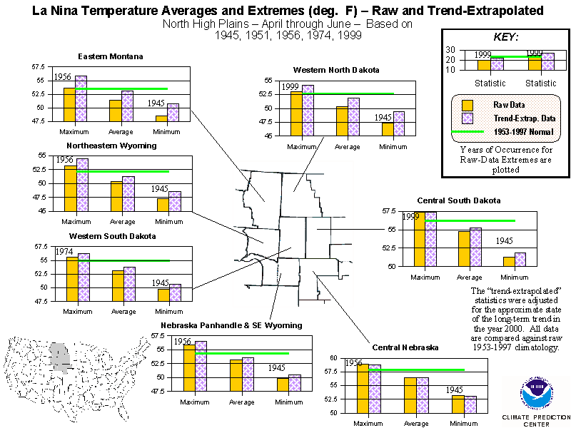
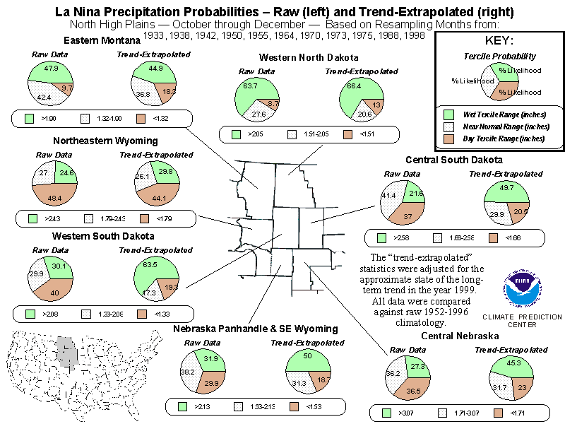
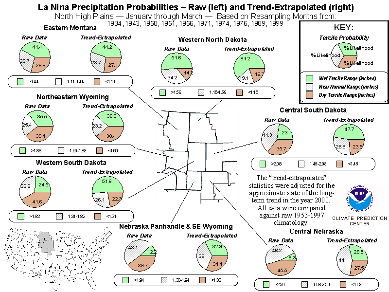
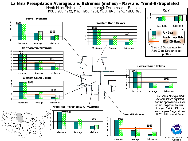
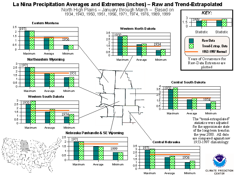
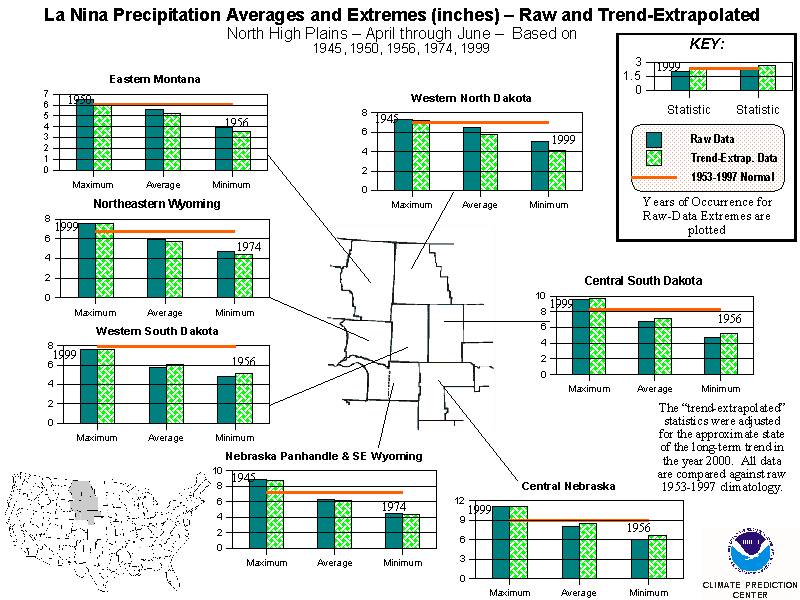
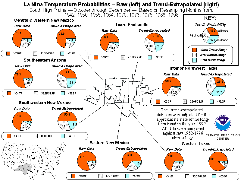
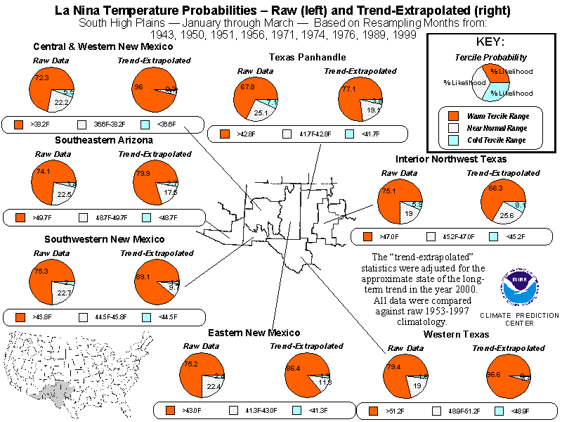
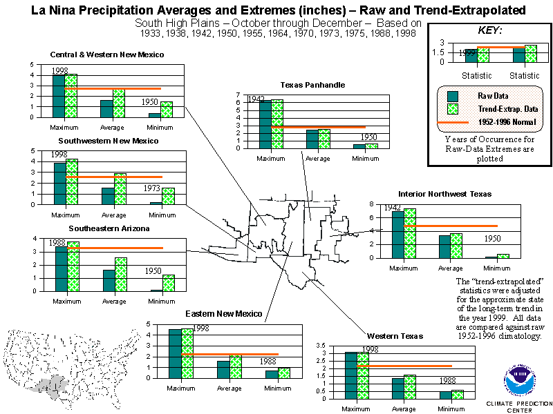
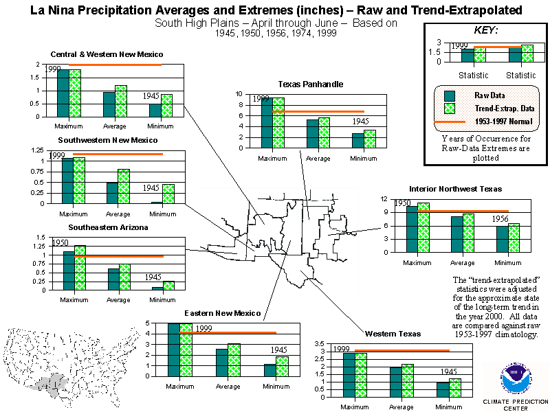
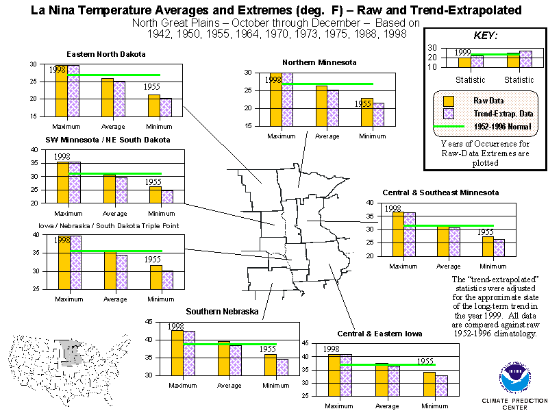
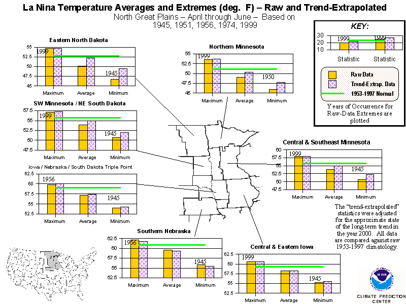
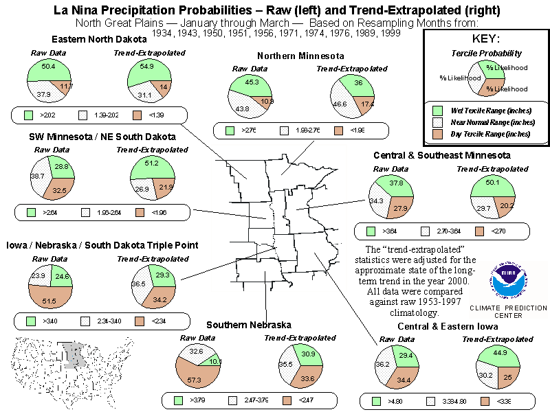
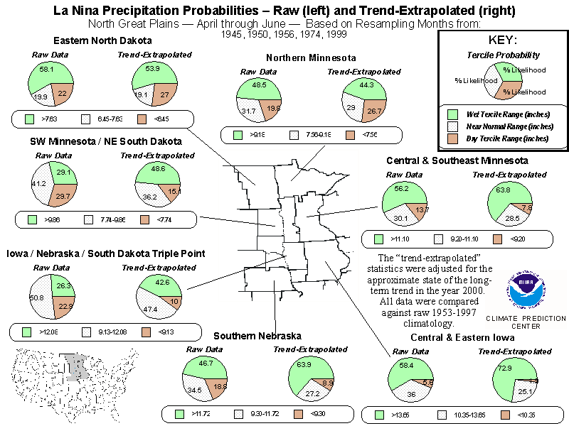
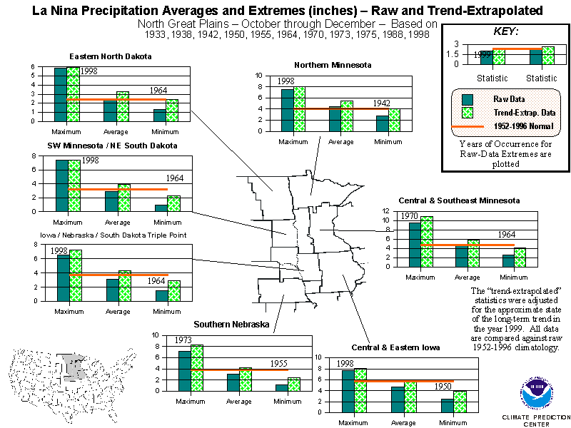
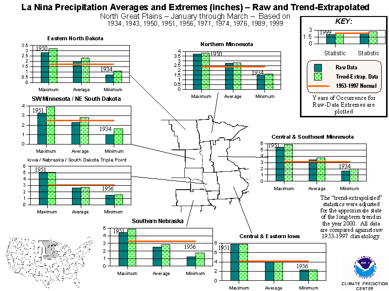
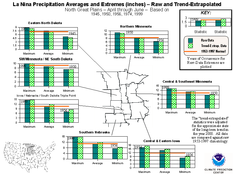
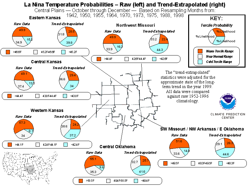
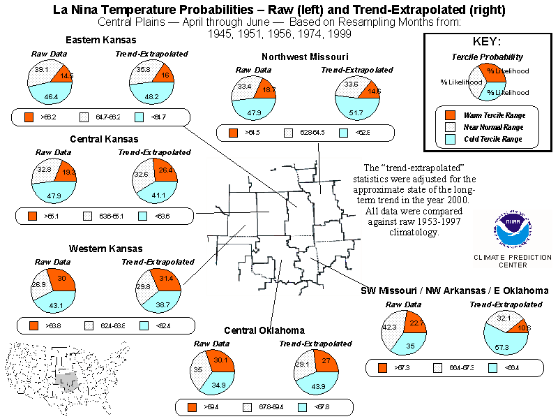
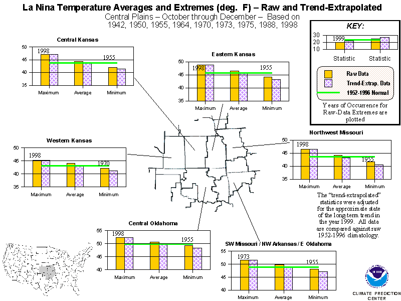
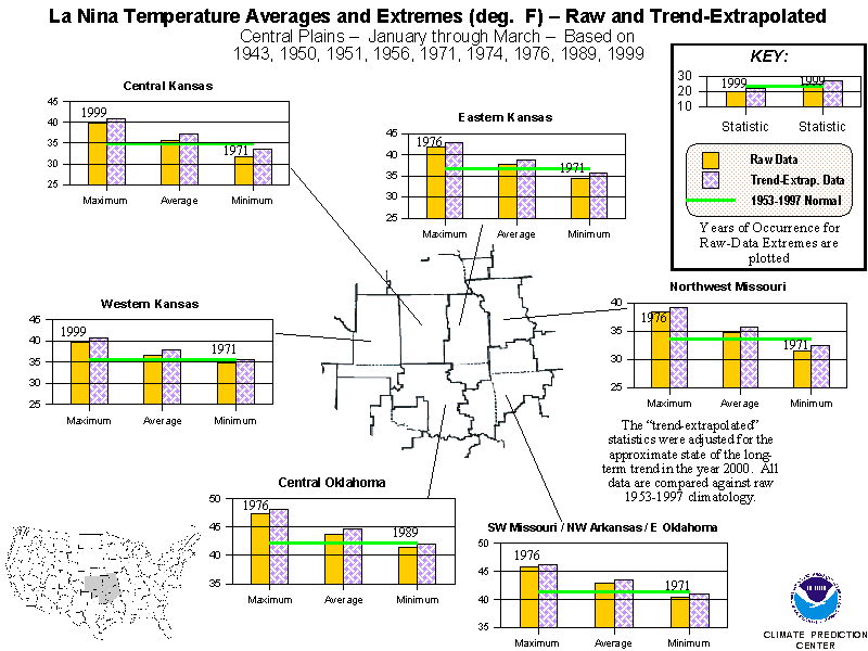
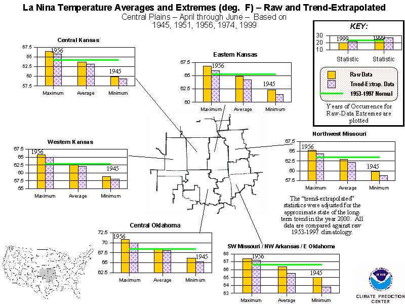
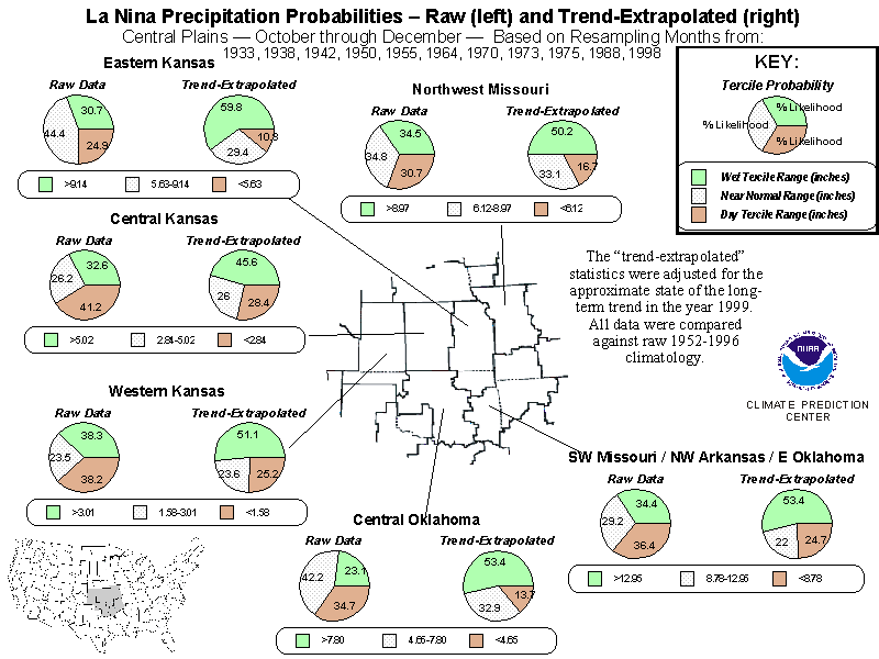
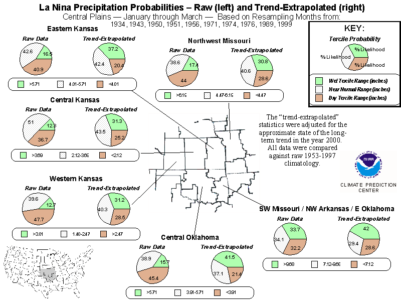
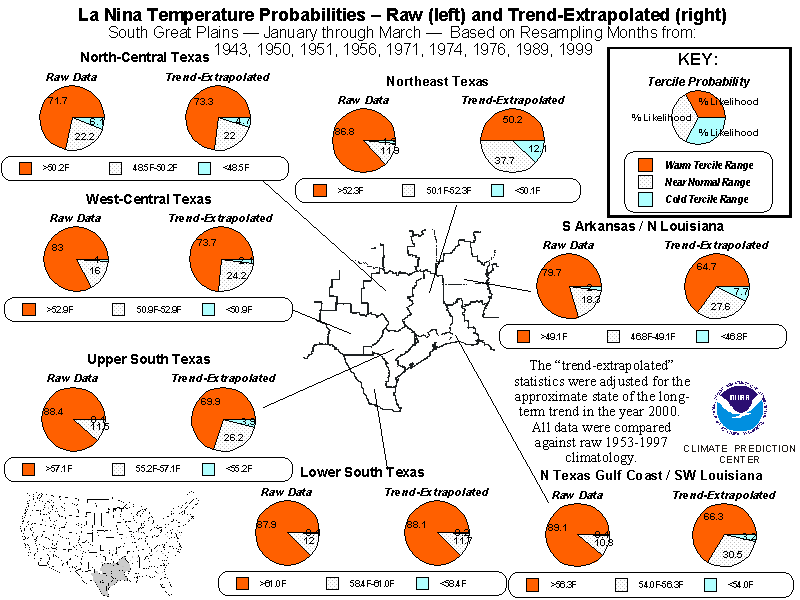
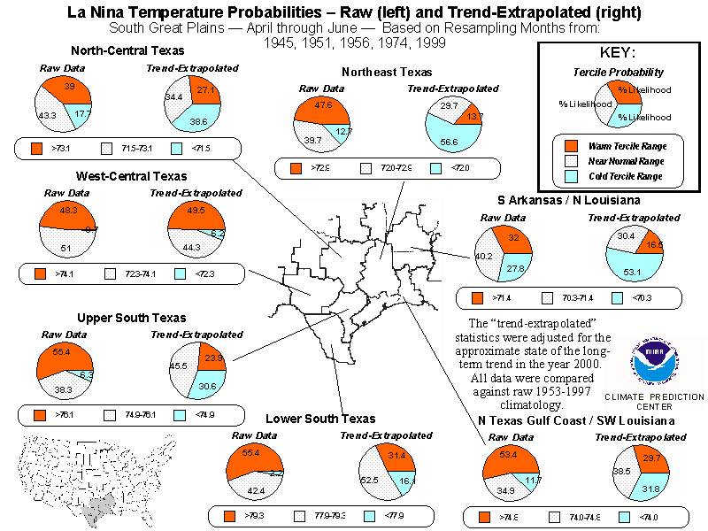
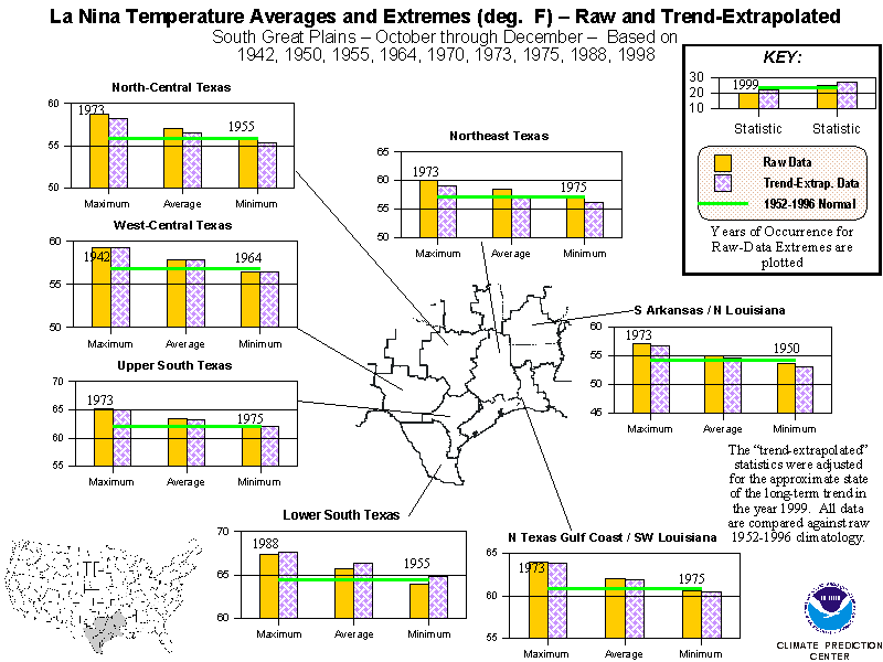
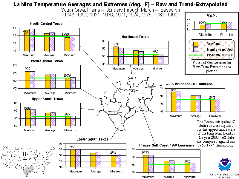
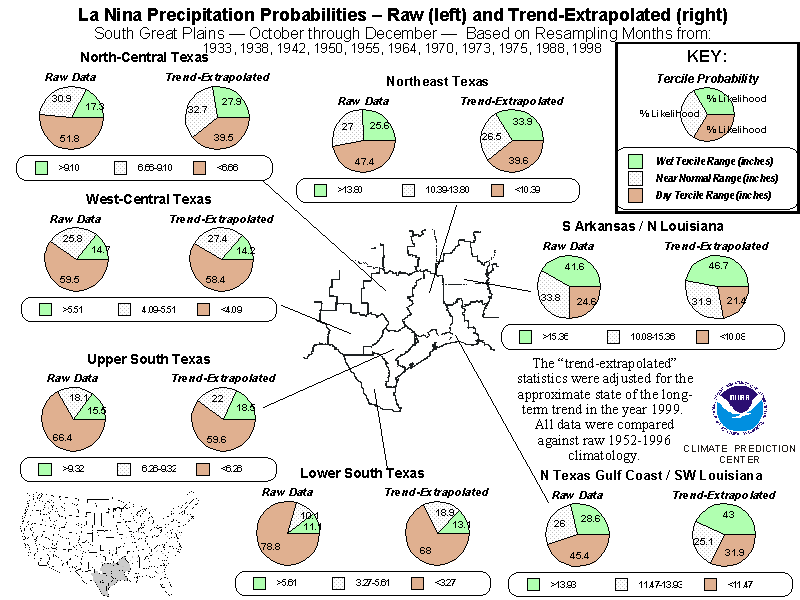
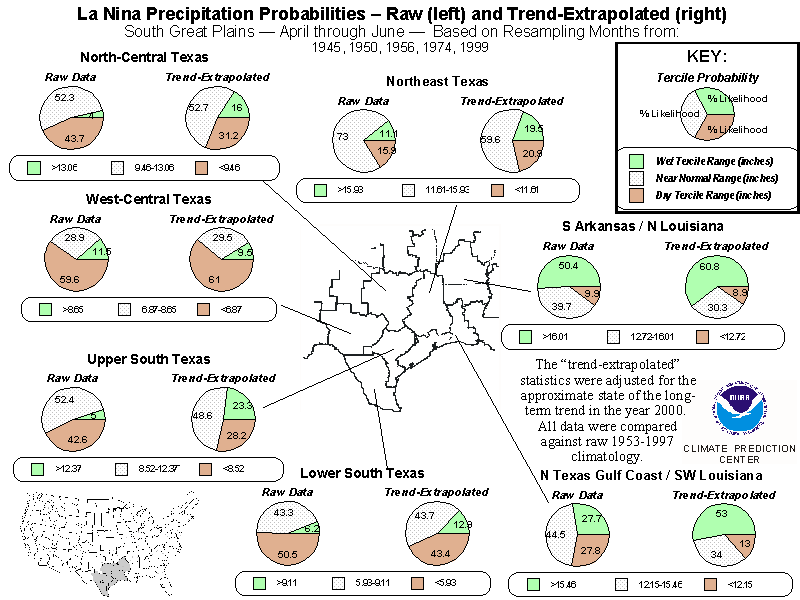
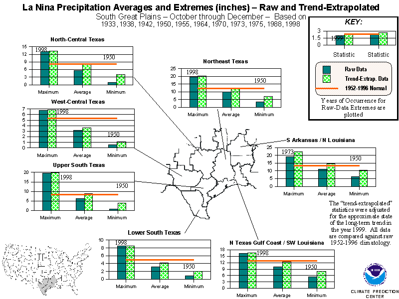
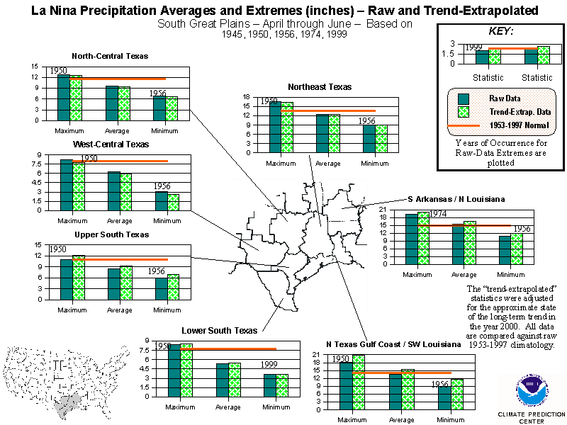
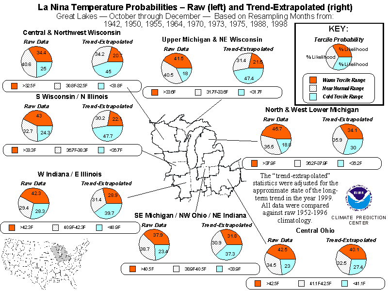
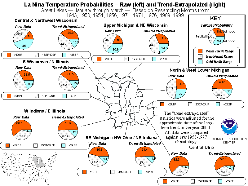
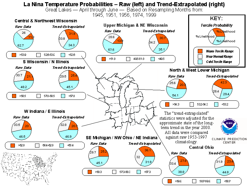
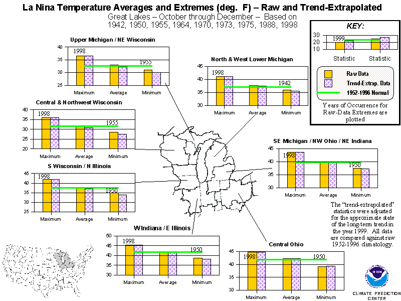
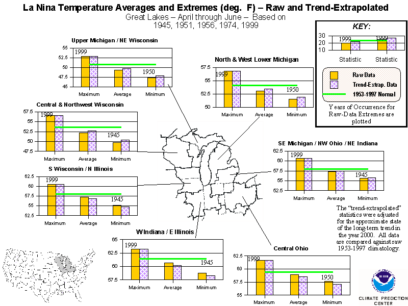
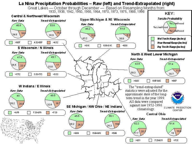
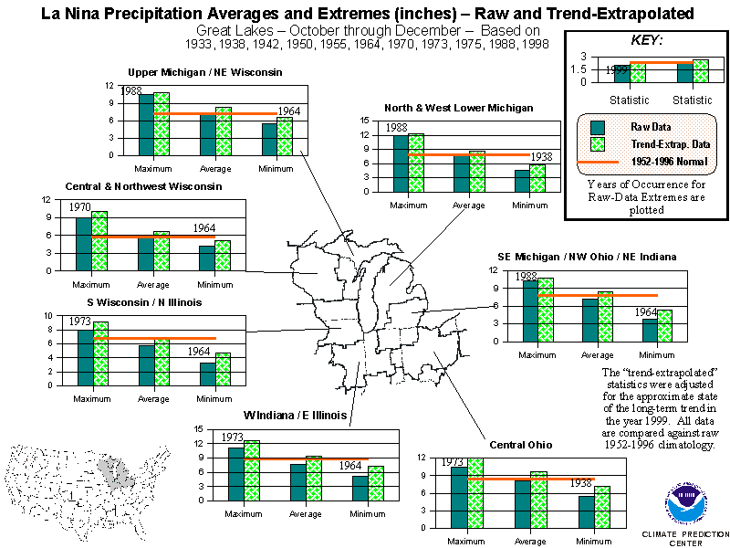
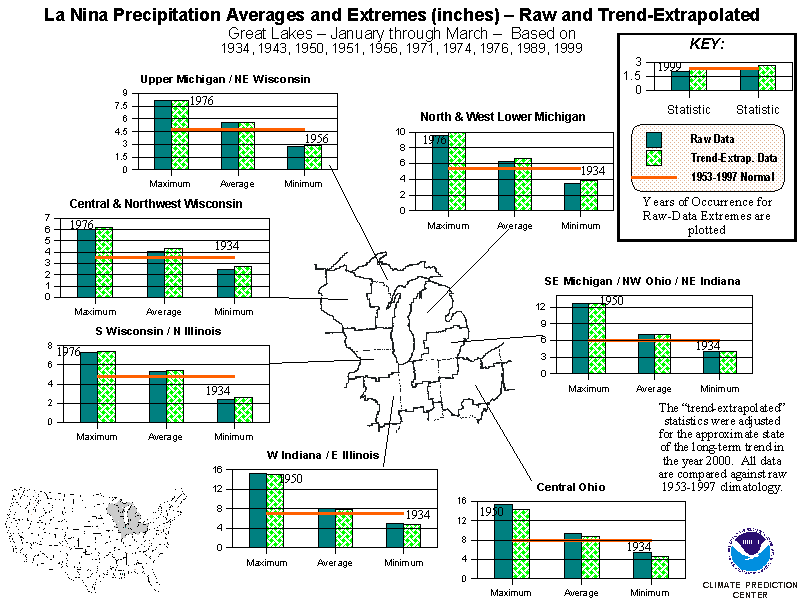
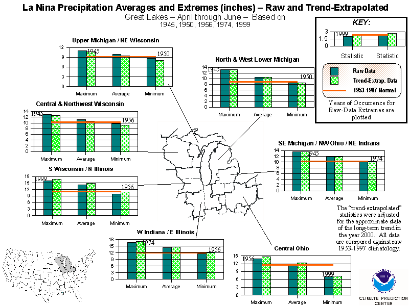
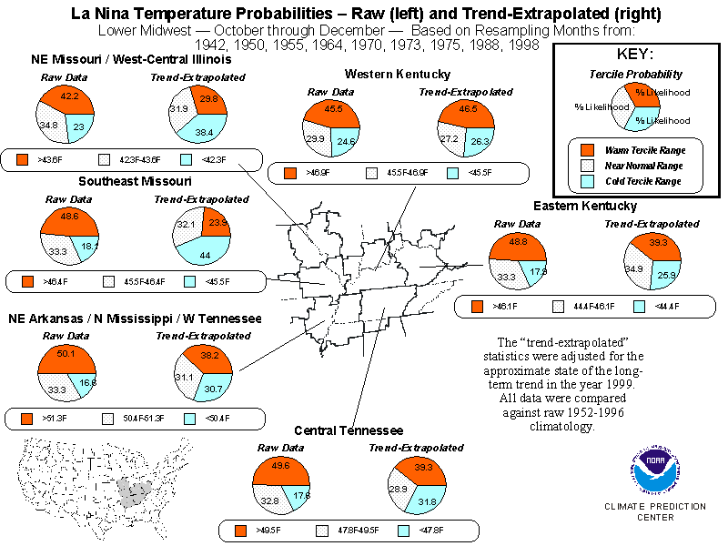
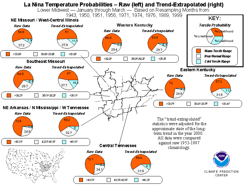
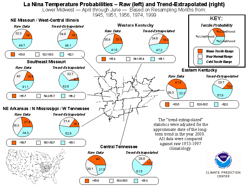
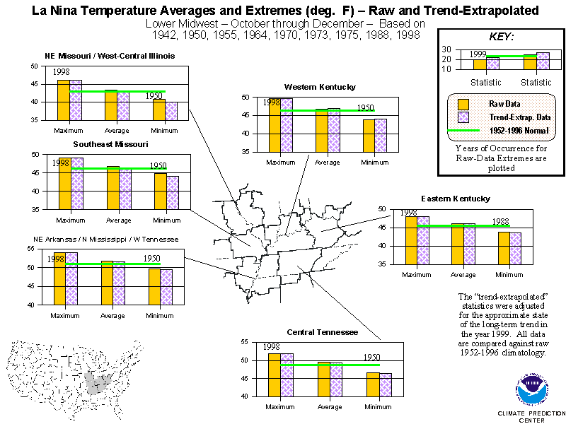
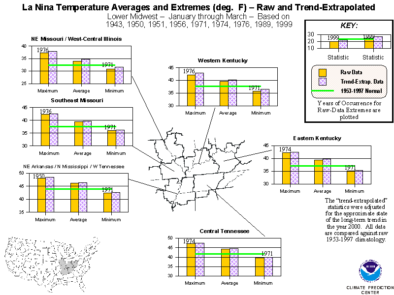
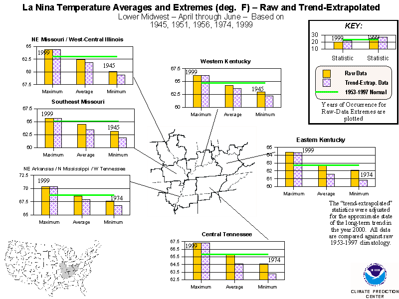
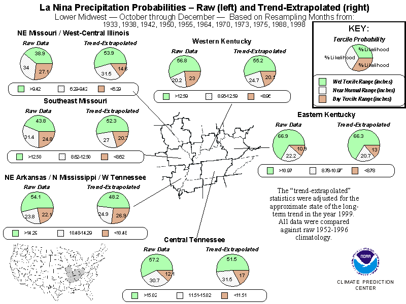
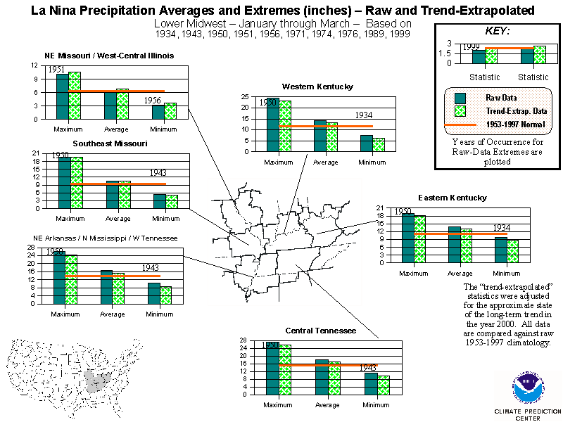
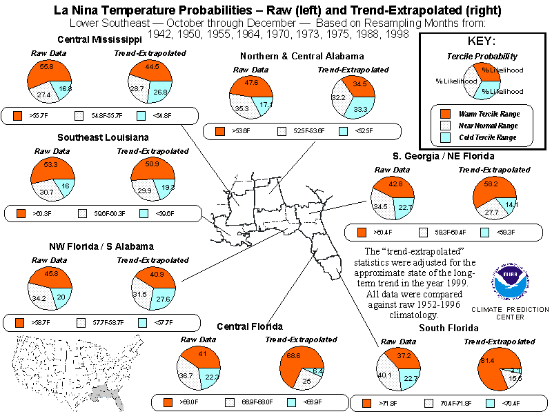
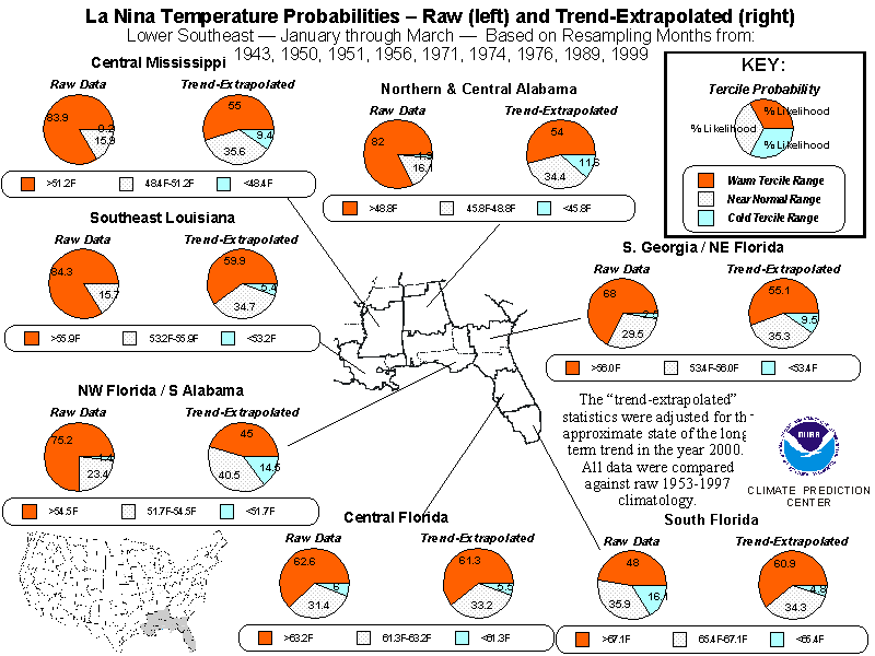
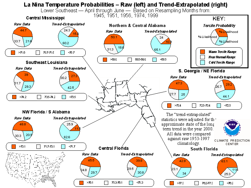
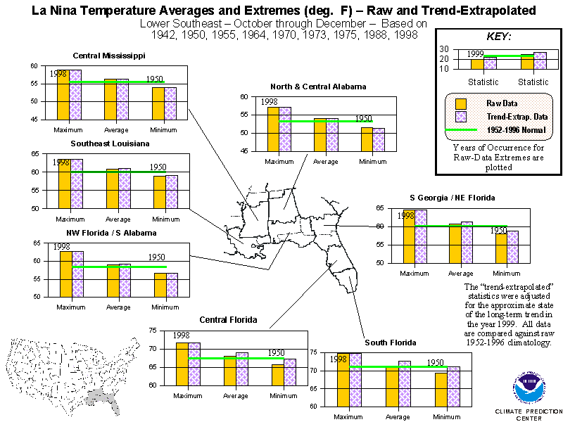
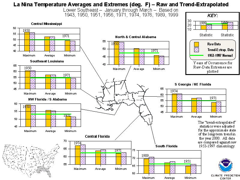
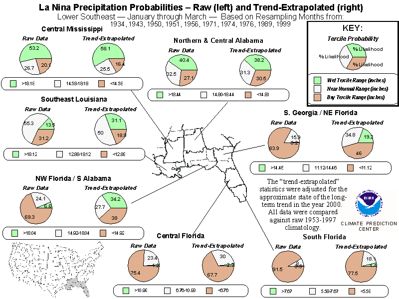
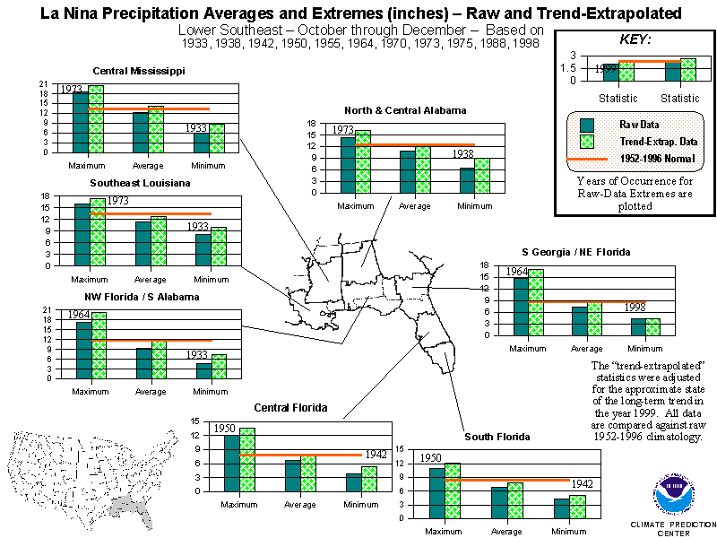
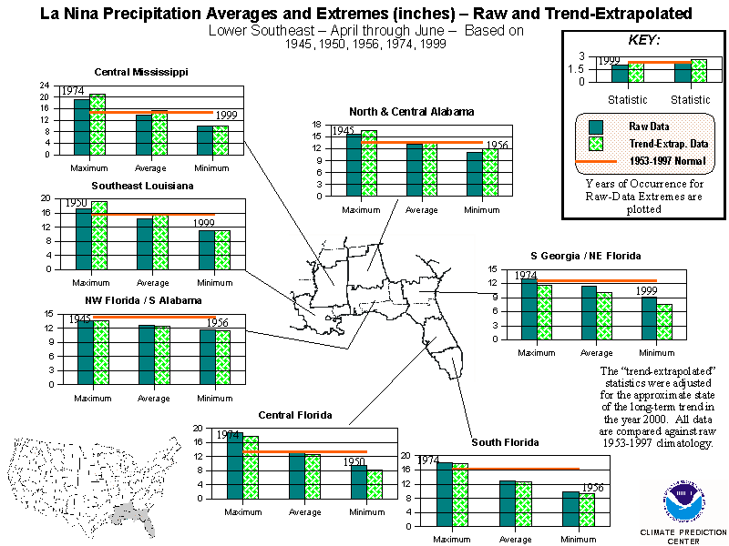
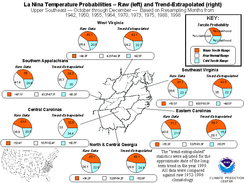
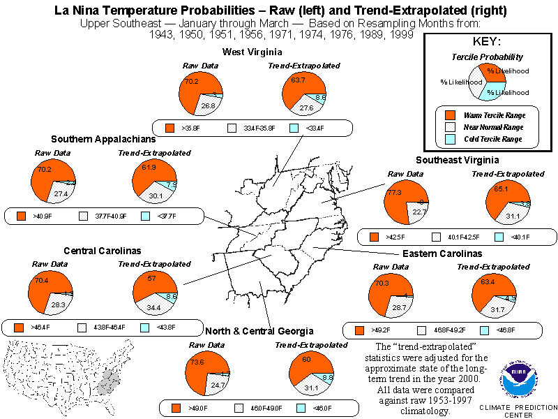
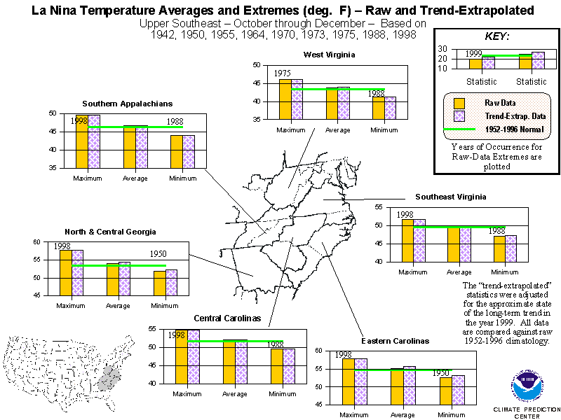
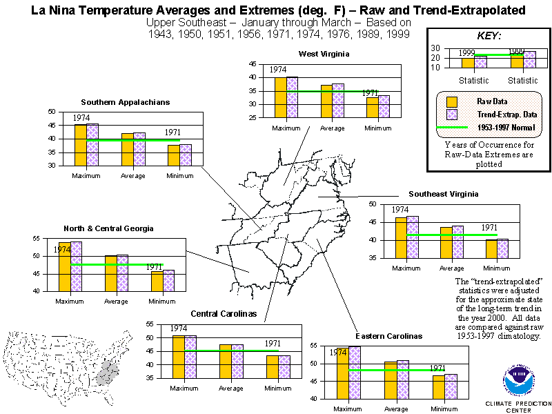
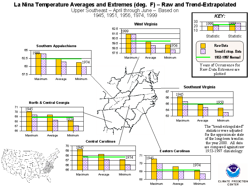
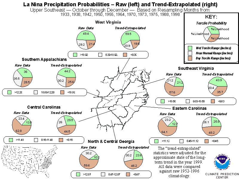
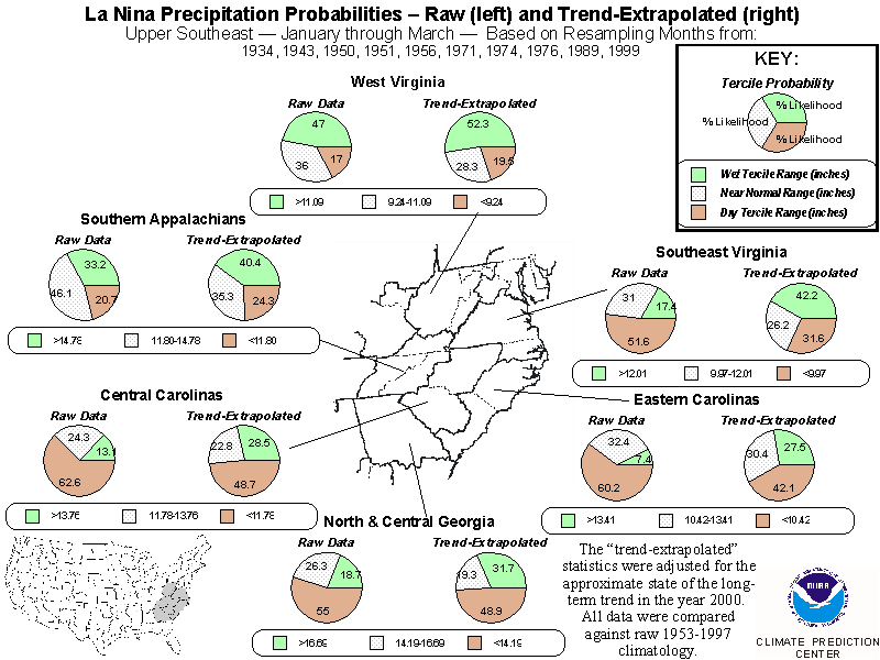
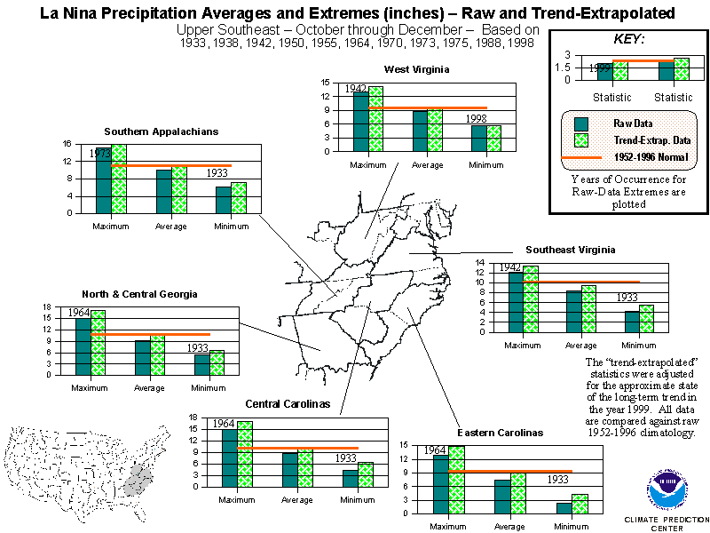
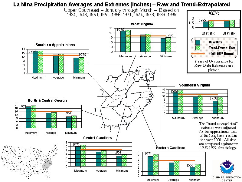
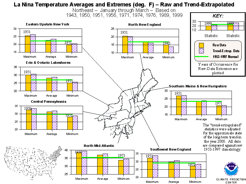
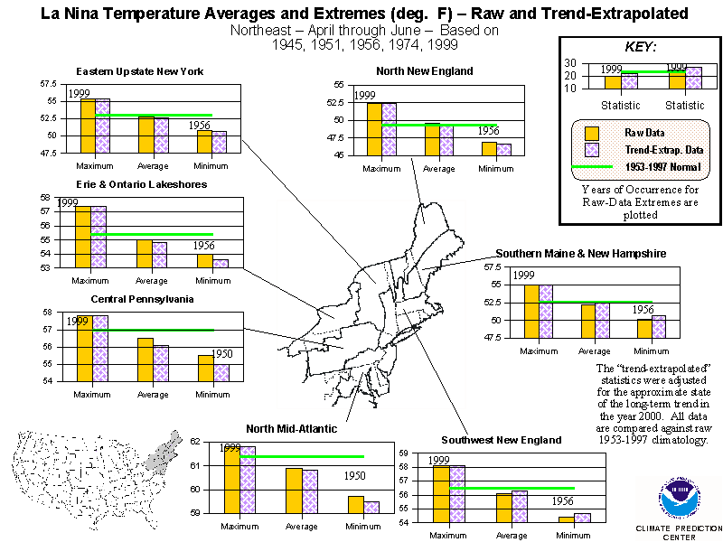
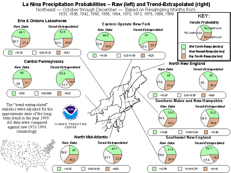
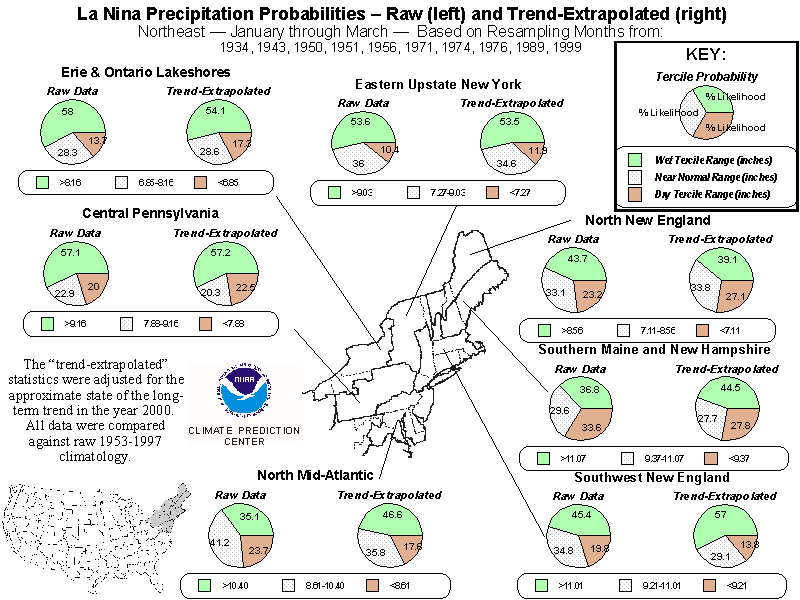
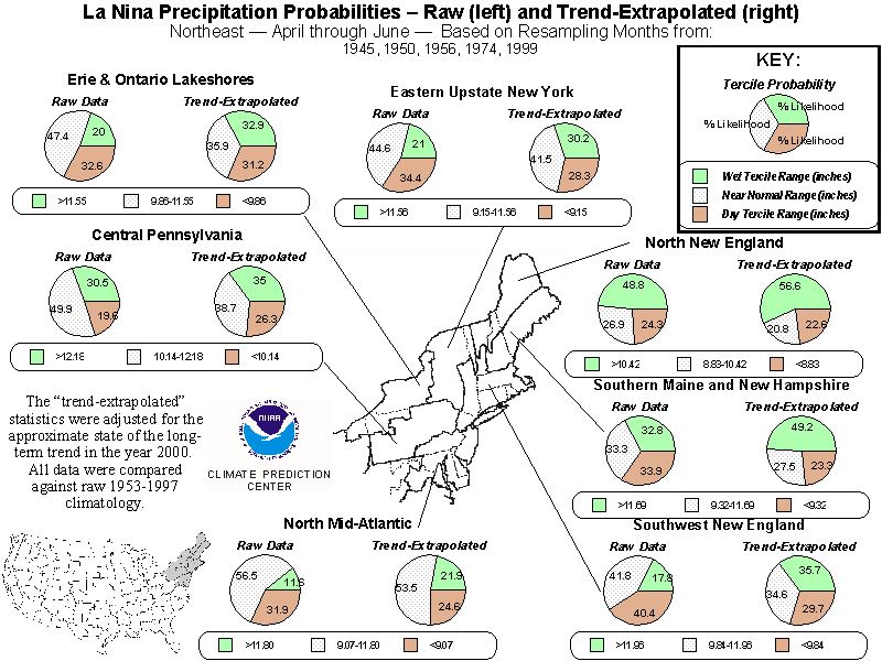
Detailed Regional Statistics
These charts provide both alternative presentations of and supplementary
information about both the raw and trend-adjusted La Niña temperature and
precipitation signals. For each of the three non-overlapping 3-month periods
that comprise three-quarters of a calendar year (October - December, January-March,
and April-June) the contiguous U.S. was divided into 15 large regions.
Four sets of graphics (2 each for temperature and precipitation) were produced
for each of the 15 regions for each 3-month period. In contrast to the
U.S. maps, these directly contrast the raw La Niña case data with the trend-adjusted
data, so the user can readily see the influence of the long-term trend
in modifying the La Niña signals. In addition to tercile probabilities
and ranges, the means and extremes of both the historic and trend-adjusted
La Niña occurrences are presented, along with the 45-year climatological
average, for each of the 102 climate regions. The years of occurrence for
the extremes (maxima and minima) are indicated only for the raw La Niña
cases because they have no meaning for the trend-adjusted cases.
The La Niña Cases
For precipitation, cases were culled from the period 1930/1931 through
1998/1999, while for temperature cases since 1939/1940 were selected. Except
for this difference between temperature and precipitation case selection,
all graphics valid for the same 3-month period use the same set of La Niña
cases. From 1950 to the present, the case selections conform exactly to
CPC's official list of moderate to strong La Niñas with the exceptions
of October-December 1954 and January-March 1955, which did not quantitatively
satisfy the selection criteria, but
otherwise behaved like moderate La Niñas.
Definition of Above, Near, and Below Normal Categories
The range of values that constituted the above, near, and below normal
terciles were determined directly from 45 years of 3-month mean temperature
and total precipitation data for each of 102 roughly equal-sized climate
regions that comprise the lower 48 states. The periods July-September through
October-December used 1952-1996 data while the remaining 3-month periods
used 1953-1997. These 45 pieces of data (for a given climate region and
time of year) were organized into the 15 highest, 15 lowest, and 15 middle
values, with the exact tercile limits defined as the point halfway between
the lowest value in one tercile and the highest value in the next lower
tercile.
Estimation of Probabilities
The probabilities were developed for a particular season through a bootstrap
technique that consists of building hypothetical sample La Niña cases by
resampling (with replacement) a pool of all the months from the La Niña
case years in that season. Statistical tests determined that this resampling
technique increased confidence in the reliability of the results as though
the number of cases was 30% larger than it actually is, thus helping to
reduce sampling error and raggedness in the final products.
Adjustments to Account for Long-Term Temperature and Precipitation Trends
As indicated earlier, these maps were derived for two different sets
of La Niña data, both of which are presented in this suite of products.
The first is straightforward, using unadjusted (raw) data during La Niña
case years. However, the probabilities derived from this data are insufficient
for the estimation of current probabilities because the long-term trends
imply a changing climate. CPC forecasters first encountered this difficulty
in attempting to apply El Niño-based composites to winter/spring temperature
predictions during 1996/1997.
A first attempt has been made to quantitatively take the long-term trend
signals into account, guided by insight from other work done at CPC (especially
Livezey
and Smith (1999)). In the set of U.S. probability distributions
that takes the trends into account, data for the La Niña case years were
adjusted to linear extrapolations of long-term trends to 1999/2000. As
an example, assume region x for some season averaged 50 degrees Fahrenheit
in 1969. Assume further that there has been an upward trend of 0.5 degrees
Fahrenheit per decade for this region and season since the mid-1960's from
a base-period average estimated from the early 1940's to the mid-1960's.
If you extrapolate this trend from 1966 to 2000, you get an accumulated
change to the base climatological state of +1.7 degrees Fahrenheit. However,
in 1969, three years' worth of trend would already have been incorporated
into this value, or 0.15 degrees Fahrenheit. This is removed from the cumulative
adjustment (since it's already in the observed value), resulting in an
overall adjustment of 1.70 - 0.15 = 1.55 degrees which is added to the
raw value (in this case, 50 degrees) to create an adjusted value of 51.55
degrees. Although this example cites 1966 as the start of the trend, there
is uncertainty in this starting point, and this uncertainty has been built
into the resampling by using a family of trends derived by making small
adjustments to the start, hinge-point, and final years of data from which
the signal is extracted. The starting point was juggled between 1939 and
1943 (1929 and 1933 for precipitation), the trend-start point between 1964
and 1968, and the final point between 1994 and 1998.
The results of incorporating these trend adjustments into the historical
La Niña data amount to conditional forecasts that take both La Niña effects
and the long-term trend effects into account. Although these data are modified
from the real-world observations, the Climate Prediction Center feels they
more accurately depict the true probability distributions than do the maps
which ignore the trends. It is primarily the trend-adjusted maps on which
our long-term seasonal outlooks have relied with respect to La Niña's expected
influence on U.S. conditions during the next few seasons.
La Niña Case Selection
The years representing moderate to strong La Niñas change from period
to period. This is because the part(s) of the year for which the central
equatorial Pacific sea surface temperatures (SST's) are well below normal
differs from episode to episode. The cases included in these products are
those for which the average SST in a key area was near or greater than
one degree Celsius below normal in at least one of the three months spanning
a particular period, and near or greater than 0.8 degree Celsius below
normal in the remaining months. The key area used for case selection is
bounded by the International Dateline and 150 degrees west longitude, and
5 degrees north and 5 degrees south latitudes. This area was used because
it approximates the region in the equatorial Pacific where the intensity
and areal extent of tropical showers and thunderstorms (the major source
of atmospheric energy in the tropics) are the most sensitive to relatively
small changes in SST. Thus, the SST anomaly in this area should be a good
index of how strong a La Niña's impact on the global atmosphere will be.
The diagrams shown here reflect, complement, and extend the information
recently presented by Livezey et al. (1997: J. Climate, 10, 1787-1820),
which used similar selection criteria.
|


