North America
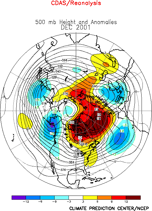
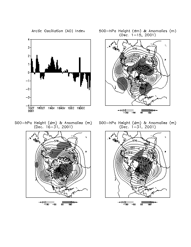
During the first half of December the upper-level atmospheric circulation featured a
deep trough over western North America, and a ridge over the eastern United States and
western North Atlantic (Fig. A2.2, top right). This
pattern reflected a disappearance of the mean trough from its climatological position over
eastern Canada and the eastern United States, and of the mean ridge from its
climatological position over western North America. In contrast, the North American
circulation during the second half of the month featured amplified ridges and troughs in
approximately their climatological mean positions (A2.2,
bottom left).
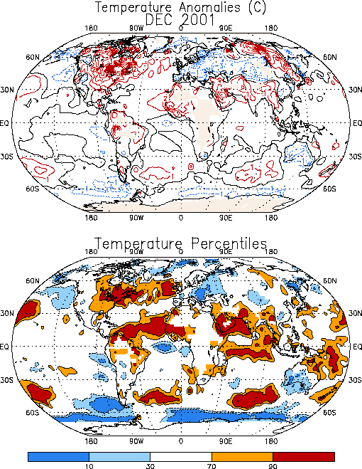
For the month as a whole large positive temperature anomalies were observed throughout
North America for a third consecutive month, with December mean values exceeding the 90th
percentile across the northeastern quadrant of the United States and most of eastern
Canada (Fig. E1). The largest absolute temperature
anomalies during December (exceeding 8°C) were observed over southeastern Canada.
This anomalous December warmth was accompanied by a continuation of below-average
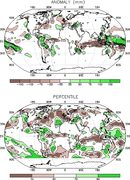
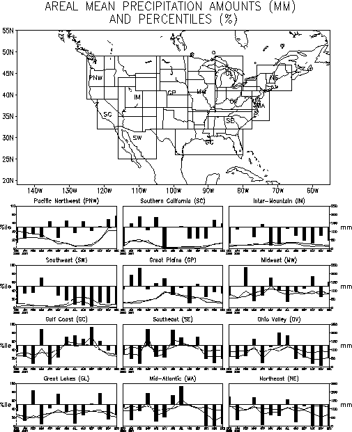
precipitation over the eastern half of the United States (Fig. E3),
with the Northeast and mid-Atlantic regions also experiencing significant precipitation
deficits for a third consecutive month (Fig. E5).
Elsewhere, below-average precipitation has been recorded in the Intermountain and Ohio
Valley regions since August, in the Southwest since May, and in the Southeast for the
second consecutive month.
2. Southern Hemisphere
The Southern Hemisphere circulation during December reflected a continuation since
October of positive 500-hPa height anomalies across the middle latitudes, and negative
anomalies over the high latitudes of the eastern South Pacific (Fig. E16, E18, E19).
These conditions were also accompanied for a third consecutive month by an anomalous
large-scale 500-hPa trough and below-average surface temperatures over central and
southern Australia (Fig. E1).
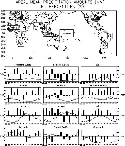
In southern Africa area-averaged monthly rainfall totals reached the 90th
percentile for the second consecutive month (Fig. E4), with
the largest local rainfall anomalies again found in the heavy agricultural and
climatologically heavy rainfall region of eastern South Africa (Fig.
E3 top). The South African monsoon season typically lasts from November thru
April.


