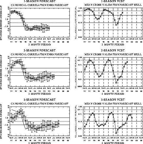
| The canonical correlation analysis (CCA) forecast
of SST in the central Pacific (Barnett et al. 1988, Science, 241, 192-196;
Barnston and Ropelewski 1992, J. Climate, 5, 1316-1345), is shown in Figs.
F1 and F2. This forecast is produced
routinely by the Prediction Branch of the Climate Prediction Center. The predictions from
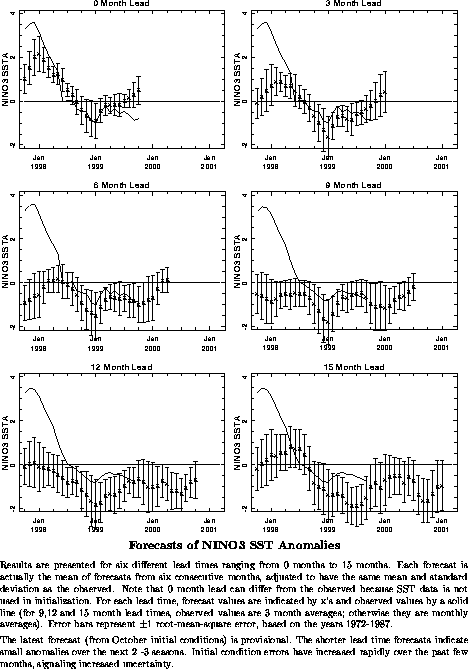
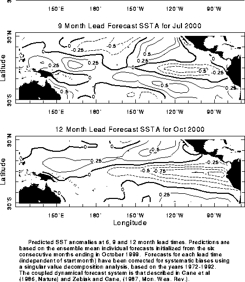
the National Centers for Environmental Prediction (NCEP) coupled ocean/atmosphere model
(Ji et al. 1998, Mon. Wea. Rev, 126, 1022-1034) are presented in Figs. F3 and F4. Predictions from the Cane and
Zebiak model (Cane et al. 1986, Nature, 321, 827-832; Zebiak and Cane 1987, Mon.
Wea. Rev., 115, 2262-2278) are shown in Figs. F5 and
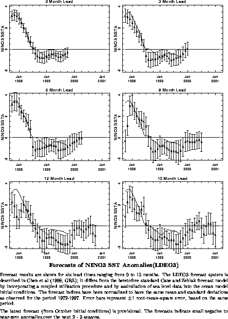
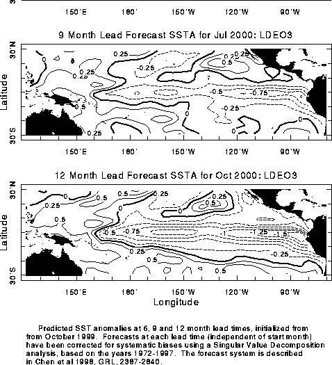
F6. Predictions from the modified Cane and Zebiak model (Chen
et al. 1998, Geophys. Res. Let., 103, 2387-2840), referred to in the figures
as LDEO3, are shown in Figs. F7 and F8.
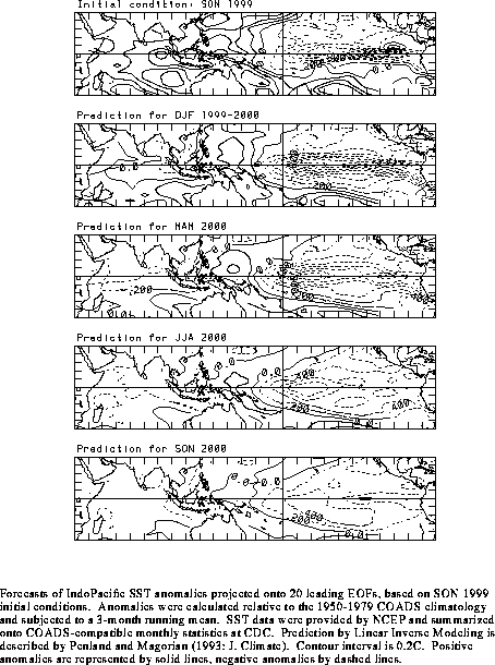
Predictions using linear inverse modeling (Penland and Magorian 1993, J. Climate, 6,
1067-1076) are shown in Figs. F9 and F10.
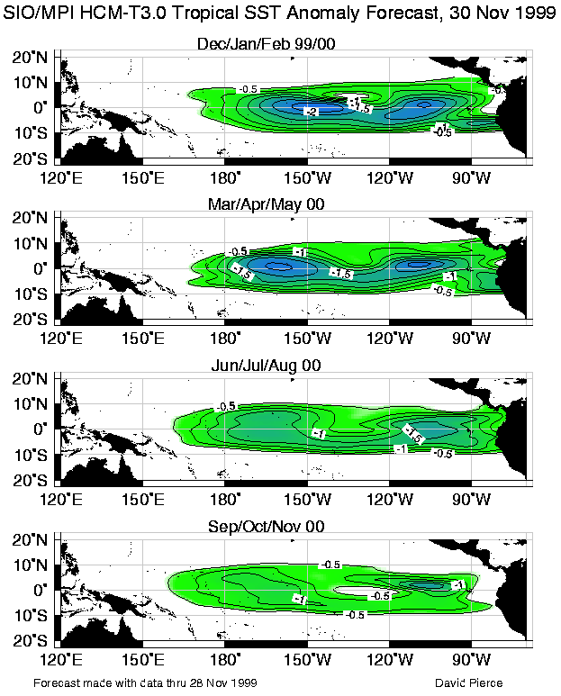
Predictions from the Scripps / Max Planck Institute (MPI) hybrid coupled model (Barnett et
al. 1993, J. Climate, 6, 1545-1566) are shown in Fig. F11. The CPC and the contributors to the Forecast Forum caution
potential users of this predictive information that they can expect only modest skill.
Discussion and Outlook
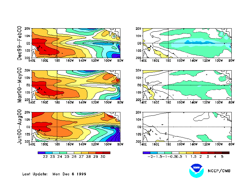
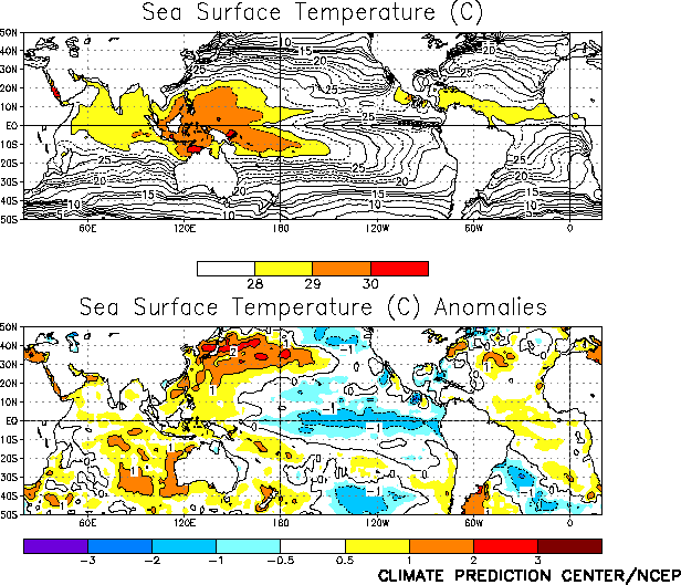
Cold (La Niña) episode conditions intensified in the
equatorial Pacific during November as sea surface temperature (SST) anomalies became
increasingly negative across the central and eastern tropical Pacific (Fig. T18 and Table T2). Consistent with
this pattern, the depth of the 20°C isotherm remained deeper (shallower) than normal in
the western (eastern) equatorial Pacific during November (Fig. T16),
with the thermocline more than 30 m shallower than normal from 135 oW to 105oW. Over the
past several months the pattern of subsurface temperature anomalies has been very
persistent, with positive anomalies in the western equatorial Pacific and negative
anomalies in the eastern equatorial Pacific (Fig. T17).
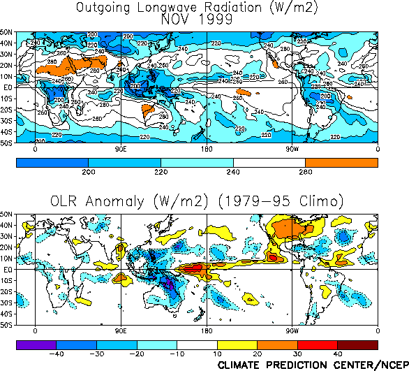
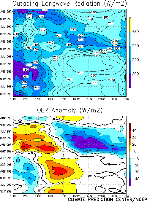
Accompanying these conditions, tropical convection remained suppressed across the western
and central equatorial Pacific and enhanced over Indonesia and the Philippines (Fig. T25).
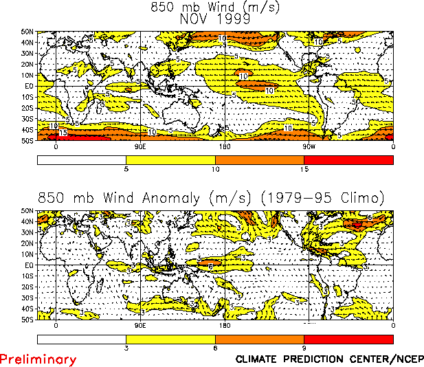
The associated low-level wind field featured a continuation of enhanced easterlies over
the western and central tropical Pacific and near-normal easterlies over the eastern
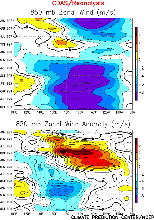
Pacific (Fig. T20). Low-level easterly anomalies have been
confined to the western and central equatorial Pacific since June 1998 (Fig. T7). At upper levels, westerly winds were enhanced over
much of the central and eastern tropical Pacific during November (Fig.
T21). This overall wind pattern reflected an enhanced equatorial Walker
circulation, and was consistent with the La Niña-related pattern of anomalous tropical
convection. All of these overall conditions been very persistent for the past 18 months (Figs.
T7, T8, T11),
and are consistent with the ongoing cold episode.
In the past the depth of the 20°C isotherm has been a good indicator of transitions to
either warm or cold episodes. The onset of warm (cold) episodes is preceded by a
deeper-than-normal (shallower-than-normal) thermocline across the central and eastern
equatorial Pacific. At the present time the subsurface oceanic conditions show no signs of
an evolution toward a pre-warm episode state. Thus, it is likely that cold episode
conditions will persist in the tropical Pacific for at least the next several months. This
assessment is supported by the most recent NCEP coupled model forecast (Figs. F3 and F4) and by other available
coupled model and statistical model predictions that indicate cold episode
conditions persisting through the Northern Hemisphere spring of 2000.
Based on current conditions in the tropical Pacific, on the NCEP SST predictions, and
on results from historical studies on the effects of cold episodes, we expect
wetter-than-normal conditions to occur during the December-March period over Indonesia,
northeastern Australia, southern and southeastern Africa, and northeastern South America.
In the United States, wetter-than-normal conditions are expected in the Pacific Northwest
and Great Lakes regions. Also, drier-than-normal and warmer-than-normal conditions are
expected along the southern tier of the United States and cooler-than-normal conditions
are expected along the northern tier of the United States.
Weekly updates of SST, 850-hPa wind and OLR are available on the Climate Prediction
Center homepage at: http://www.cpc.ncep.noaa.gov (Weekly
Update). |


