Tropical
Highlights - November 2000
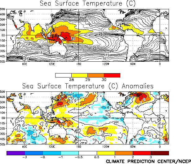
Weak cold episode conditions re-developed across
the tropical Pacific during November 2000, as sea surface temperatures (SSTs) dropped to
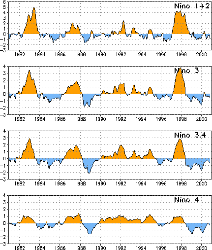
0.5°-1.0°C below normal across the central and eastern equatorial Pacific (Fig. T18). This evolution is reflected by decreases in all
four Niño region indices, with the Niño 3.4 index recording its lowest value since March
2000 and the Niño 3 index recording its lowest value since February 2000 (Fig. T5, Table T2).
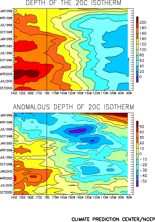
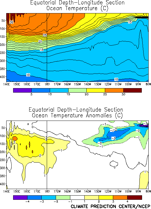
Accompanying this anomalous cooling the equatorial oceanic thermocline shoaled across
the east-central and eastern Pacific and deepened throughout the western and central
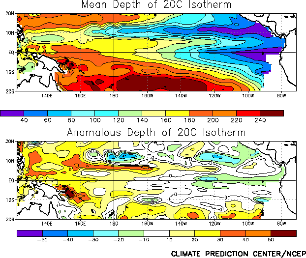
Pacific (Fig. T15). This evolution resulted in an increase
in both the slope of the oceanic thermocline (Fig. T16)
and the magnitude of east-west temperature gradient across the equatorial Pacific, with
oceanic temperatures increasing to more than 2°C above normal in the western Pacific and
decreasing to more than 3°C below normal in the eastern Pacific (Fig.
T17).
Tropical convection during November was below normal over the central Pacific [as
inferred from positive anomalies of outgoing longwave radiation (OLR)] and above normal
over the western Pacific, Indonesia, and northern Australia (Fig.
T25). This pattern of anomalous convection is consistent with La Niña conditions
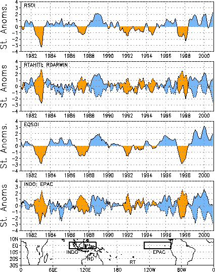
and has largely persisted since mid-1998 (Fig. T8).
Intraseasonal activity (Madden-Julian Oscillation-MJO) with a period near 45 days also
continued to impact tropical convection. During November, this activity contributed to
increased convection over the Indian Ocean and Indonesia (Fig. T11).
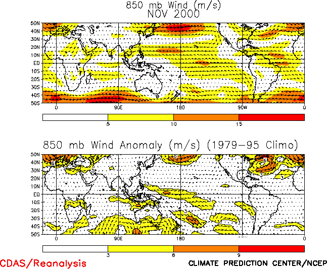
The anomalous tropical convection during November was associated with increased
low-level (850 hPa) easterly wind anomalies over the western equatorial Pacific (Figs. T7, T20, and Table
T1). Easterly wind anomalies have been observed over the western and central
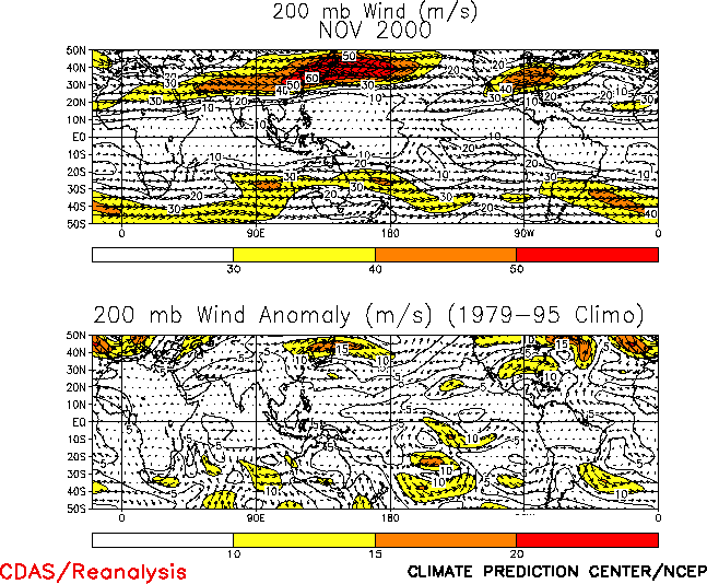
equatorial Pacific since the onset of cold episode conditions in mid-1998 (Fig. T7). At upper levels, westerly wind anomalies persisted
over the central equatorial Pacific, consistent with cyclonic circulation anomalies
flanking the region of suppressed convection (Fig. T21, T22).
The sea level pressure (SLP) pattern featured positive anomalies over the eastern half
of the tropical Pacific during November, and negative anomalies throughout the remainder
of the global Tropics (Fig. T19). This pattern was
associated with large positive values (2.0) of both the Southern Oscillation Index (SOI)
and the equatorial SOI during the month (Table T1, Fig. T2). |


