Skip Navigation Links www.nws.noaa.gov 
NOAA logo - Click to go to the NOAA home page National Weather Service   NWS logo - Click to go to the NWS home page
Climate Prediction Center


CPC Search
 
HOME > Expert Assessments > Climate Diagnostics Bulletin  
 

figure t26

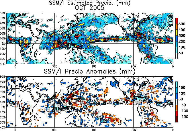
FIGURE T26. Estimated rainfall (top) (mm) and anomaly (bottom) (mm)  using the Special Sensor Microwave/Imager (SSM/I) precipitation index (Ferraro 1997, J. Geophys. Res., 102, 16715-16735). Contour interval for means (anomalies) is 100 (50) mm. Anomalies are computed from the July 1987 - June 2004 base period means. Anomalies have been smoothed for display purposes.


NOAA/ National Weather Service
National Centers for Environmental Prediction
Climate Prediction Center
5200 Auth Road
Camp Springs, Maryland 20746
Climate Prediction Center Web Team
Disclaimer Privacy Notice