Tropical
Highlights - October 2000
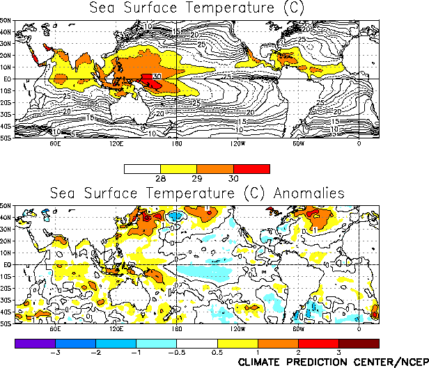
Sea surface temperatures (SSTs) remained weakly
negative over portions of the central and eastern equatorial Pacific during October, with
all four Niño region indices indicating SSTs within 0.5°C of normal for the third
consecutive month (Fig. T18, Table
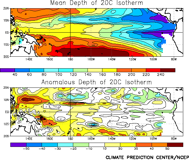
T2). The oceanic thermocline was deeper than normal west of 130°W during the
month (Fig. T16), as the thermocline deepened in the
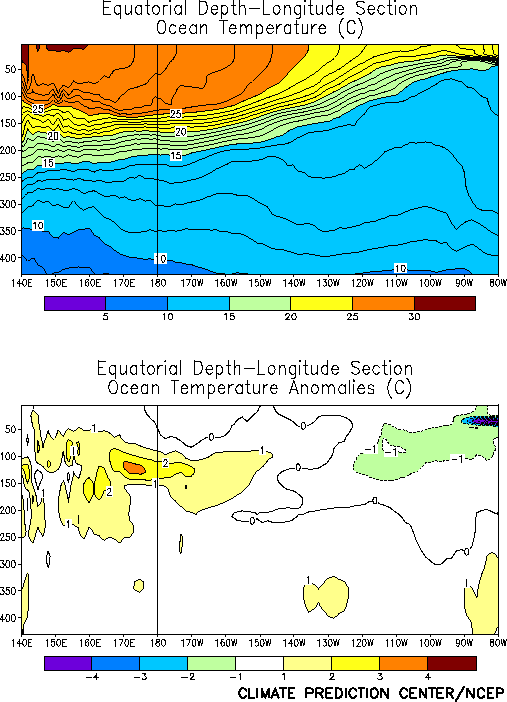
central Pacific during October (Fig. T15). Consistent with
this pattern, temperature anomalies at thermocline depth were weakly positive across the
central Pacific and weakly negative in the eastern Pacific (Fig.
T17).
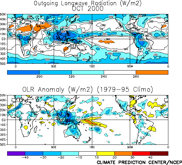
Tropical convection during October [as inferred from anomalous outgoing longwave
radiation (OLR)] was slightly below-normal over the western and central Pacific (Figs. T1, T25) and above normal over
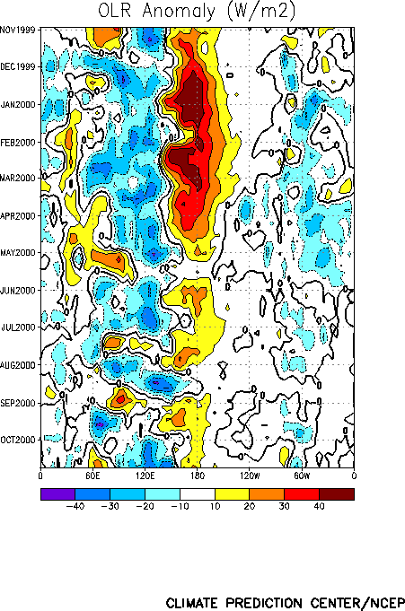
Indonesia. The large increase in convection over Indonesia was associated with tropical
intraseasonal activity (Madden-Julian Oscillation-MJO), which has persisted during the
past 6 months with a period near 45 days (Fig. T11).
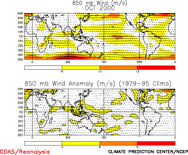
Low-level (850 hPa) easterly wind anomalies persisted over the western equatorial
Pacific during October (Fig. T20, Table
T1), while anomalous cross-equatorial flow continued over the central tropical
Pacific. This pattern of low-level winds was consistent with the suppressed convection
over the central tropical Pacific, and also with a strengthening of the ITCZ over the
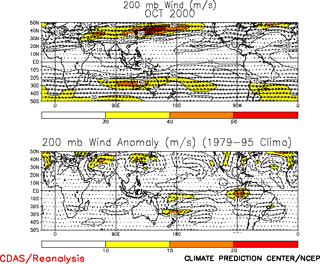
eastern Pacific (Fig. T25). At upper levels, westerly
anomalies were observed over the central equatorial Pacific, in association with an
anomalous cyclonic couplet centered near the date line (Fig. T21).
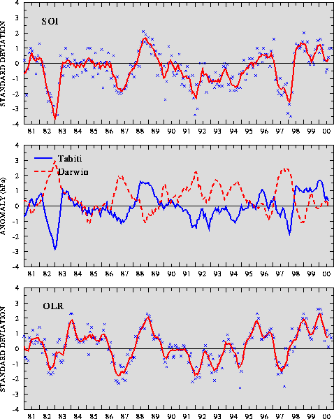
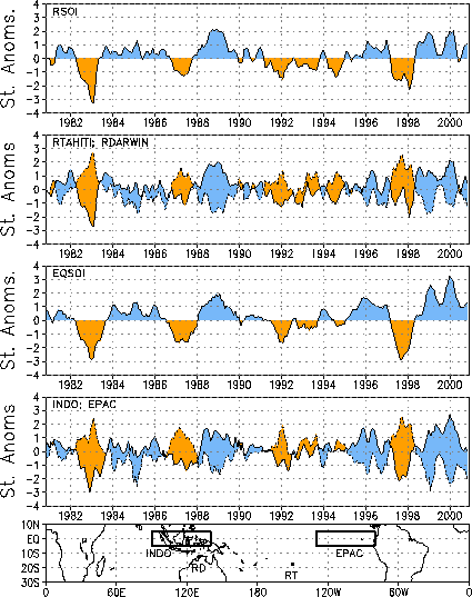
The sea level pressure (SLP) pattern across the Tropics during October featured
negative anomalies extending from the eastern Indian Ocean across Indonesia to the western
Pacific (Fig. T19). These anomalies were associated with
positive values of both the Southern Oscillation Index (SOI) (1.0) and the equatorial SOI
(1.3) during the month (Table T1, Fig. T2). |


