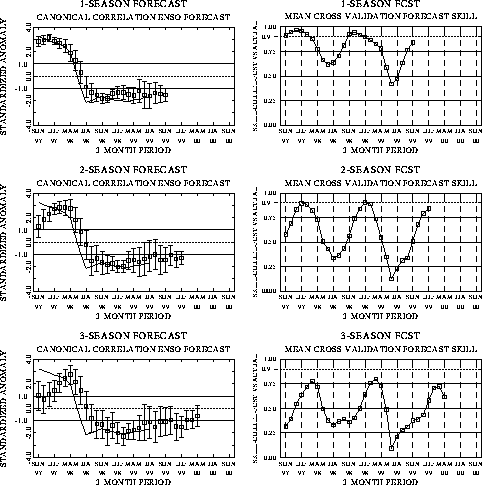
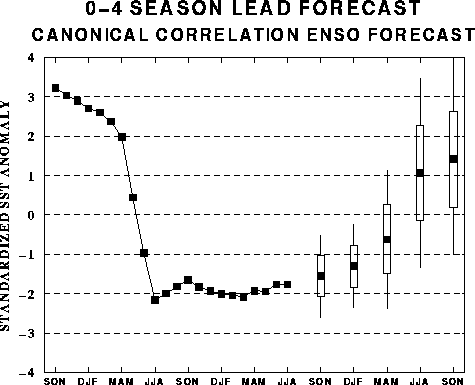
| The canonical correlation analysis (CCA) forecast
of SST in the central Pacific (Barnett et al. 1988, Science, 241, 192-196;
Barnston and Ropelewski 1992, J. Climate, 5, 1316-1345), is shown in Figs.
F1 and F2. This forecast is produced
routinely by the Prediction Branch of the Climate Prediction Center. The predictions from
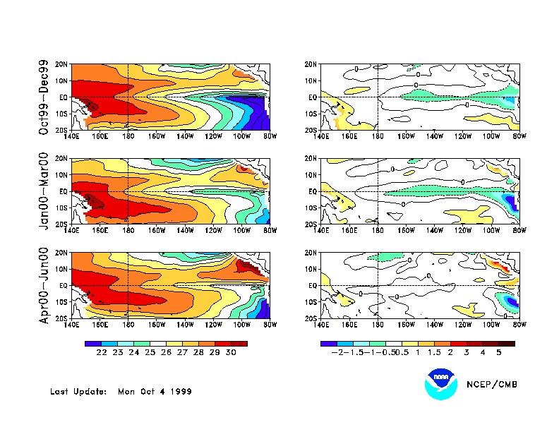
the National Centers for Environmental Prediction (NCEP) coupled ocean/atmosphere model
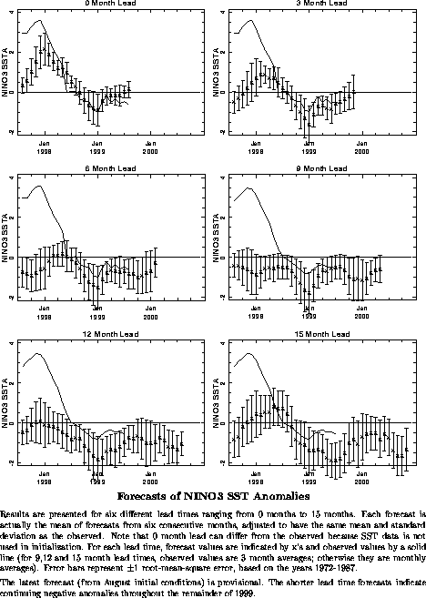
(Ji et al. 1998, Mon. Wea. Rev, 126, 1022-1034) are presented in Figs. F3 and F4. Predictions from the Cane and
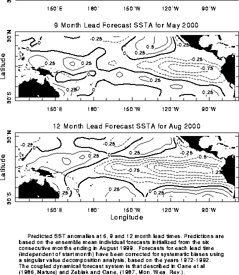
Zebiak model (Cane et al. 1986, Nature, 321, 827-832; Zebiak and Cane 1987, Mon.
Wea. Rev., 115, 2262-2278) are shown in Figs. F5 and
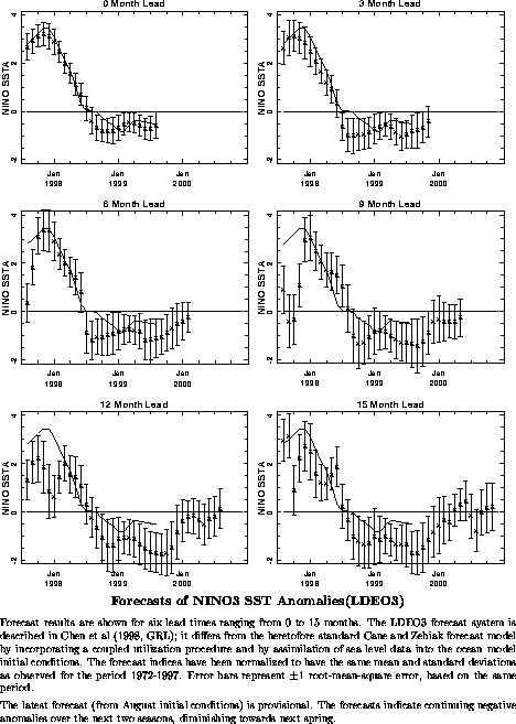
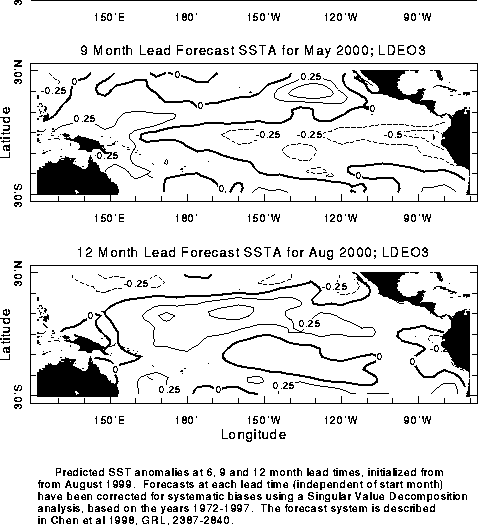
F6. Predictions from the modified Cane and Zebiak model (Chen
et al. 1998, Geophys. Res. Let., 103, 2387-2840), referred to in the figures
as LDEO3, are shown in Figs. F7 and F8.
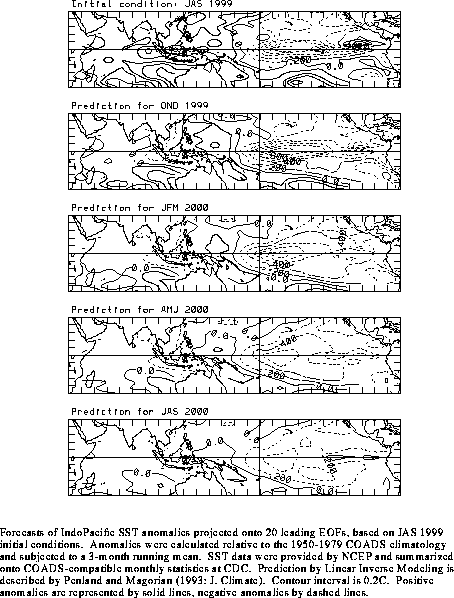
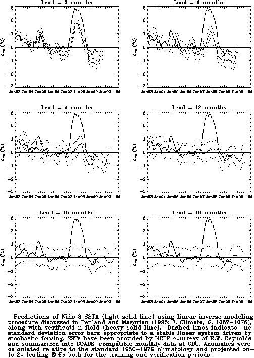
Predictions using linear inverse modeling (Penland and Magorian 1993, J. Climate, 6,
1067-1076) are shown in Figs. F9 and F10.
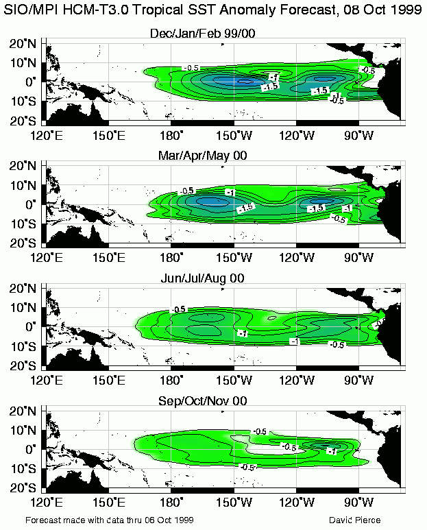
Predictions from the Scripps / Max Planck Institute (MPI) hybrid coupled model (Barnett et
al. 1993, J. Climate, 6, 1545-1566) are shown in Fig. F11. The CPC and the contributors to the Forecast Forum caution
potential users of this predictive information that they can expect only modest skill.
Discussion and Outlook
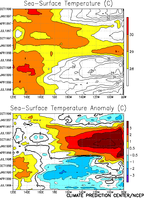
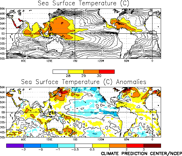
Cold episode (La Niña) conditions continued in the tropical Pacific during September.
Sea surface temperatures (SSTs) averaged more than 1°C below normal across the tropical
Pacific between 150°W and the South American coast, with weak negative anomalies
extending westward to 160°E (Figs. T9, T18).
Consistent with this, tropical convection [as inferred from anomalous outgoing longwave
radiation (OLR)] remained suppressed across the western and central equatorial Pacific
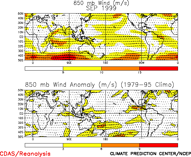
during the month (Fig. T25) and the low-level equatorial
winds remained stronger than normal across the same region (Fig.
T20).
The pattern of subsurface temperature anomalies has been highly persistent, with
positive anomalies in the western equatorial Pacific and negative anomalies farther east (Fig. T17). Consistent with this pattern, the oceanic
thermocline remained deeper (shallower) than normal in the western (eastern) equatorial
Pacific (Fig. T16). Over the last couple of months
temperatures at thermocline depth have decreased to more than 4°C below normal across the
east-central and eastern tropical Pacific. Also, the positive sub-surface temperature
anomalies in the west-central equatorial Pacific continue to show little evidence of an
eastward shift, indicating that cold episode conditions are likely to persist in the
tropical Pacific through the Northern Hemisphere winter 1999/2000. This assessment is
supported by the most recent NCEP coupled model forecast (Figs. F3 and F4) and by other available
coupled model and statistical model predictions that indicate cold episode
conditions persisting through the Northern Hemisphere spring of 2000.
Weekly updates of SST, 850-hPa wind and OLR are available on the Climate Prediction
Center homepage at: http://www.cpc.ncep.noaa.gov (Weekly
Update).
|


