1. Northern Hemisphere
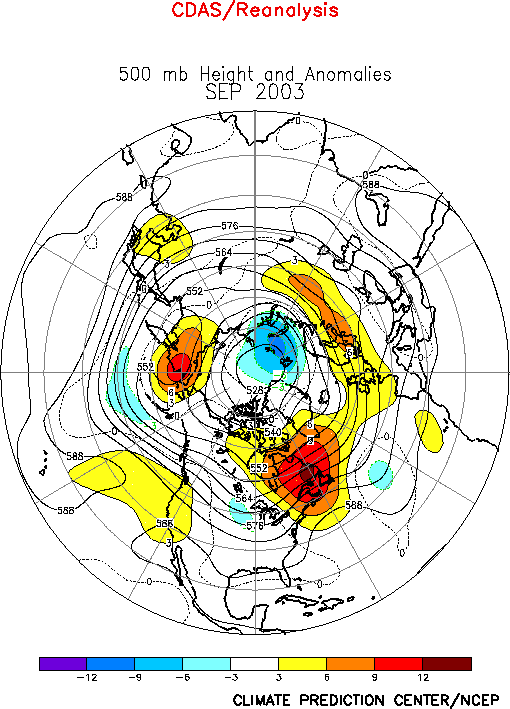
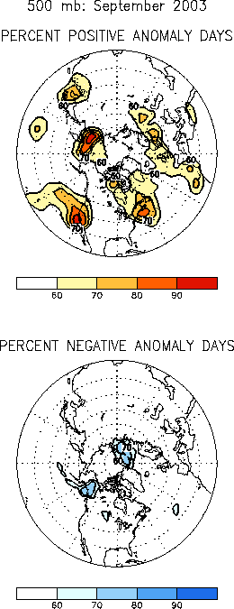
The 500-hPa circulation during September 2003 featured generally
above-average heights in the extratropics, with the major areas of
persistent positive anomalies observed over the western United States,
eastern Canada, and much of Eurasia (Figs. E10,
E12). Smaller areas of negative height
anomalies were observed over the central United States, the central North
Pacific, and the polar region.
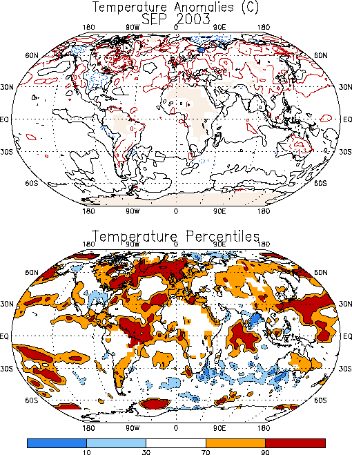
Large areas of significantly warmer-than-average conditions during the
month generally coincided with the persistent positive height anomalies (Fig.
E1), while cooler-than-average temperatures were confined to the
eastern half of the United States and eastern Alaska. Prominent
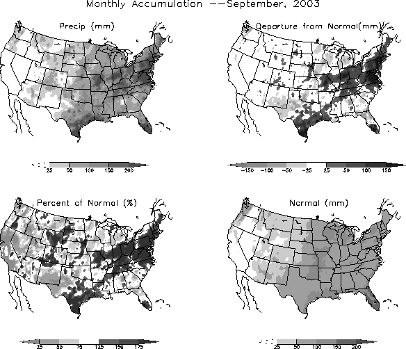
precipitation anomalies during September included a continuation of
above-average totals in the eastern United States, and below-average totals
in Europe (Fig. E3).
a. North America
The mean circulation featured amplified upper-level ridges over western
North America and eastern Canada (Fig. E10),
and a trough over the central United States. The entire eastern U.S. was
situated in the region of large-scale ascending motion downstream of the
mean trough axis. This region experienced well above-average rainfall (Figs.
E3, E6), with totals
exceeding the 90th percentile in portions of the Mid-Atlantic
States. This excess rainfall was also associated with Hurricane Isabele,
which produced totals of 100 mm and more across portions of North Carolina,
and Virginia. The Ohio Valley, Mid-Atlantic and Southeast regions have
recorded above-average precipitation in almost every month since September
2002 (Fig. E5), and the Gulf Coast region
has recorded above-normal rainfall for four consecutive months.
Well above-average surface temperatures were again observed in the
western U.S. and central Canada during September, with the anomalous warmth
also extending across eastern Canada and the North Atlantic (Fig.
E1). In contrast temperatures were below-average in the eastern
U.S. in the vicinity of the mean upper-level trough axis, with some areas
in the deep South recording temperatures in the lowest 10th
percentile of occurrences.
b. Europe
A strong upper-level ridge again prevailed across Europe during
September (Fig. E10), resulting in
continued warmer and drier than average conditions over most of the
continent. Monthly mean temperatures exceeded the 70th
percentile throughout Europe (Fig. E1) and
rainfall totals were generally below the 30th percentile (Fig.
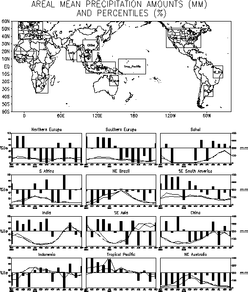
E3). Area-averaged rainfall totals in both northern and southern
Europe have been significantly below-average since March (Fig.
E4).
However, slightly above-average totals were observed in extreme southern
Europe during September, which marks the first time since March 2003 that
this region has not experienced significant rainfall deficits. This
increased rainfall was associated with storm activity within the southern
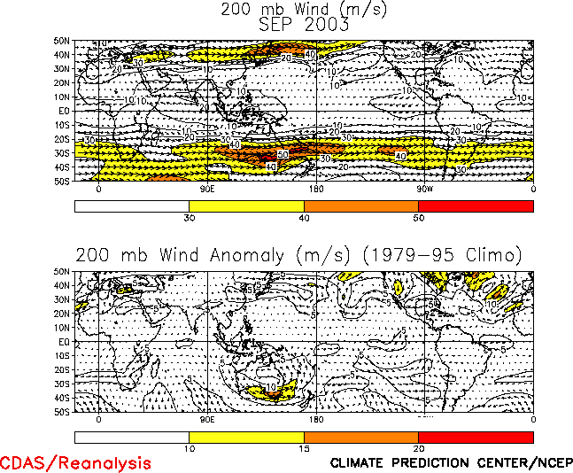
branch of a fairly strong split flow pattern at upper levels (Figs. E10,
T22).
c. West Africa
The West African monsoon season typically lasts from May-October, with
the largest totals observed during June-September. The 2003 monsoon season
featured slightly above-average rains across the African Sahel and African
Sudan throughout this four-month period (Fig. E4),
resulting in an above-average monsoon season. A characteristic feature of
above-average monsoon seasons rains is the anomalous northward extent of
the convective rainfall.
Considerable rainfall occurred as far as 20̊N
during September, in association with a series of strong easterly
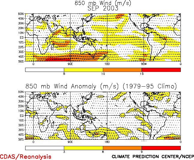
disturbances moving along the equatorward flank of the African easterly jet
(at 700-hPa), and with an overall northward shift of the associated wave
energy and deep tropical convection. As is typical of active West African
monsoon seasons these conditions were related to an overall northward shift
of the mean African easterly jet throughout the season, and to
above-average cyclonic shear along the equatorward flank of this jet stream
overspreading the heart of the monsoon region (Fig.
T20, bottom).
2. Southern Hemisphere
a. Circulation
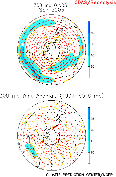
In the Southern Hemisphere the 500-hPa circulation during September
featured an anomalous zonal wave-3 pattern, with above-average heights over
the central ocean basins, and below-average heights generally situated
poleward of the three continents (Fig. E16).
This anomaly pattern was associated with enhanced upper-level westerlies
along the southern portions of the three continents (Fig.
E17), and with a pronounced anomalous anticyclonic circulation
across Australia. (Fig. T21).
Large portions of eastern Australia experienced a continuation of
above-average temperatures during September (Fig. E1).
The anomalous warmth also covered northern New Zealand, where monthly mean
temperatures again averaged above the 70th percentile. In
southeastern Australia the anomalous anticyclonic circulation was
associated with significantly below-average rainfall, with monthly totals
averaging below the 10th percentile
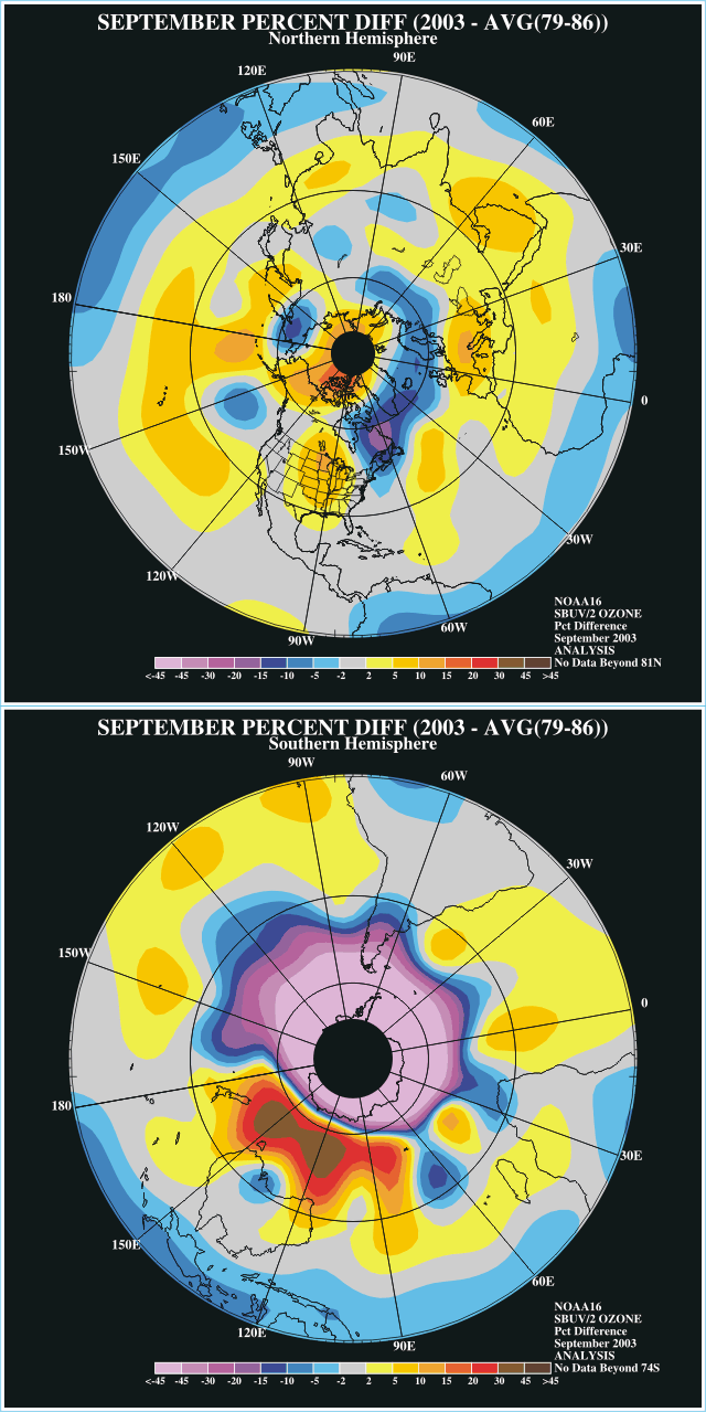
b. Stratospheric Ozone Hole
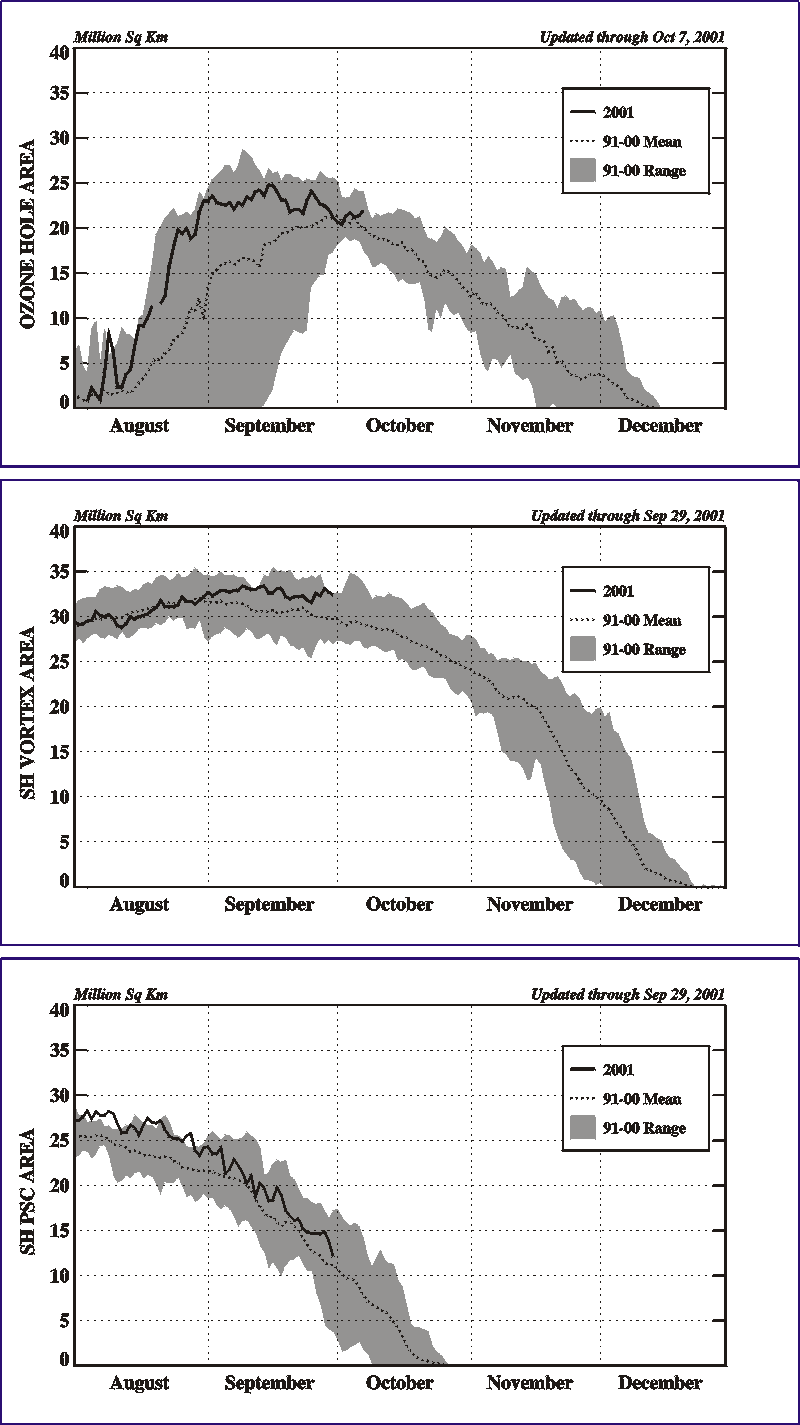
The stratospheric ozone hole over Antarctica (Fig.
S6) reached record size during August and September (Fig.
S8, top), covering close to 25 x 106 km2 by
late August and reaching 27 x 106 km2 in September.
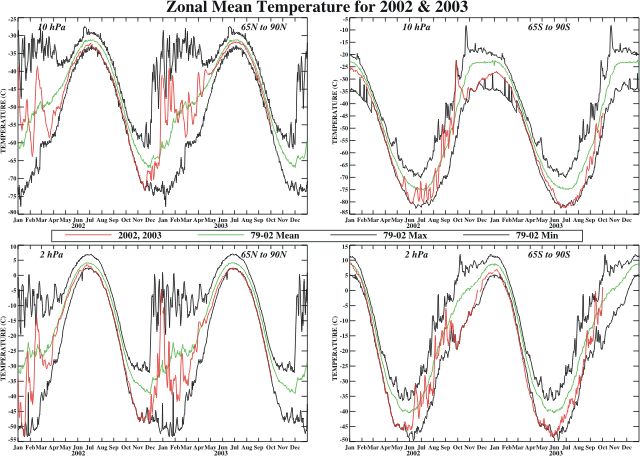
This large ozone hole is related to record or near-record low temperatures
at both 10-hPa and 2-hPa during June-September (Fig.
S4), which resulted in an above-average amount of polar
stratospheric cloud (PSC) cover (Fig. S8, bottom).
The PSC’s are comprised mostly of nitric acid and water, and form when
stratospheric temperatures drop below -78oC. These clouds
provide an ideal surface upon which inert chlorine compounds can react with
sunlight to form active chlorine compounds such as chlorine peroxide. As
sunlight reaches the polar region in August and September the resulting
reactions destroy nearly all stratospheric ozone, often to altitudes of 20
km.


