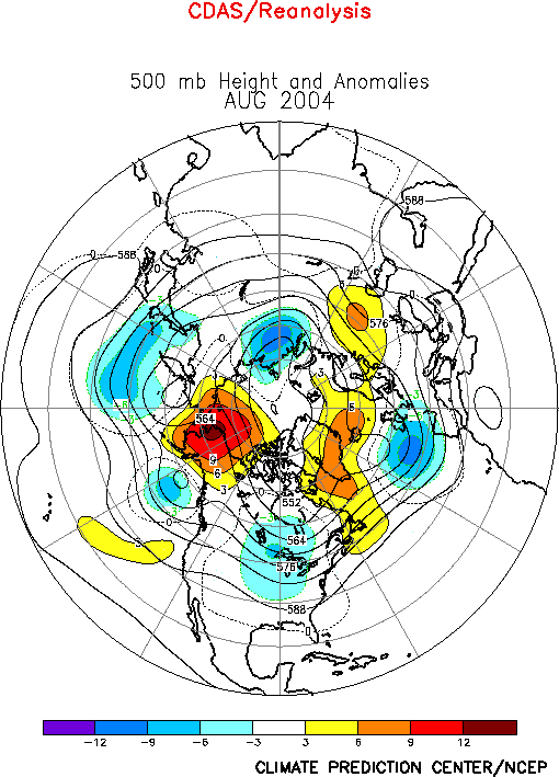
The 500-hPa circulation pattern in August featured above-average heights
over Alaska, northwestern Canada, Greenland and western Russia, and
below-average heights over the north-central U.S., much of Europe, eastern
and central Siberia and over the Pacific from Japan eastward to the Gulf of
Alaska (Fig. E9). This circulation pattern was associated with a
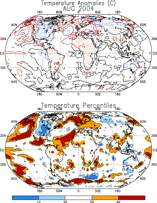
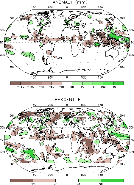
continuation of above-average surface temperatures and below-average
precipitation in Alaska, and with cooler-than-average conditions in central
Canada and the central U.S. (Figs. E1, E3). It was also associated
with above-average temperatures throughout northern and central Europe.
a. North America
Over North America the circulation during August
featured a blocking upper-level ridge over Alaska, and an amplified trough
over central Canada and the Great Lakes (Fig. E9). The blocking ridge
over Alaska contributed to a shift in the mean jet stream and storm track to
well south of the state (Fig. E10), which led to a continuation of
exceptionally warm and dry conditions throughout the state. Farther east
anomalous northwesterly flow upstream of the amplified upper-level trough
contributed to a continuation of below-average surface temperatures across
central Canada and over most of the United States east of the Rocky
Mountains. This anomalous circulation is similar to that observed during
April-July. The persistence of these circulation features has led to five
consecutive months of extremely warm and dry conditions in Alaska, and to a
prolonged period of anomalously cold temperatures across central and eastern
Canada and large portions of the central and eastern U.S. (Fig. E1).
Also in the United States, significantly above-average
precipitation was observed over the Pacific Northwest and along the eastern
seaboard during August, with totals in these areas exceeding the 70th
percentile of occurrences. Frequent cold frontal passages in the central
United States contributed to increased storminess and above-average
precipitation in the eastern United States.
b. Europe
The amplified ridge over high latitudes of the North
Atlantic was associated with a southward shift in the jet stream over the
eastern Atlantic and Europe, which contributed to above-average temperatures
in northern Europe and wetter-than-average conditions in portions of central
Europe (Figs. E1, E3).
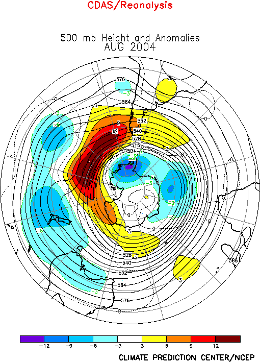
2. Southern Hemisphere
The 500-hPa circulation pattern during August featured
below-average heights at high latitudes and in the mid-latitudes Australia
eastward across the South Pacific, and above-average heights over the
southeastern Pacific centered around 50°S (Fig. E15). Temperatures
were generally near to above average over South America, southern Africa
and southeastern Australia (Fig. E1). Below-average temperatures
were observed over portions of western and northern Australia.


