Weak cold episode conditions continued across the
tropical Pacific during July (Tables T1, T2).
Sea surface temperatures (SSTs) averaged between 0.5°C and 1.0°C below normal across
most of the central and eastern tropical Pacific (Table T2, Fig. T18). SSTs across the equatorial Atlantic remained more
than 1.0°C above normal east of 30°W (Fig. T18). These
warmer than normal Atlantic SSTs have persisted since May 1999. The oceanic thermocline
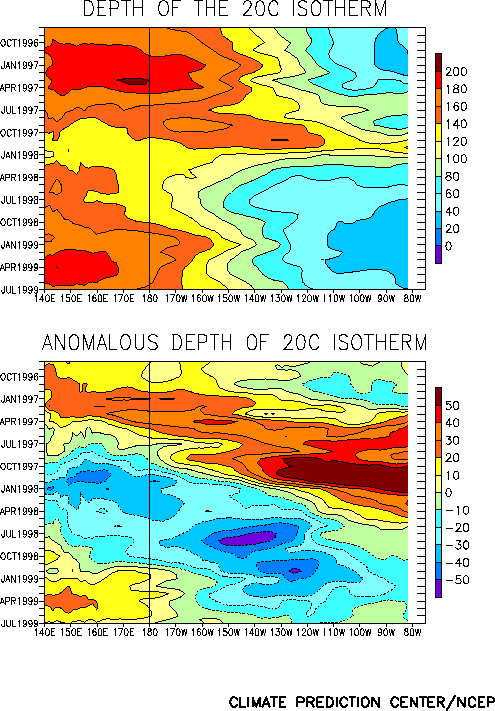
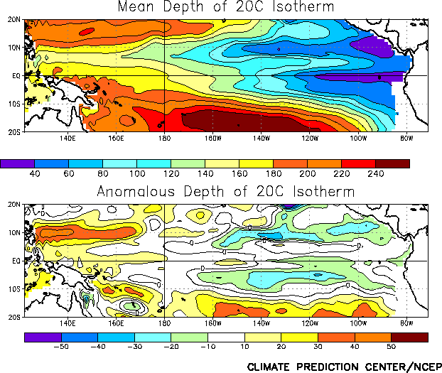
remained shallower than normal throughout the east-central and eastern Pacific and deeper
than normal in the west-central and western Pacific, although the thermocline has deepened
between 165°W and 125°W during the past few months (Figs. T15,
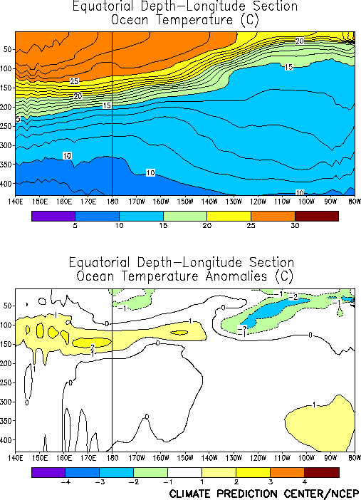
T16). Consistent with this structure, equatorial ocean
temperatures at thermocline depth were more than 2°C below normal in the east-central and
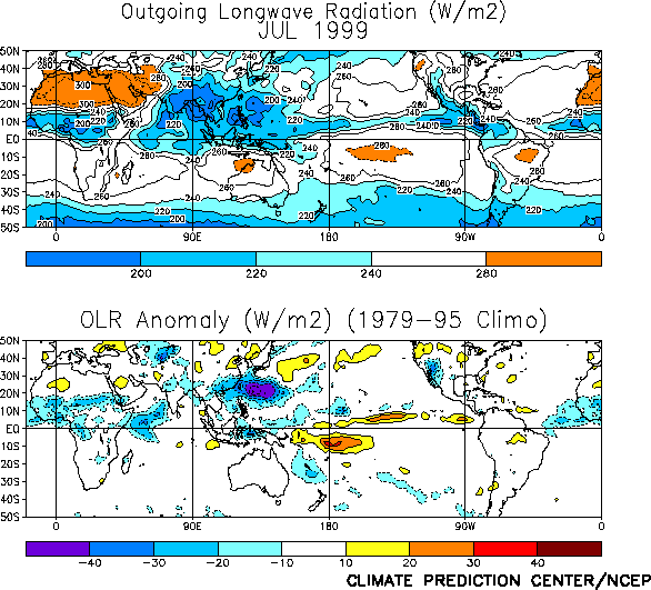
eastern Pacific, and more than 2°C above-normal in the western Pacific (Fig. T17). Tropical convection [as inferred from anomalous
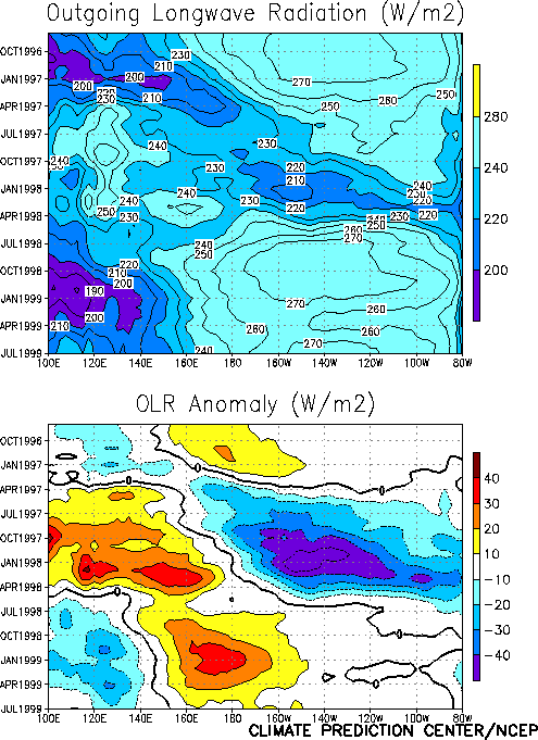
outgoing longwave radiation (OLR)] during July was suppressed across the western and
central equatorial Pacific and enhanced across eastern Indonesia and the Philippines (Fig. T25). This pattern has prevailed since the middle of
1998 and is consistent with ongoing cold episode conditions (Fig.
T8). This pattern of tropical convection was accompanied by anomalous easterly
winds at low-levels (850 hPa) over the western equatorial Pacific, where the maximum
easterly anomalies averaged near 3 m s-1. These stronger-than-normal easterlies
have been observed in this region since May 1998 (Fig. T7).
Elsewhere, convection was enhanced across the African Sahel and suppressed across southern
India during the month (Fig. T25).
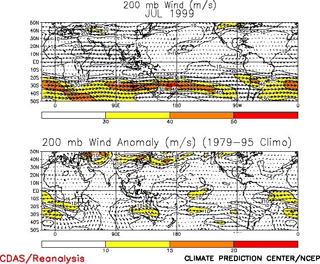
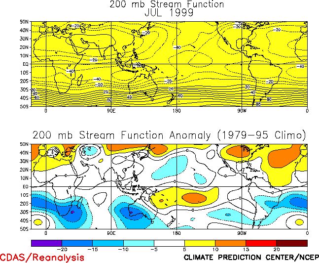
The upper-level atmospheric circulation in the Tropics was also consistent with the
pattern of tropical rainfall and cold episode conditions, with well-defined troughs
observed over the low-latitudes of the mid-Pacific in both hemispheres and amplified
subtropical ridges observed across most of the remainder of the two hemispheres (Fig. T21, T22). At higher latitudes, the
wintertime sub-tropical jetstream across the South Pacific was weaker than normal,
consistent with the pattern of tropical rainfall and an amplified mid-Pacific trough.
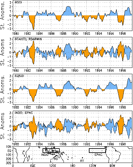
The Southern Oscillation Index (SOI) was 0.4 (Table T1, Fig. T1), and the equatorial SOI was 1.7 (Fig.
T2) during July. These indices reflect positive sea level pressure (SLP) anomalies
over the eastern Pacific and negative SLP anomalies over the western Pacific and Indonesia
(Fig. T19) and are consistent with cold episode
conditions.


