1. Northern Hemisphere
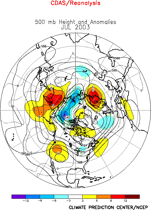
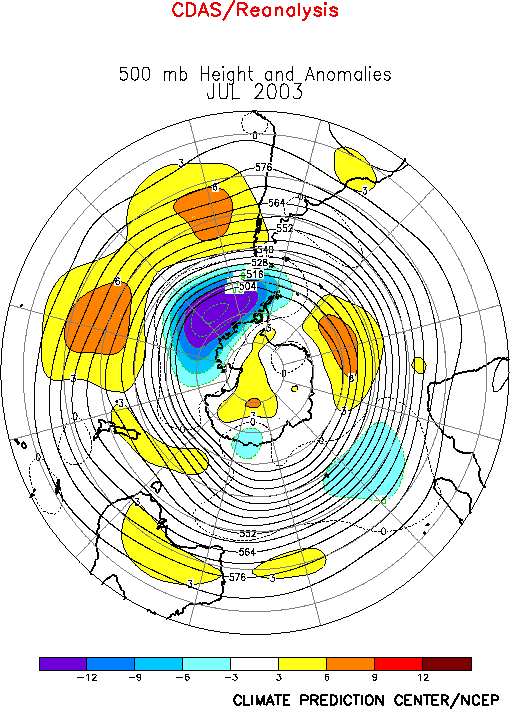
During July 2003 positive 500-hPa height anomalies were observed from
eastern Siberia to the western United States, over Scandinavia, and across
the central North Atlantic to northern Africa, and negative height
anomalies were found over the eastern United States and the eastern North
Atlantic (Fig. E10). The prominent
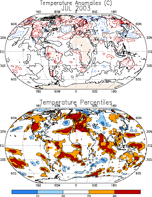
temperature anomalies during the month included a continuation of
significantly warmer-than-average conditions over the western United States
and Europe, and cooler-than-average conditions over the eastern United
States and central Russia (Fig. E1).
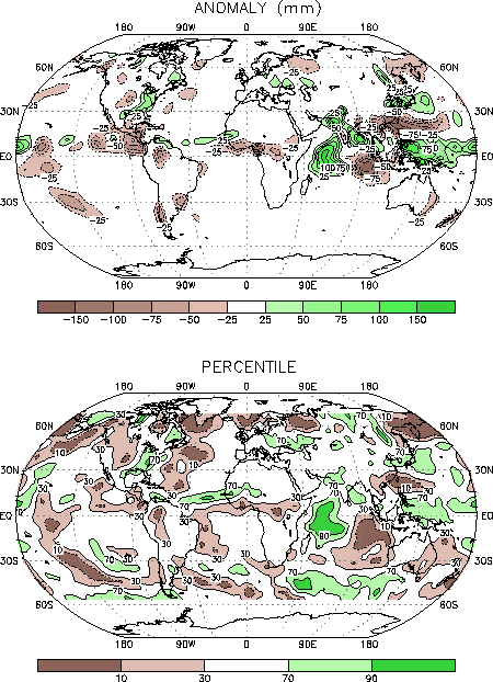
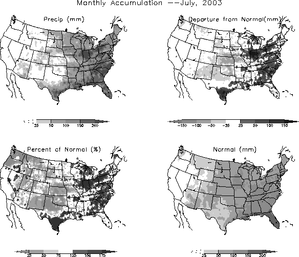
Prominent precipitation anomalies during July included above-average totals
in the southeastern and eastern United States, and below-average totals in
the Pacific Northwestern states, western Canada, and northern Europe (Fig.
E3).
a. Pacific/North America
The mean upper-level circulation during July featured a persistent
pattern of above-average heights extending from eastern Siberia to the
Rocky Mountains (Fig. E12). Associated with
this anomaly pattern the mean upper-level ridge axis in North America was
situated over the Rocky Mountains and shifted approximately 20 degrees
longitude west of its climatological mean position. This circulation was
accompanied by an amplified upper-level trough over eastern North America (Figs.
E10, T22).
The significant rainfall and temperature departures during July in North
America were associated with this anomalous ridge-trough structure. Over
western North America below-average rainfall (Fig.
E3) and significantly above-average temperatures (Fig.
E1) coincided with the mean upper-level ridge. In the United States
below-average rainfall also extended eastward to the Great Plains in the
region between the mean upper-level ridge and trough axes (Figs. E5,
E6). Conversely, above-average rainfall was
observed across the southeastern and eastern United States in the area
downstream of the mean trough axis. The Southeast, Ohio Valley, and
Mid-Atlantic regions have recorded above-average precipitation in nine of
the last ten months beginning September 2002 (Fig.
E5).
b. Europe
The upper-level circulation during July featured a blocking pattern over
Scandinavia, and a pronounced split-flow configuration farther south across
northern Europe and western Russia (Fig. E10).
This circulation contributed to significantly above-average temperatures
throughout Europe, Scandinavia, and western Russia, with monthly mean
temperatures exceeding the 90th percentile in each region (Fig.
E1).
2. Southern Hemisphere
In the Southern Hemisphere the 500-hPa circulation during July featured
above-average heights across the central South Pacific and the high
latitudes of the South Atlantic, and below-average heights over the high
latitudes of the eastern South Pacific and the central Indian Ocean (Fig.
E16). Eastern Australia experienced a continuation of above-average
temperatures and below-average rainfall during July, in association with a
persistent anomalous anticyclonic circulation at upper-levels (Figs. T21,
T22).


