Tropical
Highlights - July 2000
Oceanic and atmospheric conditions continued to
return toward normal during July 2000, as negative sea surface temperature (SST) anomalies
across the tropical central Pacific decreased in magnitude, with values more than 1.0°C
below normal confined to the extreme eastern equatorial Pacific (Fig.
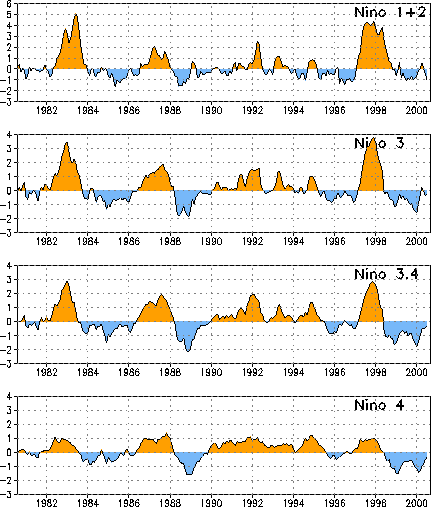
T18). Associated with this return toward normal, the Niño 3.4 and Niño 4 region
indices were only 0.3°C and 0.4°C, respectively, during July (Table
T2, Fig. T5). Across the eastern Pacific negative
SST anomalies increased in magnitude, with the Niño 1+2 region index value decreasing to
-1.0 (Table T2).
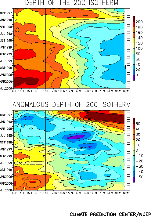
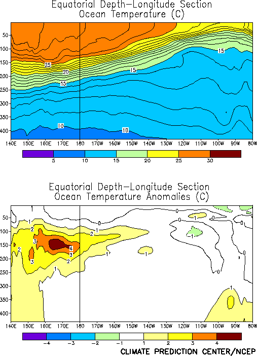
The oceanic thermocline remained deeper than normal in the equatorial west-central and
western Pacific during the month (Fig. T15), with
temperatures again averaging 3.0–4.0°C above normal at thermocline depth (Fig. T17). Over the eastern and east-central Pacific, the
depth of the thermocline has returned to near normal (Fig. T15),
resulting in a return to near-normal temperatures in the upper 150 m of the ocean east of
140°W (Fig. T17). As a result subsurface temperatures
more than 1.0°C below normal were only observed in the extreme eastern Pacific east of
100°W. This is the first month since late 1998 that the basic east-west dipole of
sub-surface temperature anomalies has been absent from the tropical Pacific.
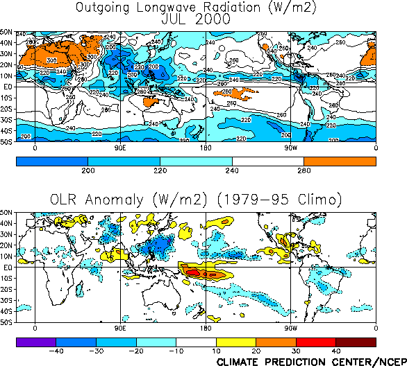
Tropical convection [as inferred from anomalous outgoing longwave radiation (OLR)] was
suppressed over the western and central equatorial Pacific during July (Fig. T25). Convection has been suppressed in this region
since the beginning of the cold episode in May 1998 (Fig. T1).
Over Indonesia convection was slightly below normal (Fig. T25) for the first time
since September 1999 (Fig. E4). Elsewhere, convection was
suppressed during the month across the monsoonal regions of India, Central America/Mexico,
and the southwestern United States (Fig. T25), in contrast
to the enhanced convection observed throughout these regions during June.
Consistent with the weakening pattern of negative SST anomalies across the equatorial
central Pacific, the low-level (850 hPa) easterly wind anomalies have also decreased over
the central Pacific since April 2000, with the zonal wind index in the region between
130°E and 180° decreasing from 3.0 in April to 0.8 this month (Table
T1). Across the eastern Pacific westerly anomalies were observed for the sixth
consecutive month (Table T1). At upper levels, weak
features replaced the well-defined upper level troughs that had persisted across the
central tropical Pacific since September 1999.
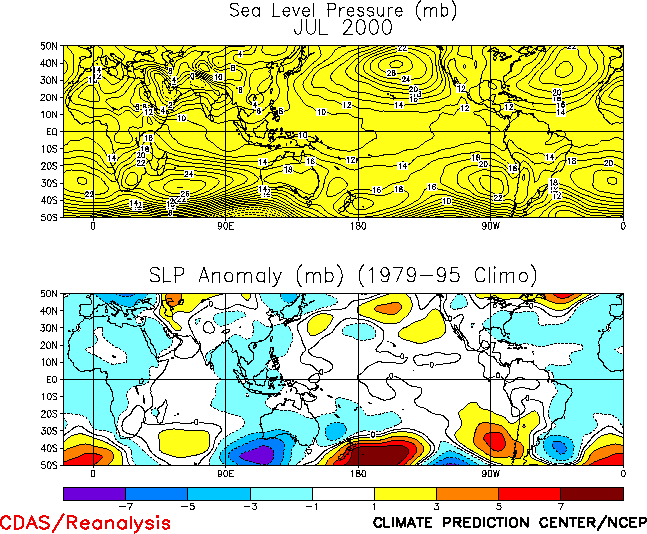
The sea level pressure (SLP) pattern across the Tropics during July featured weak
positive anomalies across the tropical central and eastern Pacific and negative anomalies
throughout the rest of the global Tropics (Fig. T19). The
Southern Oscillation Index (SOI) was negative for the second month in a row (-0.4) (Table T1), but the equatorial SOI continues to be positive
(1.3), reflecting weak cold episode conditions (Fig. T2). |


