Extratropical Highlights - April 1999
1. Northern Hemisphere
a. North Pacific
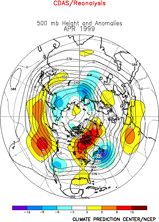
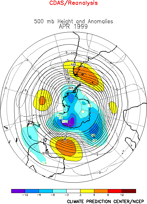
The circulation over the North Pacific during April featured below-normal heights at
high latitudes and above-normal heights in the middle latitudes (Fig.
E9). In the subtropics, it also featured anticyclonic (cyclonic) circulation
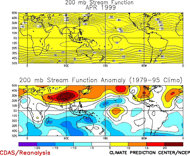
anomalies across southern Asia (the central North Pacific) (Fig.
T22 , bottom). Each of these features was also present during February and March.
Overall, these conditions reflect a pronounced westward retraction of the East Asian jet
stream toward Asia, along with a slight northward shift of the jet (Fig. T21). They also reflect a confinement of the mean
low-latitude ridge to the Indonesia sector, and a strengthening of the mid-Pacific trough
in the region east of the date line. Similar features were also evident in the large-scale
atmospheric circulation over the South Pacific during the period. In the Northern
Hemisphere, these circulation features were again accompanied by an extremely
well-developed diffluent flow and jet exit region over the central subtropical North
Pacific. These conditions are consistent with ongoing cold-episode conditions and the
pattern of La Niña-related tropical heating and convection.
At higher latitudes a persistent upper-level trough across the North Pacific during the
past three months (Fig. E9 ) has completely suppressed the
high-latitude blocking activity which is typical of La Niña conditions, and therefore has
contributed to above-normal temperatures and to a reduced frequency of cold-air outbreaks
across Canada and portions of the U.S. (Fig. E1).
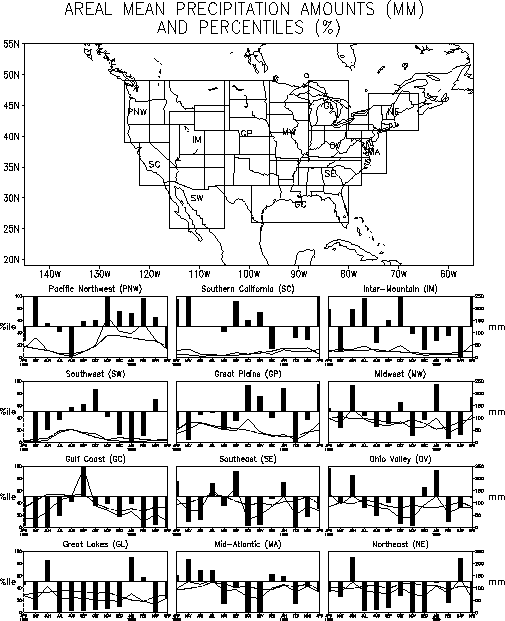
Accompanying these conditions, an increased westerly flow of marine air has persisted
during the past few months in western Canada and the northwestern United States, which has
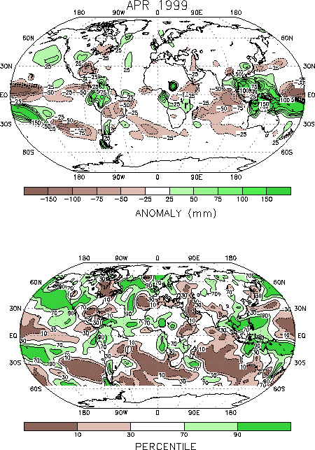
contributed to above-normal precipitation in these regions (Figs. E4, E5).
A large region of positive height anomalies at upper levels has also persisted across
central and eastern Canada during the past three months, in association with a reduced
strength of the climatological mean Hudson Bay Low (Fig. E9).
This pattern has contributed to above-normal temperatures across eastern Canada during the
period.
b. North Atlantic, Europe, Asia
The circulation during April featured above-normal heights across the high latitudes of
the North Atlantic (Fig. E9 ) and below-normal heights
over the western North Atlantic. Above-normal heights also covered the eastern North
Atlantic and northern Africa during the month. This circulation contributed to
above-normal precipitation across the high latitudes of the North Atlantic, and to
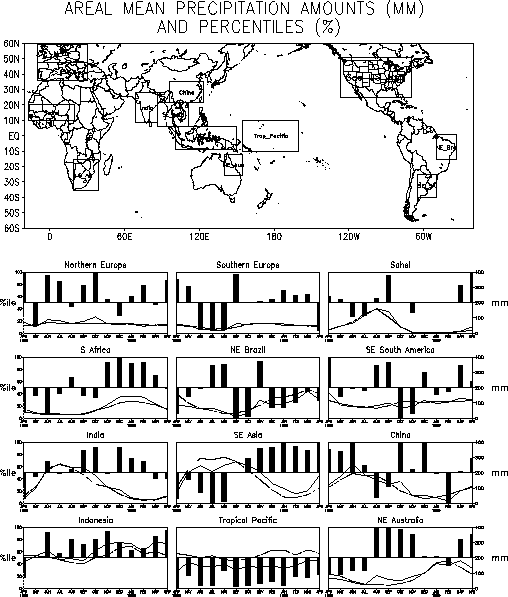
below-normal rainfall across the Mediterranean Sea and the Middle East (Figs. E3, E4). Farther north and east,
a large-amplitude ridge at upper levels covered western Russia and eastern Europe during
the month. This feature contributed to above-normal temperatures throughout the region,
with values averaging 1-3°C above normal in many locations (Fig.
E1).
2. Southern Hemisphere
The Southern Hemisphere extratropical circulation during April again featured
above-normal heights across the middle latitudes of the South Pacific (Fig. E15). At lower latitudes, the
circulation featured a well-defined low-latitude ridge over the eastern Indian Ocean and
Australia and a large-amplitude trough east of the date line (Fig.
T22). Overall, these conditions were associated with abnormally weak winds at jet
stream level across the middle latitudes of the eastern South Pacific (Fig. T21), and a poleward shift of the main jet stream to
higher latitudes. These conditions and their Northern Hemisphere counterparts are
consistent with ongoing strong La Niña conditions.
|


