Tropical Highlights - April 2003
Conditions across the Tropical Pacific returned to normal for the first
time since May 2002, as sea surface temperature (SST) anomalies decreased
across the entire equatorial Pacific (Table T2).
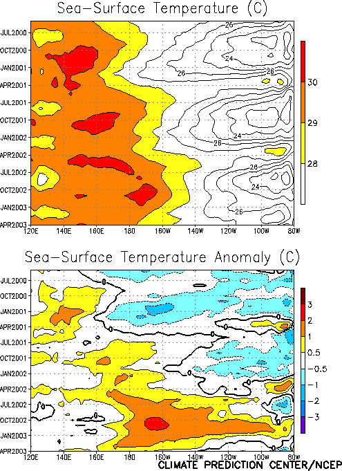
Since peaking in late 2002, SST anomalies have steadily decreased throughout
the central and eastern equatorial Pacific (Fig. T9),
with below normal SSTs observed in the eastern Pacific east of 140
°W,
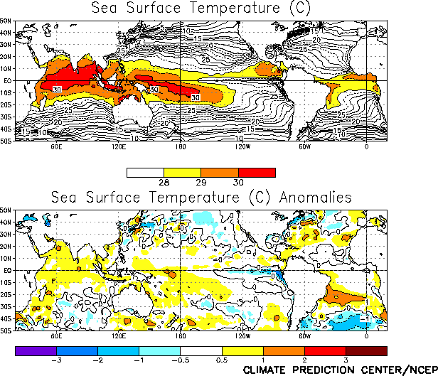
and slightly above normal SSTs recorded across the western and central
Pacific during April (Fig. T18). The
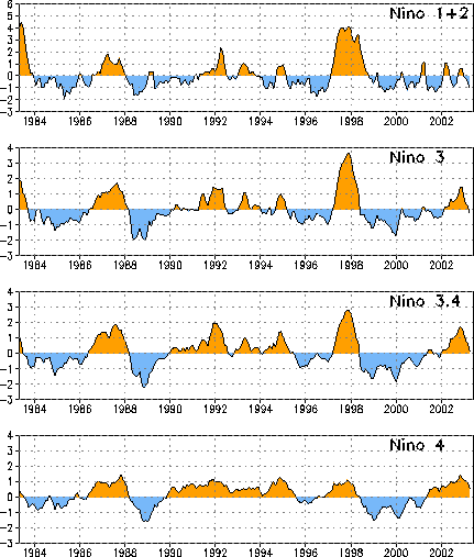
anomalies in all four Niño region
indices decreased for the fourth consecutive month (Table
T2, Fig. T5), with the value in the Niño
3 region becoming negative for the first time since February 2002 (Fig.
T5).
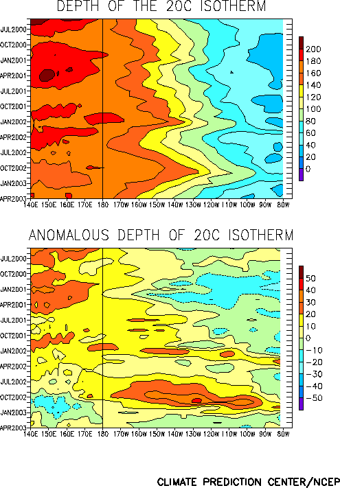
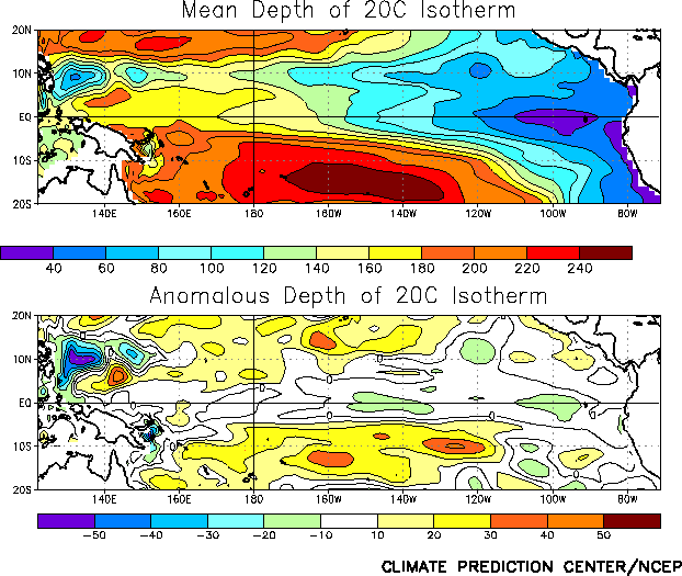
Consistent with the cooling trend in SSTs, the depth of the equatorial
oceanic thermocline has steadily decreased since late 2002, with negative
subsurface temperature departures developing in the upper ocean of the
equatorial Pacific during April (Figs. T15, T16).
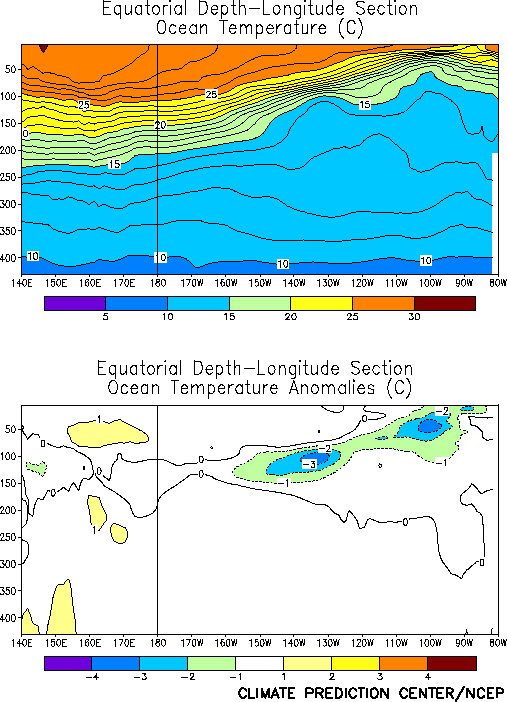
Ocean temperatures at thermocline depth were below normal across the central
and eastern equatorial Pacific, with negative departures of more than 3
°C
recorded between 130°W
and 140°W
and also near 100°W
(Fig. T17).
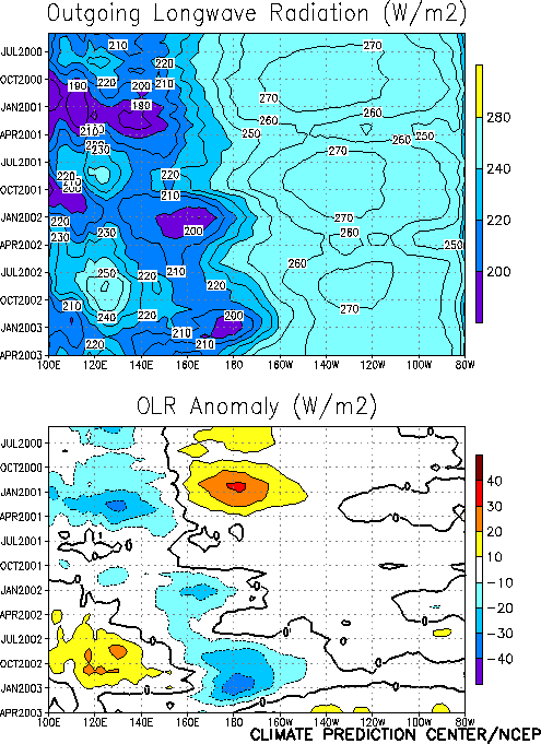
Consistent with weakening warm episode conditions, convection over the
central equatorial Pacific has steadily decreased since January 2003 (Fig.
T8). Tropical convection (precipitation and cloudiness) was below
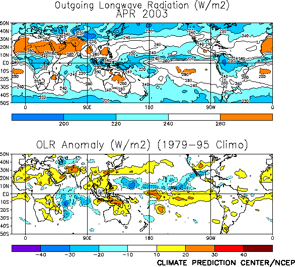
average over Indonesia and across the central and eastern Pacific and near
average over the western Pacific during April (Fig. T25). This is the
first time since July 2002 that suppressed convection has been observed over
the central equatorial Pacific (Fig. T8, Table T1).
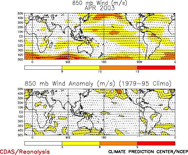
The low-level (850-hPa) equatorial easterly winds were slightly stronger
than normal over the central and eastern Pacific during April (Fig. T20).
Near-normal to slightly enhanced easterlies have been observed across the
equatorial Pacific since the beginning of the year, consistent with
weakening warm episode conditions (Fig. T4).
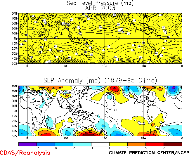
The tropical sea-level pressure (SLP) pattern during April featured
slightly above normal SLP over the eastern half of the Pacific Ocean and the
Atlantic Ocean and slightly below normal SLP over the Indian Ocean and the
western Pacific (Fig. T19). This pattern was associated with a small
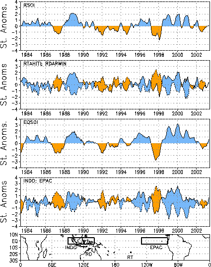
negative value of the SOI (-0.4) (Table T1) and the first positive
value of the equatorial SOI (0.7) since April 2002 (Fig. T2).


