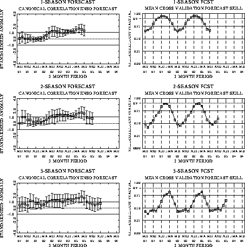
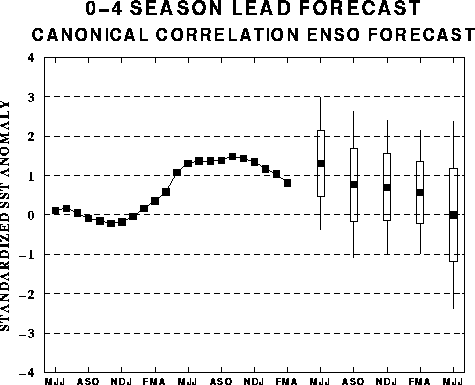
The canonical correlation analysis
(CCA) forecast of SST in the central Pacific (Barnett et al. 1988, Science, 241,
192-196; Barnston and Ropelewski 1992, J. Climate, 5, 1316-1345), is shown
in Figs. F1 and F2. This forecast
is produced routinely by the Prediction Branch of the Climate Prediction Center. The
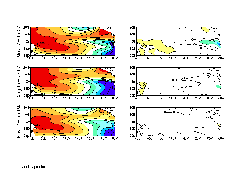
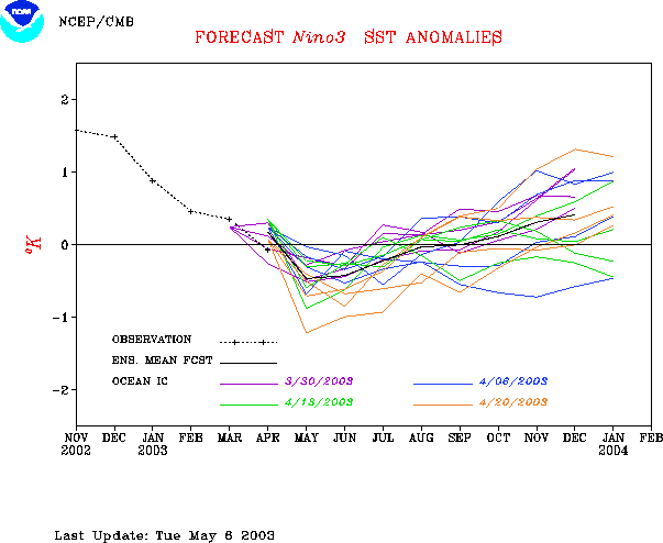
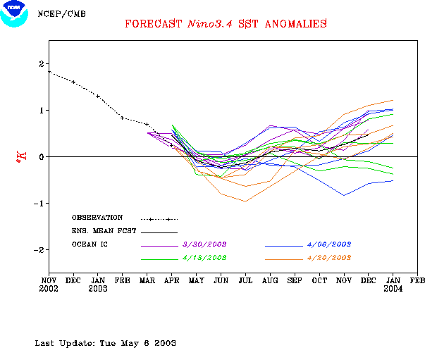
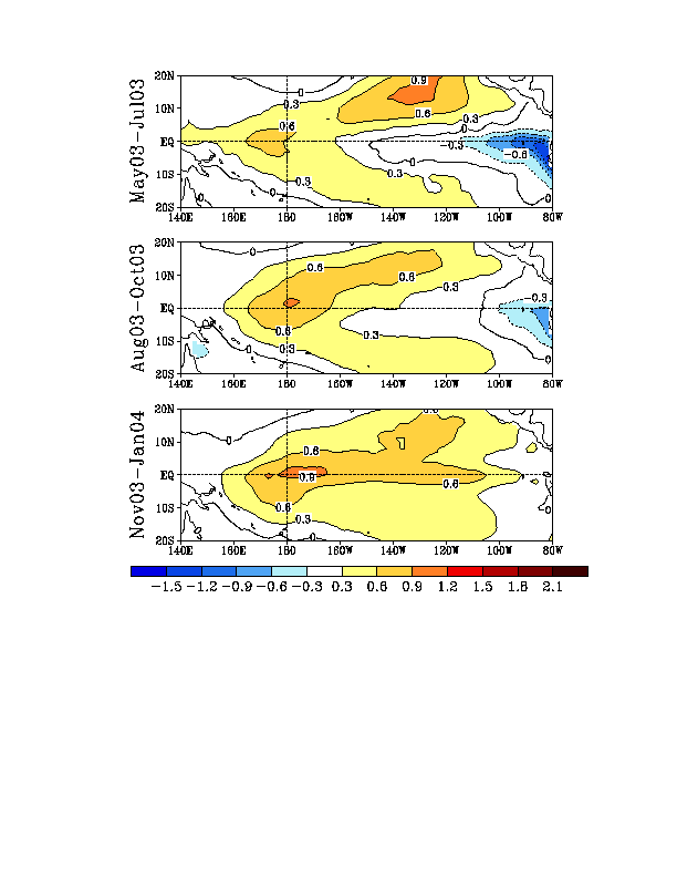
predictions from the National Centers for Environmental Prediction (NCEP) coupled
ocean/atmosphere model (Ji et al. 1998, Mon. Wea. Rev, 126, 1022-1034) are
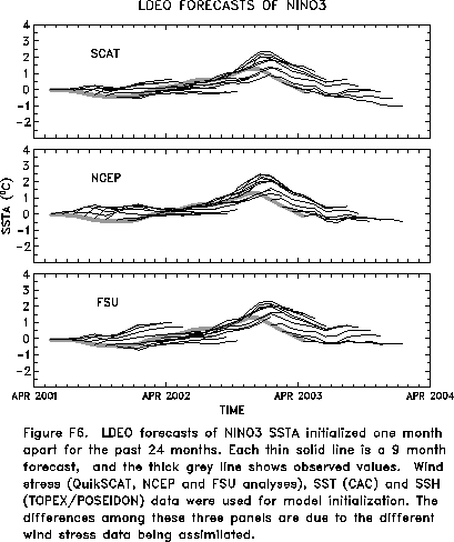
presented in Figs. F3 and F4a, F4b. Predictions from the Markov model (Xue, Y., A. Leetmaa,
and M. Ji, 2000: ENSO prediction with Markov model: The impact of sea level. J. Climate,
13, 849-871) are shown in Figs. F5 and F6.
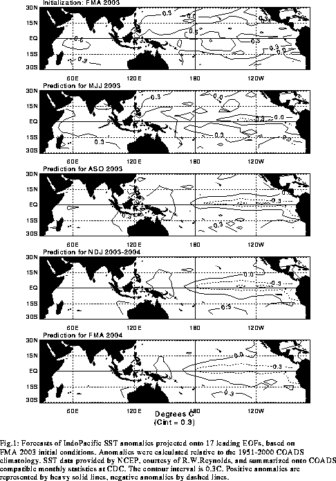
Predictions from the latest version of the LDEO model (Chen, D., M. A. Cane, S.
E. Zebiak, Rafael Canizares and A. Kaplan, 2000, Geophys. Res. Let., 27,
2585-2587) are shown in Figs. F7 and F8.
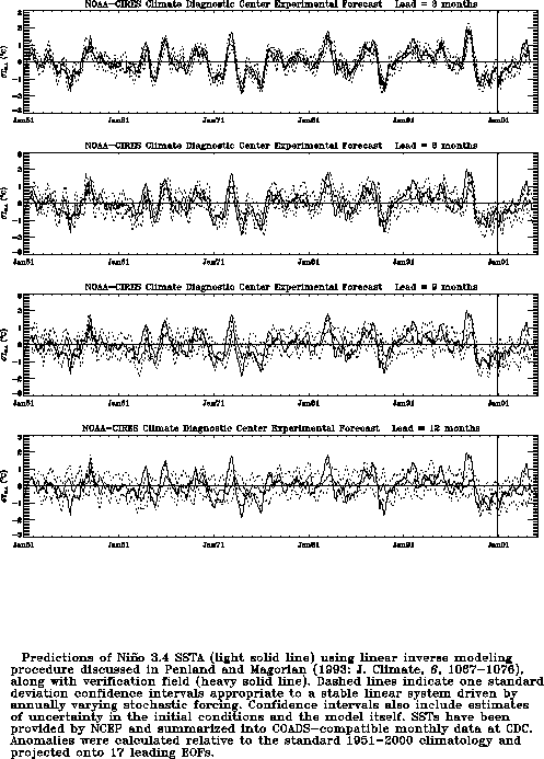
Predictions using linear inverse modeling (Penland and Magorian 1993, J. Climate, 6,
1067-1076) are shown in Figs. F9 and F10.
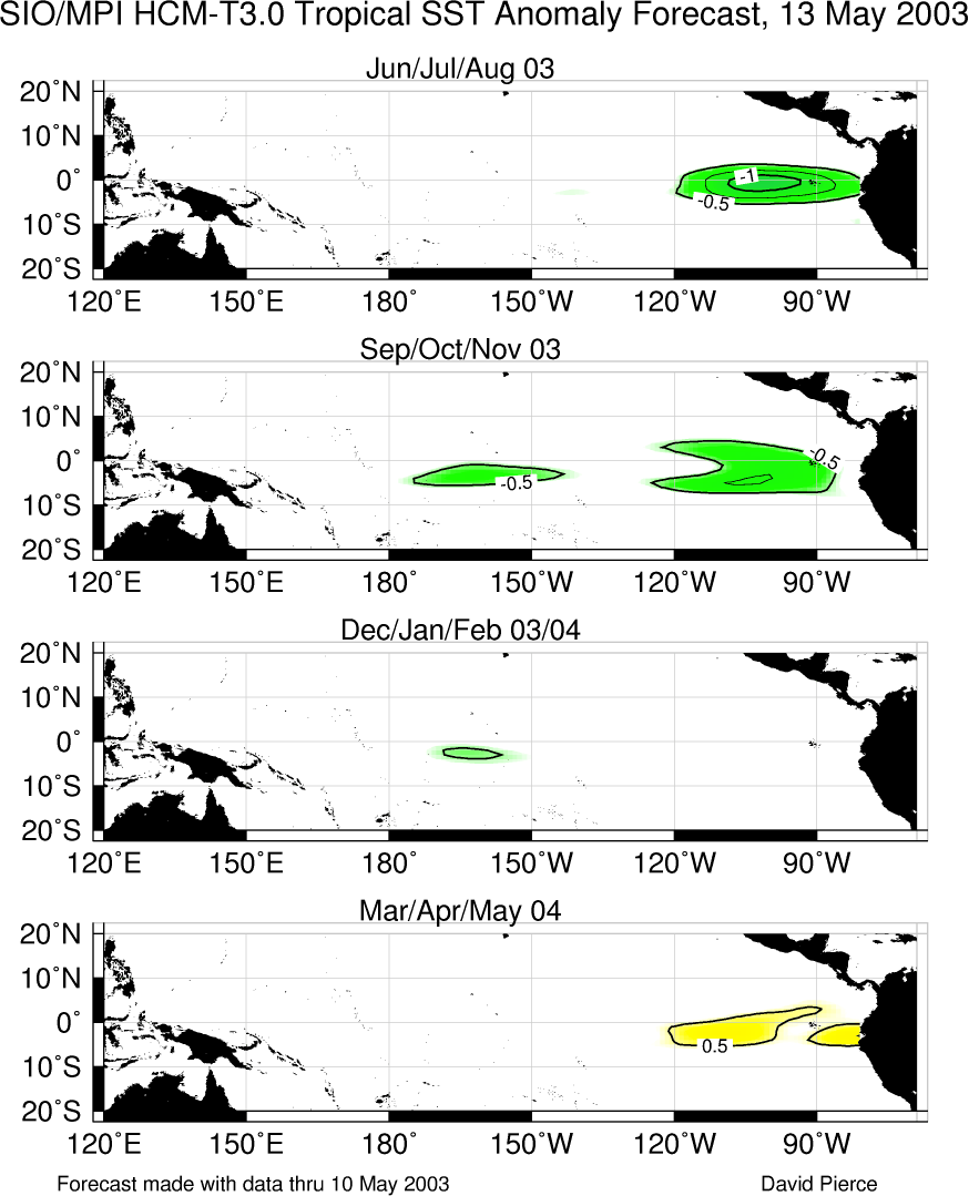
Predictions from the Scripps / Max Planck Institute (MPI) hybrid coupled model (Barnett et
al. 1993, J. Climate, 6, 1545-1566) are shown in Fig. F11. Predictions from the ENSO-CLIPER statistical model
(Knaff, J. A. and C. W. Landsea 1997, Wea. Forecasting, 12, 633-652) are
shown in Fig. F12. Niño
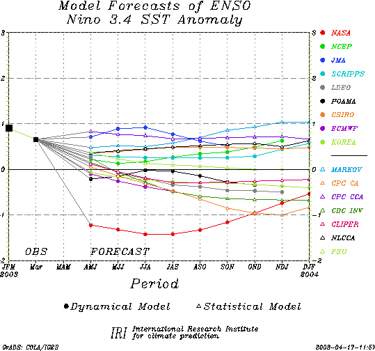
3.4 predictions are summarized in F13,
which is provided by the Forecasting
and Prediction Research Group of the IRI.
The CPC and the contributors to the Forecast Forum caution potential users of
this predictive information that they can expect only modest skill.
Outlook
Based on current conditions and recent observed
trends, it appears likely that cold episode (La Niña)
conditions will develop in the tropical Pacific during the next several
months.
Discussion
Warm episode (El Niño)
conditions rapidly dissipated in the tropical Pacific during March and
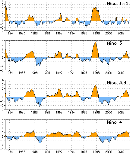
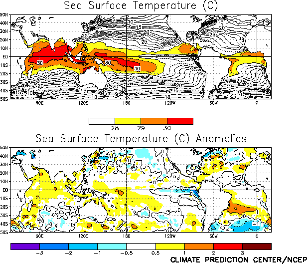
April 2003. Sea-surface temperature anomalies continued to decrease
across the central and eastern equatorial Pacific during the month (Table
2, Figs. T5 and T9),
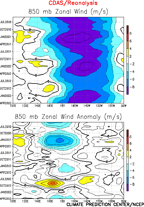
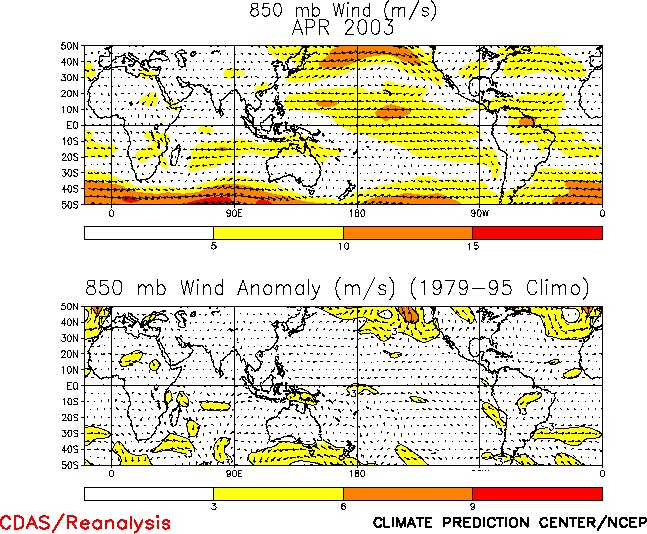
while low-level equatorial easterlies continued to strengthen (Figs. T7
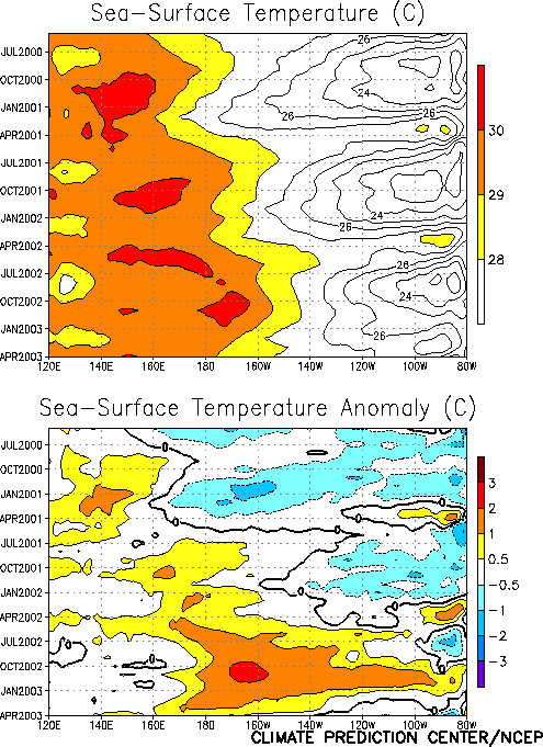
and T20). During April SST’s were below
normal over a large portion of the east-central and eastern tropical
Pacific (Fig. T18). During the past
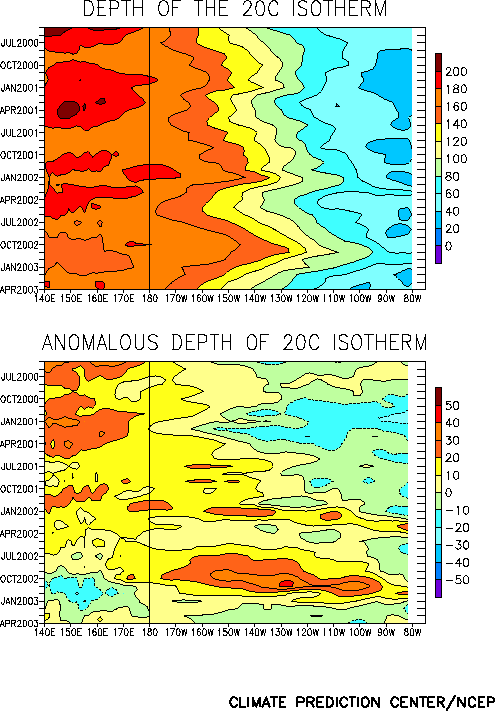
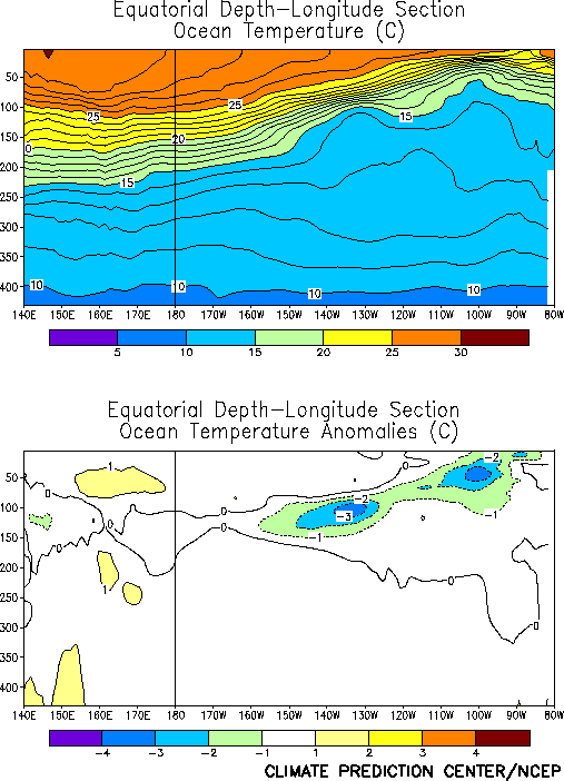
several months the depth of the oceanic thermocline has steadily
decreased across the central and eastern equatorial Pacific, consistent
with the appearance of colder than normal subsurface water in the upper
ocean of the equatorial Pacific (Figs. T15
and T17).
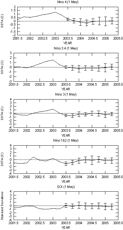
The latest statistical and coupled model forecasts indicate
considerable uncertainty for the next several months (Figs. F1,
F2, F3, F4,
F5, F6, F7,
F8, F9, F10,
F11, F12, F13).
While some forecast the possibility that La NiZa
will develop during the second half of 2003, others indicate a
resurgence of El Niño
conditions by the end of the year. All such models have relatively low
skill during the transition phases of the ENSO cycle. However, based on
current conditions and recent observed trends, it appears likely that
cold episode (La Niña)
conditions will develop in the tropical Pacific during the next several
months.
Weekly updates of SST, 850-hPa wind, OLR, and the equatorial subsurface temperature
structure are available on the Climate Prediction Center homepage at:
http://www.cpc.ncep.noaa.gov (Weekly Update).


