Tropical
Highlights - April 2002
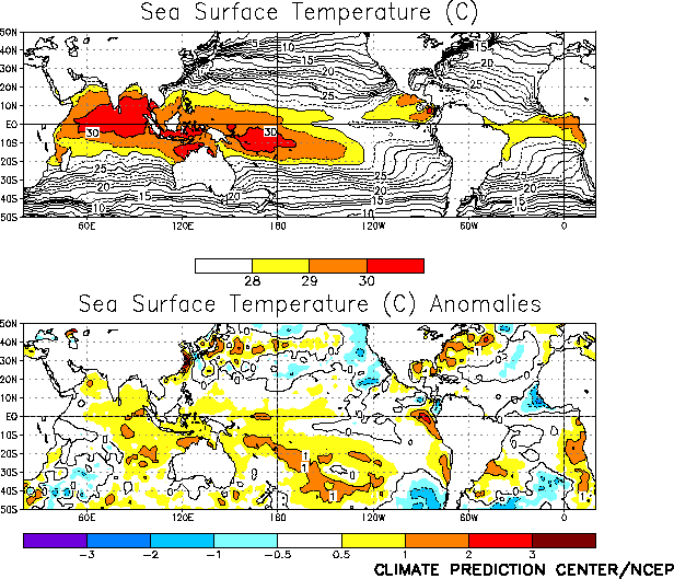
Sea surface temperatures (SSTs) averaged above
normal across most of the equatorial Pacific during April 2002, with the largest anomalies
exceeding 1°C west of the date line and in the extreme eastern Pacific (Fig. T18). This overall pattern of SST anomalies is very
similar to that observed last month, with all four Niño index regions indicating positive
anomalies in both March and April (Table T2). The
atmospheric circulation across the Pacific continued to be influenced by tropical
intra-seasonal oscillations associated with the Madden-Julian Oscillation (MJO) with a
period of approximately 30–40 days.
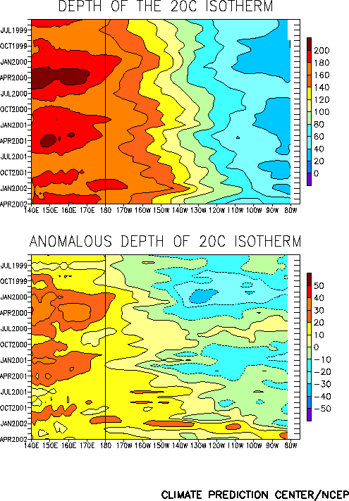
The oceanic thermocline remained deeper than normal across most of the equatorial
Pacific during April (Fig. T15) with the largest depth
anomalies located in the central Pacific between 170°E and 155°W and in the extreme
eastern Pacific (Figs. T15, T16).
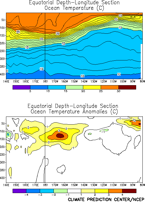
Ocean temperature anomalies at thermocline depth were also largest (+2 to +4°C) in the
central and extreme eastern equatorial Pacific, and near normal to slightly below normal
between 140°W and 105°W (Fig. T17). The thermocline has
shoaled during the past few months between 170°W-110°W (Fig. T15),
resulting in the disappearance of the large positive temperature anomalies (+4°C)
observed in this region during February 2002 (Fig. T17).
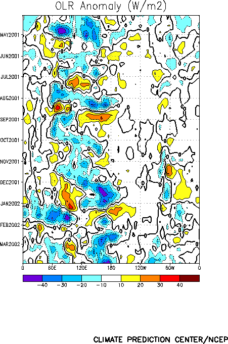
Enhanced tropical convection during April was observed over the eastern equatorial
Pacific, coastal Peru, and Ecuador, and across the equatorial Atlantic and equatorial
western Africa (Fig. T25). Tropical convection was
near-normal across the western Pacific, and slightly below normal over both the central
Pacific (Fig. T8, top), and northern Australia (Fig. T25). The above-average convection over the equatorial
Atlantic and western equatorial Africa was associated partly with the MJO (Fig. T11). The enhanced convection that was observed between
160°E and the date line (180°) during December 2001 – March 2002 was absent during
April (Figs. T8, T11).
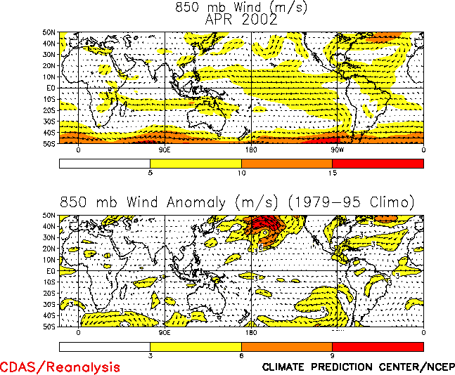
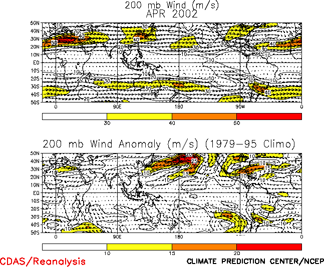
Both the low-level (850-hPa) and upper level (200-hPa) winds were near normal across
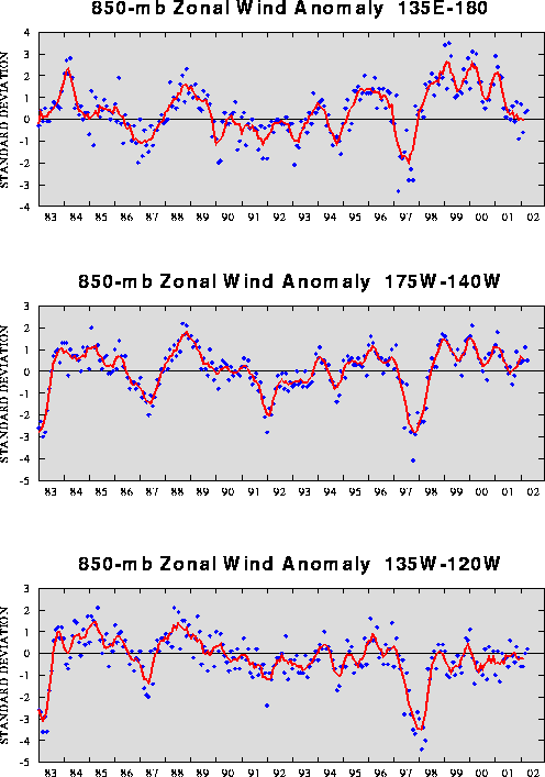
the equatorial Pacific during April (Figs. T20, T21). For most of the past year the low-level equatorial winds
have generally been near normal over the Pacific basin (Table T1,
Fig. T4), while the upper-level winds have fluctuated between
near-normal and stronger-than-normal westerlies. As such, no El Niño signal is yet
evident in these wind patterns.
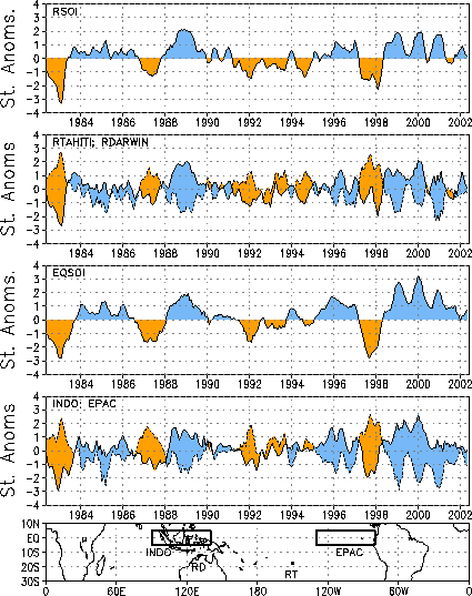
The tropical sea level pressures (SLP) during April featured negative anomalies over
the entire Tropics except for over the eastern Pacific and South America (Fig. T19). This pattern was associated with a a positive
value of the equatorial Southern Oscillation Index (SOI) (0.7), while the Tahiti - Darwin
SOI was near zero (–0.3) (Table T1). After remaining
strongly positive for the 3 ½ year period ending November 2001, the equatorial SOI has
oscillated around zero since December 2001 (Fig. T2). |


