Tropical
Highlights - April 2001
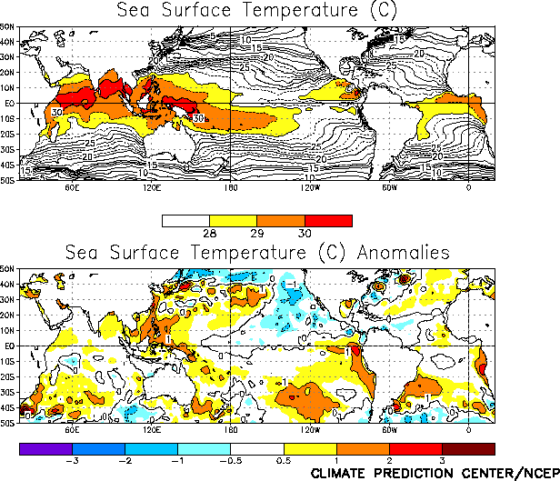
Cold episode conditions weakened during April 2001,
as sea surface temperatures (SSTs) across the central tropical Pacific returned toward
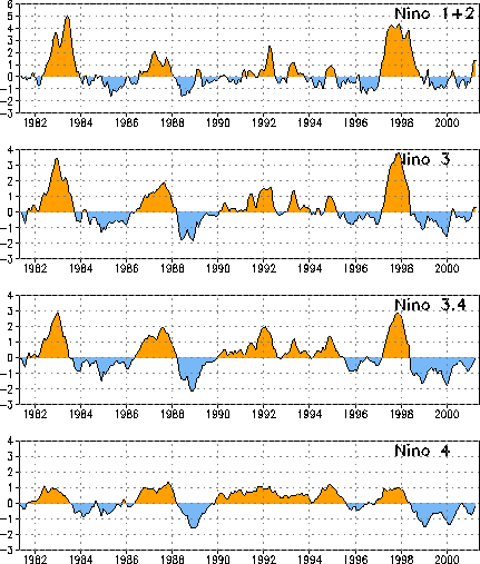
normal (Fig. T18). Since February, SSTs and SST anomalies
across the central Pacific have increased significantly, with the Niño 4 anomaly index
value increasing from -0.8 to -0.2 and the Niño 3.4 anomaly index value increasing form -0.5 to 0.0 (Table T2). SSTs in the extreme eastern Pacific (Niño 1+2)
remained above normal for the month (Figs. T5, T18, Table T2), but had returned to
near normal by the end of the month (not shown).
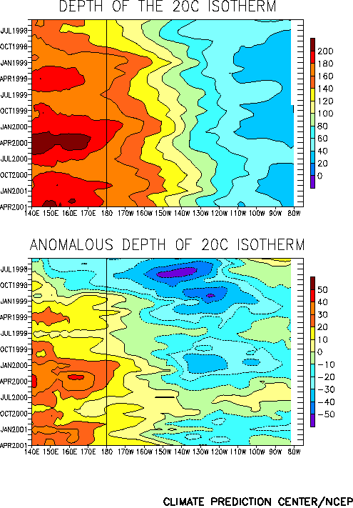
The equatorial oceanic thermocline remained shallower than normal east of 145°W and
deeper than normal to the west during the month (Fig. T15).
Consistent with this pattern, oceanic temperatures were above (below) normal west (east)
of 145°W at thermocline depth (Fig. T17). During the past
few months the thermocline has deepened across the central Pacific (Fig.
T15). Associated with this deepening, positive temperature anomalies at
thermocline depth have spread from the western Pacific into the central Pacific. This
deepening and warming is typically observed during the late stages of a cold episode.
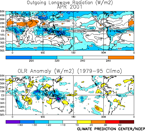
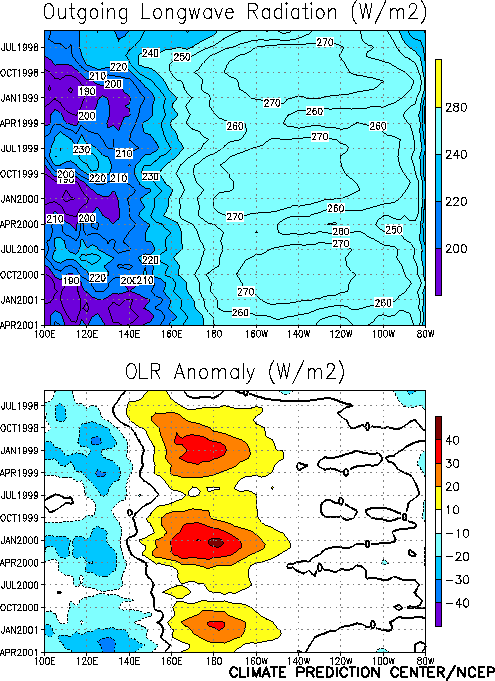
Tropical convection during April was slightly below normal over the west-central and
central Pacific [as inferred from positive anomalies of outgoing longwave radiation (OLR)]
and well above normal over the western Pacific, Indonesia, and northern Australia (Fig. T25). This pattern of anomalous convection is consistent
with La Niña conditions and has largely persisted since mid-1998 (Fig.
T8). Elsewhere, convection was also enhanced over the southern part of the Sahel
and over southern India, possibly associated with an early start to the monsoon seasons in
these regions.
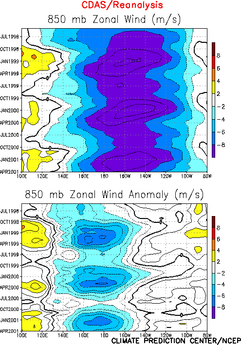
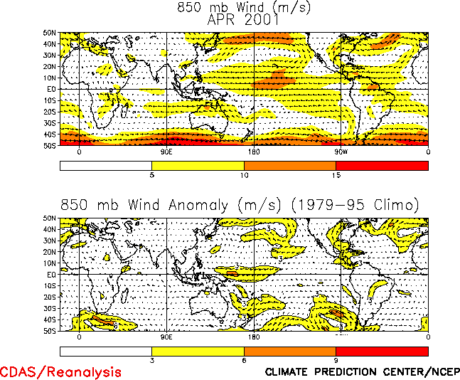
The anomalous tropical convection during April was again associated with low-level (850
hPa) easterly wind anomalies over the western equatorial Pacific and westerly wind
anomalies over the eastern Indian Ocean (Figs. T7, T20, and Table T1). Enhanced
equatorial easterlies have persisted across the western and central Pacific since the
onset of cold episode conditions in mid-1998 (Fig. T7). At
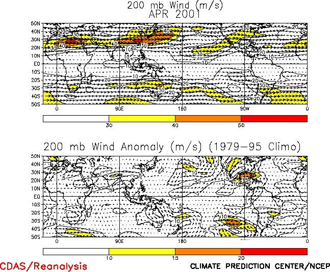
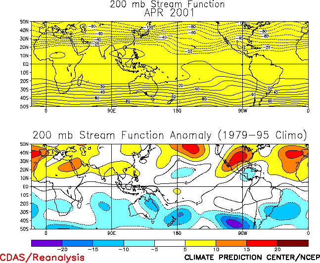
upper levels, weak low latitude troughs and westerly anomalies, centered near the date
line, were observed farther west during April than during the past few months (Figs. T21, T22).
The sea level pressure (SLP) pattern during April featured near normal SLP throughout
most of the global Tropics (Fig. T19). This pattern was
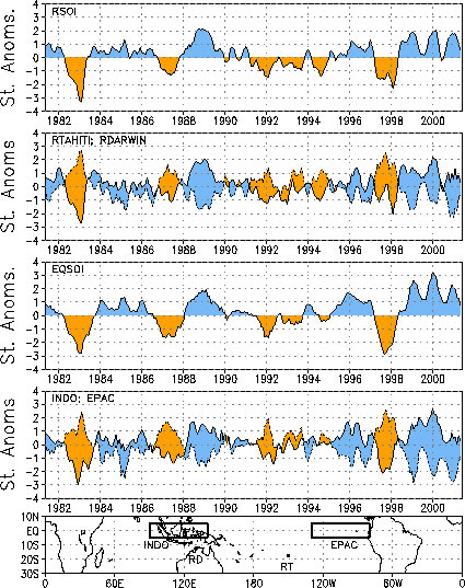
associated with a near normal value of the Southern Oscillation Index (SOI) (-0.1) and the
smallest value of the equatorial SOI (0.8) since August 2000 (Table
T1, Fig. T2). Interestingly, both the SLP anomalies at
Tahiti and Darwin were close to zero (Table T1). |


