|
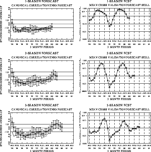
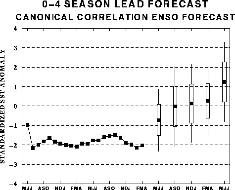
The canonical correlation analysis (CCA) forecast
of SST in the central Pacific (Barnett et al. 1988, Science, 241, 192-196;
Barnston and Ropelewski 1992, J. Climate, 5, 1316-1345), is shown in Figs.
F1 and F2. This forecast is produced
routinely by the Prediction Branch of the Climate Prediction Center. The predictions from
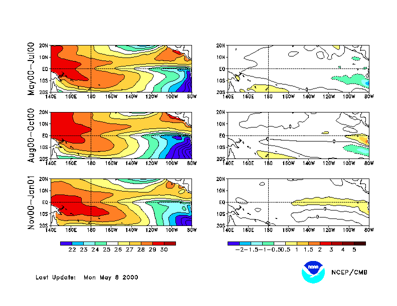
the National Centers for Environmental Prediction (NCEP) coupled ocean/atmosphere model
(Ji et al. 1998, Mon. Wea. Rev, 126, 1022-1034) are presented in Figs. F3 and F4. Predictions from the latest
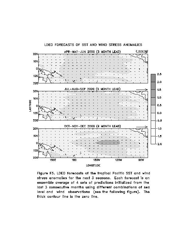
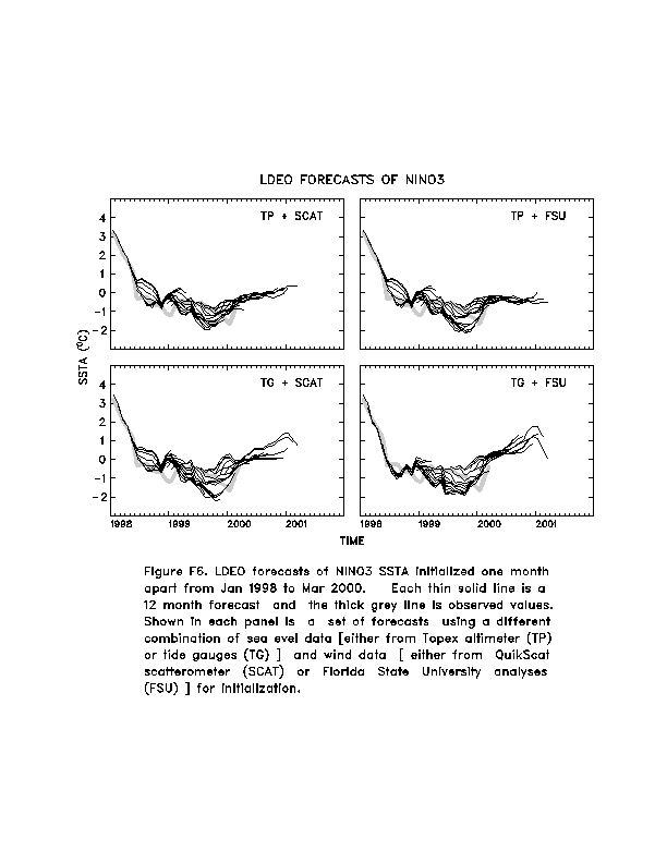
version of the LDEO model (Chen, D., M. A. Cane, S. E. Zebiak, Rafael Canizares and A.
Kaplan, 2000, Geophys. Res. Let., accepted) are shown in Figs. F5 and F6. Predictions using linear
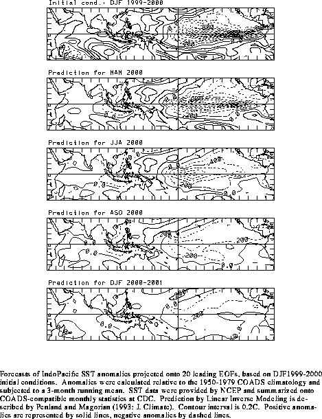
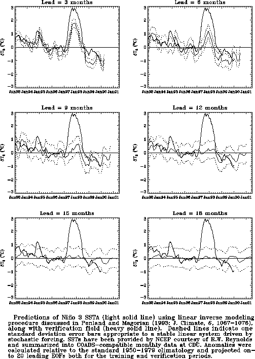
inverse modeling (Penland and Magorian 1993, J. Climate, 6, 1067-1076) are
shown in Figs. F7 and F8.
Predictions from the Scripps / Max Planck Institute (MPI) hybrid coupled model (Barnett et
al. 1993, J. Climate, 6, 1545-1566) are shown in Fig. F9.
The CPC and the contributors to the Forecast Forum caution potential users of
this predictive information that they can expect only modest skill.
Discussion and Outlook
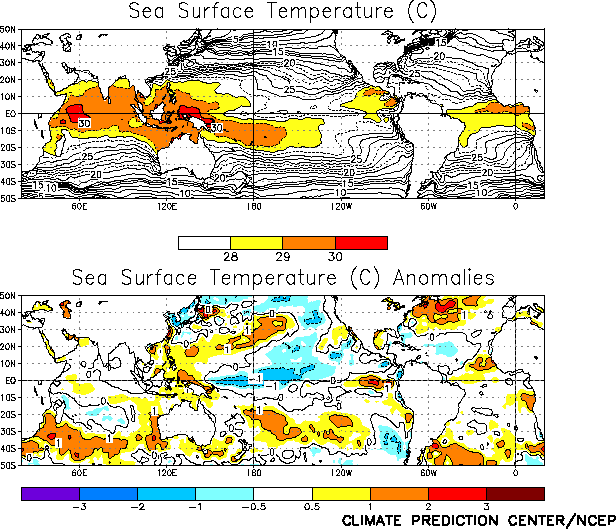
Mature cold episode conditions continued in the tropical Pacific during April, as sea
surface temperatures (SSTs) remained below normal across the west-central and central
equatorial Pacific (Fig. T18 and Table T2).
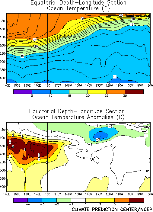
Below- normal subsurface temperatures continue to dominate the eastern equatorial Pacific
while above-normal subsurface temperatures dominate the western Pacific (Fig. T17). The local warming of the SSTs in the eastern
tropical Pacific is likely to be short lived, as the large-scale subsurface thermal
structure favors a continuation of the cold episode at this time. Accompanying these
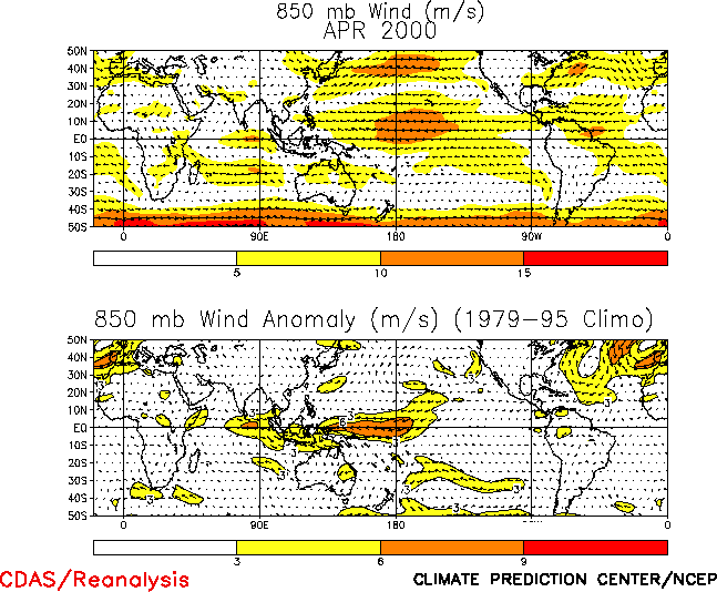
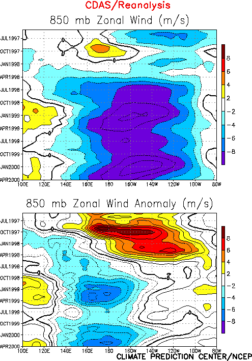
conditions, the mean low-level equatorial easterly winds remained much stronger than
normal over the western tropical Pacific and near normal over the eastern Pacific (Fig. T20). Enhanced low-level westerlies were observed over
the eastern Indian Ocean and Indonesia. This pattern of low-level winds contributed to
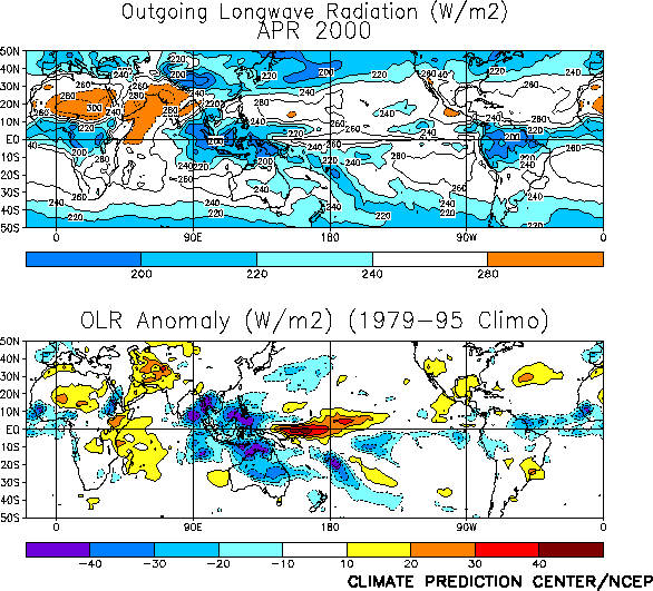
enhanced low-level convergence and precipitation over the eastern Indian Ocean, Indonesia,
the Philippines and northern Australia and suppressed precipitation over the central
equatorial Pacific (Fig. T25). These patterns of anomalous
convection and low-level winds have been highly persistent since the summer of 1998 (Figs.
T7 and T8 ), consistent with ongoing
cold episode conditions.
The latest NCEP coupled model and statistical model forecasts and other available
forecasts exhibit considerable spread in the evolution of the SSTs over the next 9 months.
Both the NCEP coupled model (Figs. F3 and F4)
and the NCEP statistical model (Figs. F1 and F2) indicate that cold episode conditions will weaken during the
next 3 months, followed by near-normal conditions during August-October and by slightly
warmer-than-normal conditions thereafter. The LDEO model (Figs. F5
and F6) forecasts a similar evolution during the next 6
months, but is warmer than the NCEP models by the end of the year. Other available coupled
model and statistical predictions (Figs. F7 , F8, F9)
indicate a gradual weakening of cold episode conditions through the remainder of the year.
The lack of any rapid evolution in the subsurface thermal structure and the persistence of
low-level easterly anomalies over the central and western equatorial Pacific continues to
support a slower decay of the cold episode conditions. Thus, it is likely that cold
episode conditions will gradually weaken over the next 6 months and that near-normal or
slightly cooler-than-normal conditions will be present in the tropical Pacific at the end
of the year.
Weekly updates of SST, 850-hPa wind and OLR are available on the Climate Prediction
Center homepage at: http://www.cpc.ncep.noaa.gov (Weekly
Update).
|


