Tropical
Highlights - March 2001
Mature cold episode conditions continued during
March 2001, although sea surface temperatures (SSTs) and anomalies increased across the
tropical Pacific (Fig. T18). During this long running
episode, SSTs in the central Pacific also increased during the Northern Hemisphere spring
in both 1999 and 2000 (Fig. T5). Despite the increase, SSTs
in the Niño 4 region remained below 28°C, which is sufficient to suppress convective
activity over the central equatorial Pacific (Fig. T18, top).
SSTs in the eastern Pacific increased to more than 1.0°C above normal, with the Niño 1+2
index reaching 1.3 (Table T2). This is the largest value
in this region since the end of the 1997/98 warm episode in July 1998 (Fig.
T5). Warming in the eastern equatorial Pacific has also been observed during each
of the prior two springs (Fig. T9).
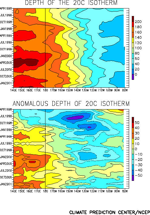
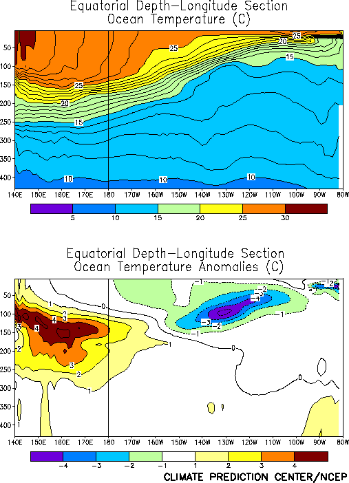
In spite of the abnormal warming in the eastern Pacific, the equatorial oceanic
thermocline remained shallower than normal in that region (Fig.
T15), giving rise to subsurface temperature anomalies more than 4°C below normal
(Fig. T17). At the same time, the thermocline remained
deeper than normal in the western and central Pacific (Fig. T15),
with subsurface temperature anomalies remaining more than 4°C above normal (Fig. T17). This dipole pattern in the subsurface temperature
anomalies is consistent with mature cold episode conditions.
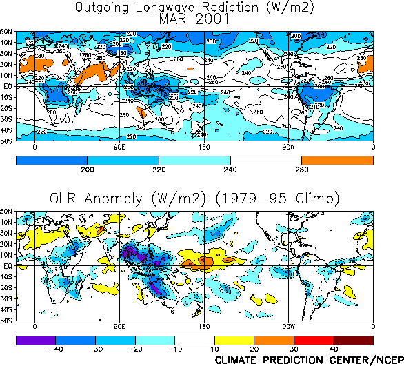
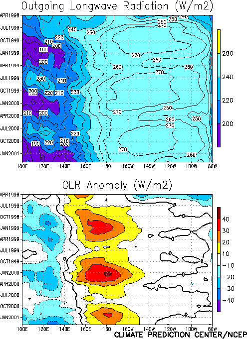
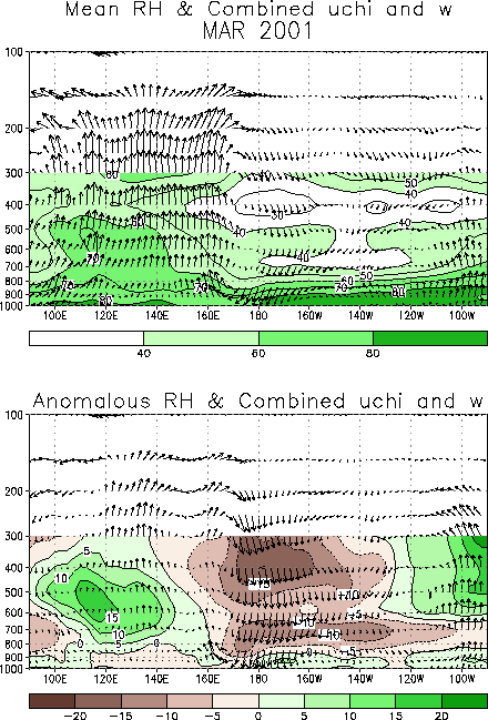
Tropical convection during March remained below normal over the west-central and
central Pacific [as inferred from positive anomalies of outgoing longwave radiation (OLR)]
and well above normal over the extreme western Pacific, Indonesia, and northern Australia
(Fig. T25). This pattern of anomalous convection is
consistent with La Niña conditions and has largely persisted since mid-1998 (Fig. T8).
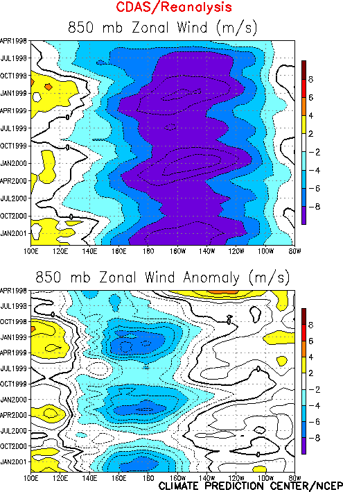
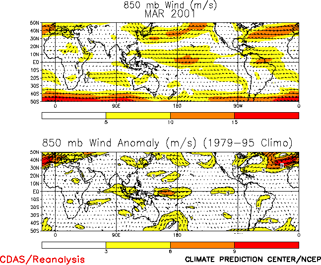
The anomalous tropical convection during March was associated with low-level (850 hPa)
easterly wind anomalies over the western equatorial Pacific and westerly wind anomalies
over the eastern Indian Ocean (Figs. T7, T20,
and Table T1). Enhanced equatorial easterlies have
persisted across the western and central Pacific since the onset of cold episode
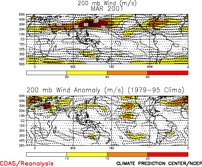
conditions in mid-1998 (Fig. T7). At upper levels, low
latitude troughs and westerly anomalies were observed across the central Pacific (Figs.
T21, T22). This pattern of
upper-level and lower level wind anomalies is consistent with an increased strength of the
equatorial Walker circulation (Fig. T29).
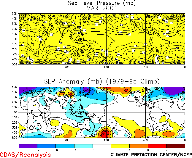
The sea level pressure pattern throughout the global Tropics during March featured a
wave-1 pattern with negative anomalies across the Indian Ocean, Indonesia and the western
Pacific and small positive anomalies elsewhere (Fig. T19).
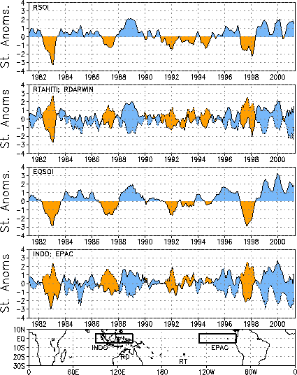
This pattern was associated with positive values of both the Southern Oscillation Index
(SOI) (0.5) and the equatorial SOI (1.9) during the month (Table
T1, Fig. T2). |


