|
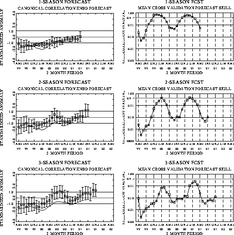
The canonical correlation analysis (CCA) forecast
of SST in the central Pacific (Barnett et al. 1988, Science, 241, 192-196;
Barnston and Ropelewski 1992, J. Climate, 5, 1316-1345), is shown in Figs.
F1 and F2. This forecast is produced
routinely by the Prediction Branch of the Climate Prediction Center. The predictions from
the National Centers for Environmental Prediction (NCEP) coupled ocean/atmosphere model
(Ji et al. 1998, Mon. Wea. Rev, 126, 1022-1034) are presented in Figs. F3 and F4. Predictions from the latest
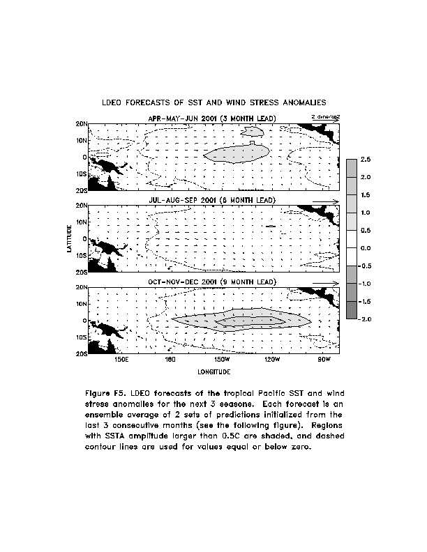
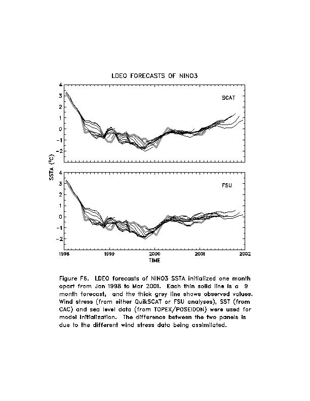
version of the LDEO model (Chen, D., M. A. Cane, S. E. Zebiak, Rafael Canizares and A.
Kaplan, 2000, Geophys. Res. Let., accepted) are shown in Figs. F5 and F6. Predictions using linear
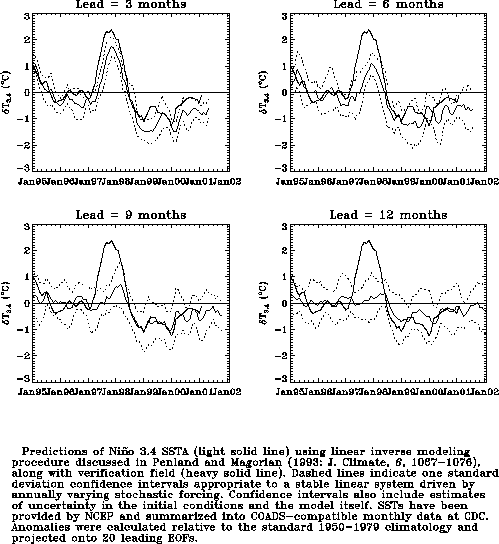
inverse modeling (Penland and Magorian 1993, J. Climate, 6, 1067-1076) are
shown in Figs. F7 and F8.
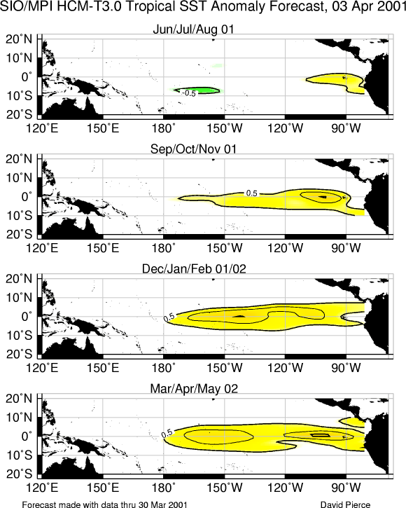
Predictions from the Scripps / Max Planck Institute (MPI) hybrid coupled model (Barnett et
al. 1993, J. Climate, 6, 1545-1566) are shown in Fig. F9.
The CPC and the contributors to the Forecast Forum caution potential users of
this predictive information that they can expect only modest skill.
Outlook
Cold episode (La Niña) conditions are expected to gradually weaken during the next few
months, followed by near-normal or slightly warmer-than-normal conditions during the
second half of 2001.
Discussion
Mature cold episode (La Niña) conditions continued in the tropical Pacific during
March, as sea surface temperatures (SSTs) remained in the range of 0.5°-1.0°C below
average across the central equatorial Pacific (Fig. T18).
Over the last two months the SSTs have become anomalously warm over most of the eastern
tropical Pacific. However, similar warming was observed in each of the past two years (Fig. T9) followed by cooling later in the NH spring as
cross-equatorial flow and warm season rainfall patterns became established over the
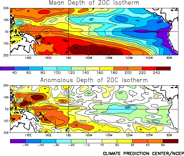
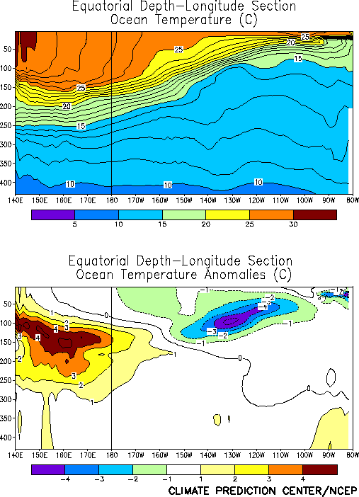
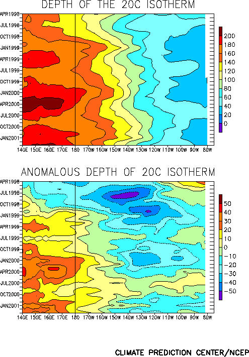
region. The slope of the oceanic thermocline remained greater than normal, with positive
(negative) subsurface temperature anomalies in the west-central (eastern) equatorial
Pacific (Figs. T16 and T17). This
pattern of anomalous subsurface temperatures has been highly persistent since mid-1998,
though its strength has exhibited a distinct annual cycle (Fig.
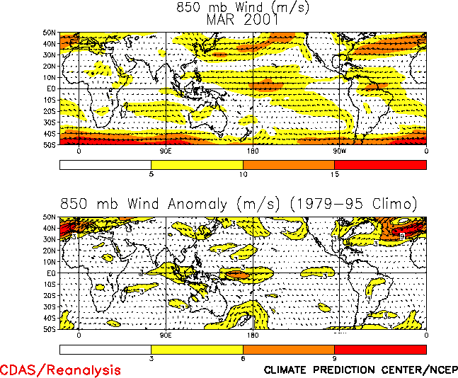
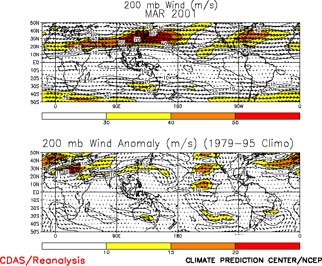
T15). The cooler-than-normal surface waters contributed to a vigorous Walker
circulation over the equatorial central Pacific (Fig. T29)
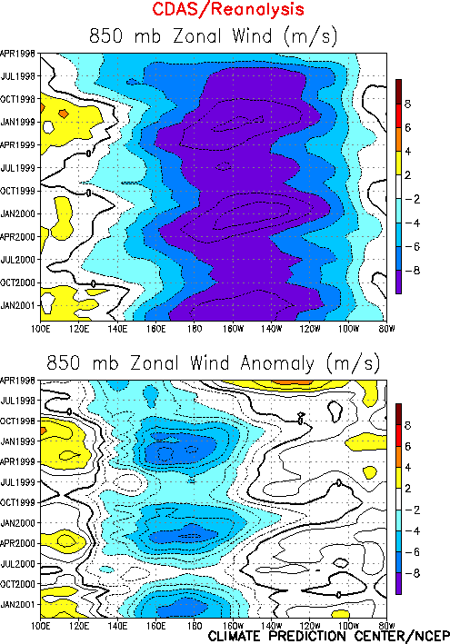
characterized by enhanced low-level easterlies (Fig. T20),
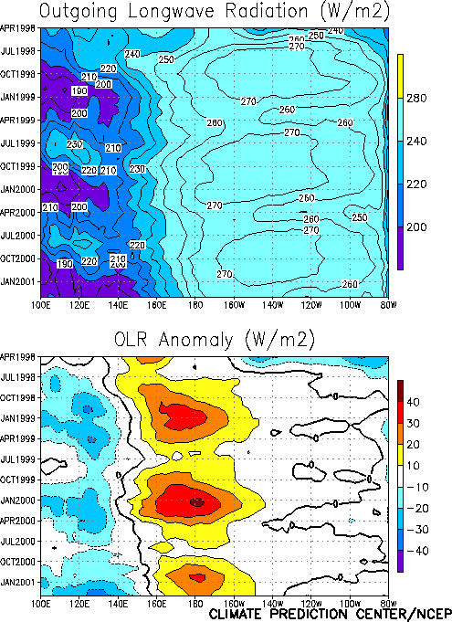
enhanced upper-level westerlies (Fig. T21), suppressed
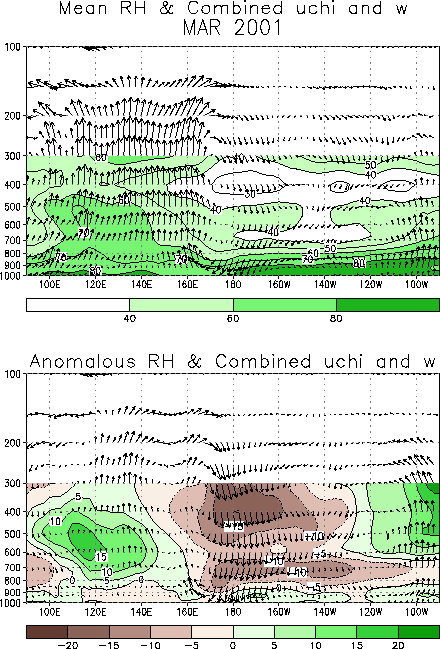
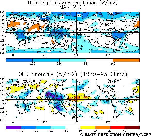
deep convection over the western and central equatorial Pacific, and enhanced deep
convection over Indonesia, the Phillippines, and northern Australia (Figs. T25 and E3). Overall, the patterns of
anomalous 850-hPa zonal wind and convection have shown remarkable similarity over the
central equatorial Pacific during the last three years, with a distinct annual cycle
featuring maxima in the low-level easterly winds (Fig. T7)
and maxima in the OLR anomalies (Fig. T8) during the
northern winter seasons.
Over the past two years there has been a gradual eastward expansion of the area of
positive subsurface temperature anomalies into the central Pacific (Fig.
T15). This evolution is consistent with a slow decay of the subsurface thermal
structure that characterizes the mature phase of cold episodes. Thus, it is likely that
cold episode conditions will gradually weaken over the next several months, with
near-normal conditions likely during the summer of 2001. This assessment is generally
supported by the most recent NCEP statistical (Figs. F1 and F2) and coupled model forecasts (Figs. F3
and F4), as well as by other available coupled model and
statistical model predictions (Figs. F5, F6,
F7, F8, F9),
which indicate a gradual weakening of cold episode conditions during the next few months.
Thereafter, the models indicate near-normal or slightly warmer-than-normal conditions
during the second half of 2001.
Weekly updates of SST, 850-hPa wind, OLR, and the equatorial subsurface temperature
structure are available on the Climate Prediction Center homepage at:
http://www.cpc.ncep.noaa.gov (Weekly Update).
|


