Tropical
Highlights - March 2000
Mature cold episode conditions continued throughout
the tropical Pacific during March, as sea surface temperatures (SST) remained more than
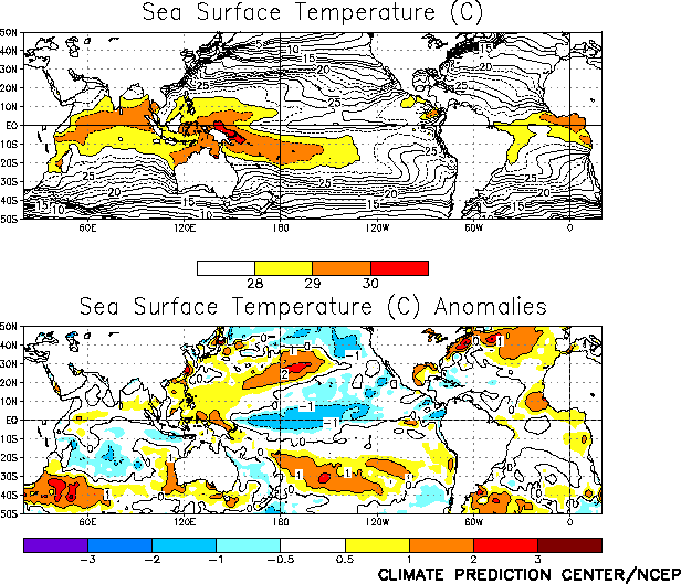
1.0°C below normal across the equatorial Pacific between 165°E and 135°W (Fig. T18). The region of negative SST anomalies has shifted
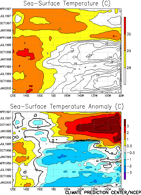
westward over the past few months (Fig. T9), with near
normal SSTs observed in the eastern Pacific during March (Fig. T18,
Table T2). This westward shift in the negative anomalies has
resulted in increases in the indices in the Niño 1+2, Niño 3, and Niño 3.4 regions (Table T2).
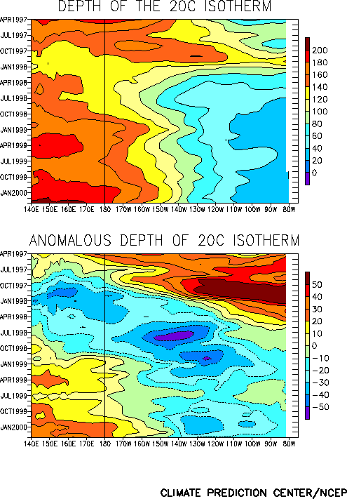
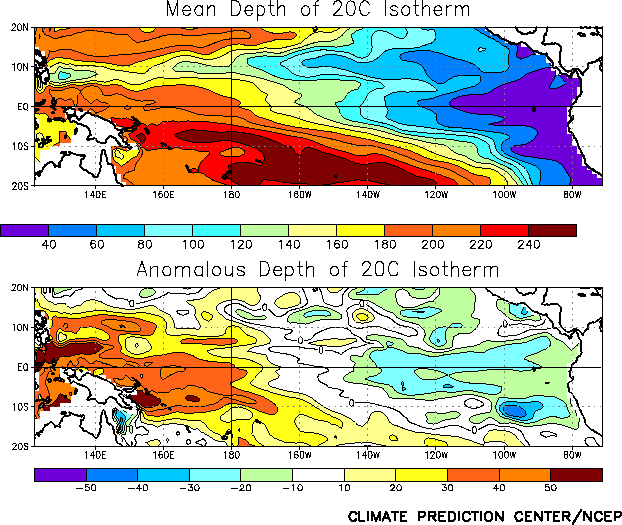
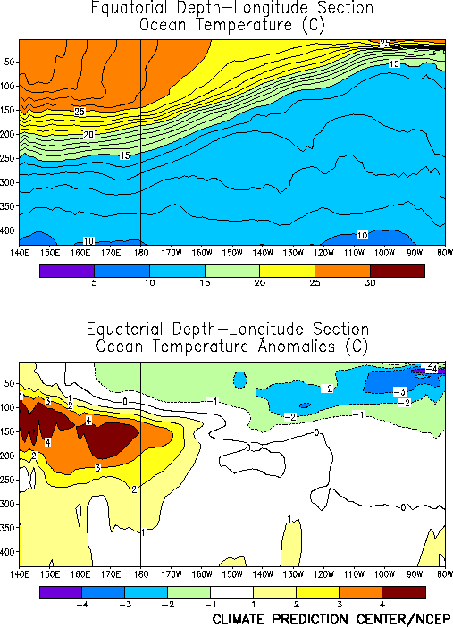
The oceanic thermocline was shallower than normal across the east-central and eastern
equatorial Pacific during the month, and deeper than normal in the west-central and
western Pacific (Fig. T15). The thermocline is more than
30 m deeper than normal in the west Pacific (Fig. T16),
which is the largest positive depth anomaly observed in this region in the last several
years. This deepening has been associated with oceanic temperatures more than 4.0°C above
normal at thermocline depth in this region (Fig. T17).
Across the east-central and eastern Pacific, the thermocline also deepened during the
month (Fig. T15), with anomalies at thermocline depth
decreasing from 6-7°C below normal during February to 2-3°C below normal during March
near 120°W (Fig. T17).
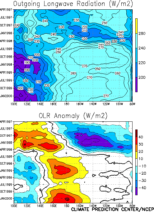
The pattern of tropical convection during March [as inferred from anomalous outgoing
longwave radiation (OLR)] was again consistent with mature cold episode conditions, with
suppressed convection observed over the western and central equatorial Pacific and
enhanced convection over Indonesia and the Indian Ocean (Fig. T25).
This pattern has persisted since the onset of cold episode conditions in late May 1998 (Fig. T8). Elsewhere, convection was again enhanced during the
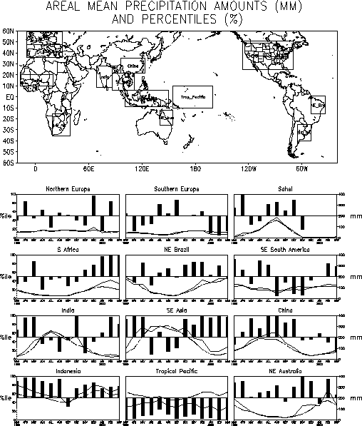
month over southeastern Africa, with rainfall totals ranking above the 95th
percentile for the third consecutive month (Figs. E3, E4).
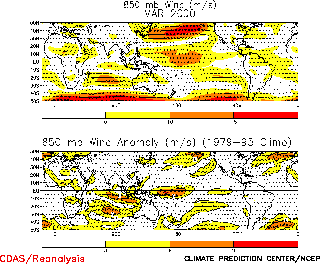
The pattern of tropical convection over the central and western Pacific was accompanied
by an enhanced Walker circulation across the equatorial Pacific (Fig.
T29). This enhanced circulation was associated with low-level (850 hPa) easterly
wind anomalies across the central and western tropical Pacific, with anomalies greater
than 6 m s-1 located between 160°E and 170°W (Fig.
T20). In contrast, westerly wind anomalies were observed over the eastern and
east-central equatorial Pacific, which contributed to a local deepening of the thermocline
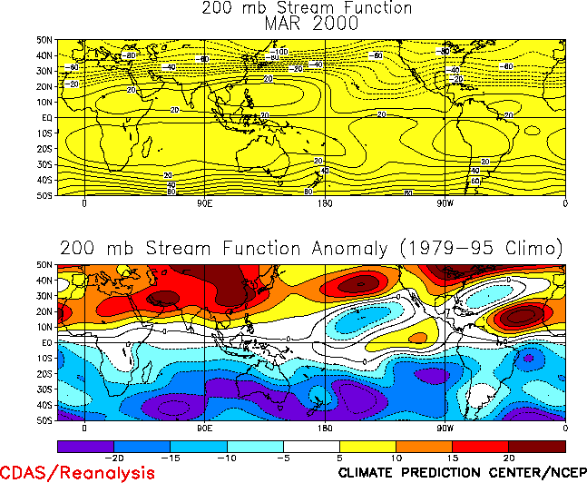
and increased SST anomalies in that region. At upper-levels (200-hPa), troughs were
observed over the low-latitudes of the central Pacific in both hemispheres, while
amplified subtropical and lower mid-latitude ridges were observed across most of the
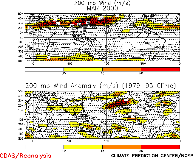
remainder of both hemispheres (Fig. T22). The upper-level
troughs were associated with enhanced equatorial westerlies across the central Pacific (Fig. T21), which are also a feature common to cold episodes.
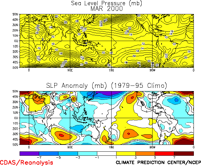
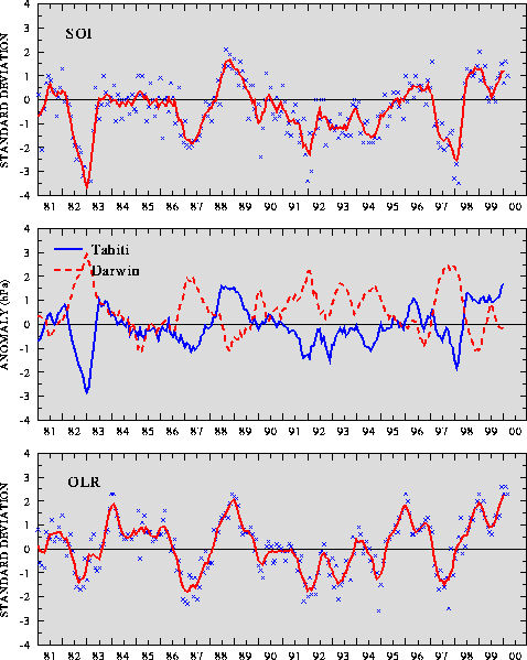
The sea level pressure (SLP) pattern across the Tropics during March featured positive
anomalies across the tropical central and eastern Pacific and negative anomalies extending
from the Atlantic Ocean eastward to Indonesia (Fig. T19).
The pattern across Indonesia and the Pacific Ocean is consistent with the ongoing cold
episode (Fig. T19), and was associated with positive
values of the Southern Oscillation Index (1.0)(SOI) (Table T1,
Fig. T1), and the equatorial SOI (2.5) (Fig.
T2). |


