Tropical Highlights - February 1999
Strong cold episode (La Niña) conditions dominated the tropical Pacific during
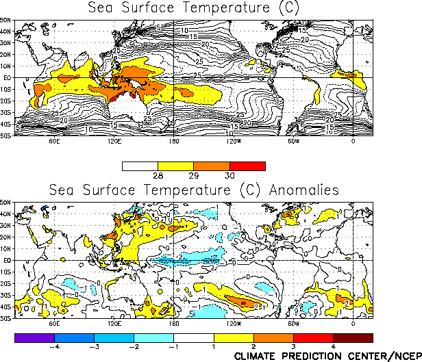
February 1999. Sea surface temperatures (SSTs) remained well below normal across the
central equatorial Pacific during the month, with SSTs more than 1°C below normal
observed from 165°E to 110°W, and more than 2.0°C below normal from 170°E to 165°W (Fig. T18). However, SSTs east of 120°W warmed during late
February, with positive SST anomalies appearing in many locations (not shown). This
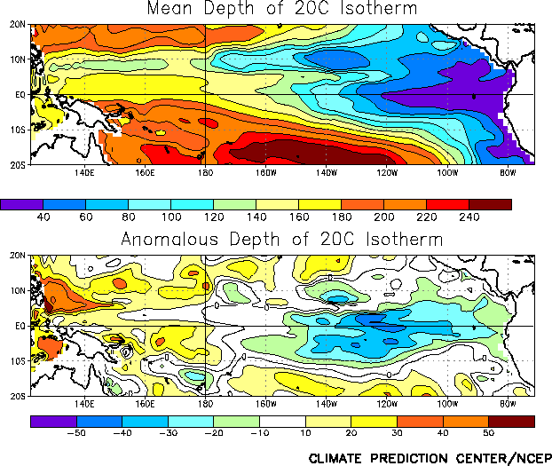
warming will likely be short-lived, as the thermocline remained shallower than normal
throughout the central and eastern Pacific during the month (Fig.
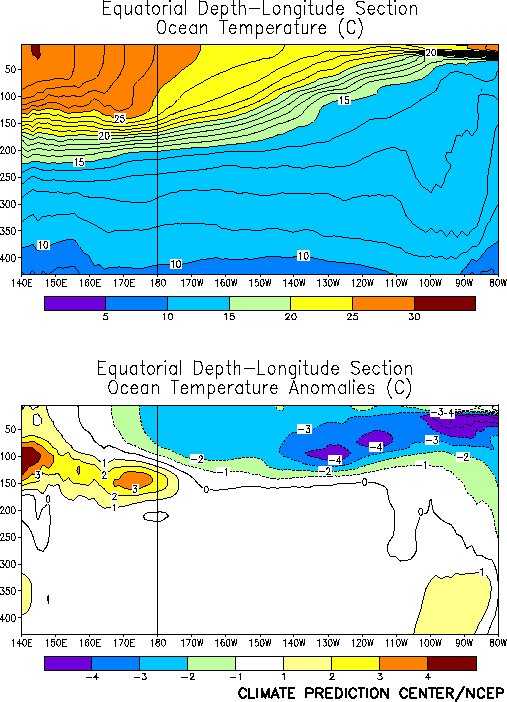
T16). Consistent with this sub-surface oceanic structure, equatorial ocean
temperatures at thermocline depth were below normal (more than 4°C) in the central and
eastern Pacific, and above-normal in the western Pacific (Fig. T17).
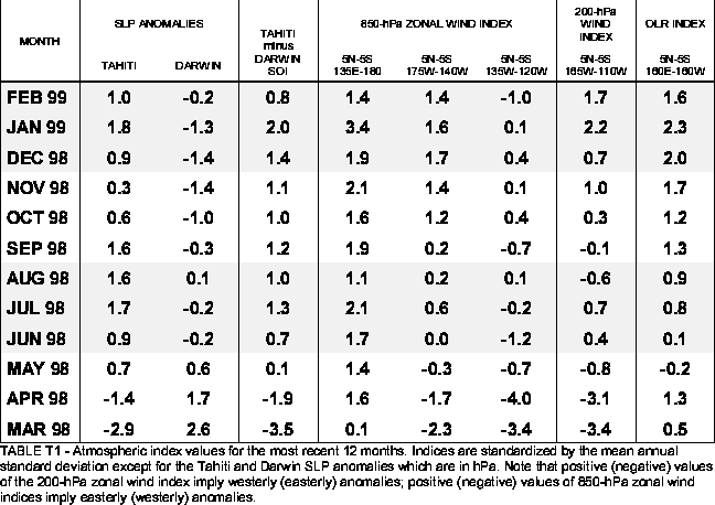
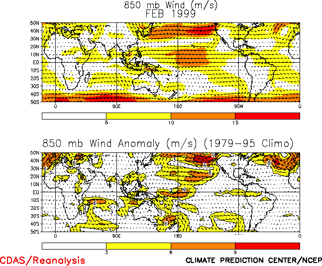
The low-level (850-hPa) equatorial winds were stronger than normal across the central
equatorial Pacific (3-6 ms-1) during February and weaker than normal across the
eastern Pacific (Table T1, Fig. T20).
An abrupt weakening of the easterly winds over the eastern Pacific during the month was
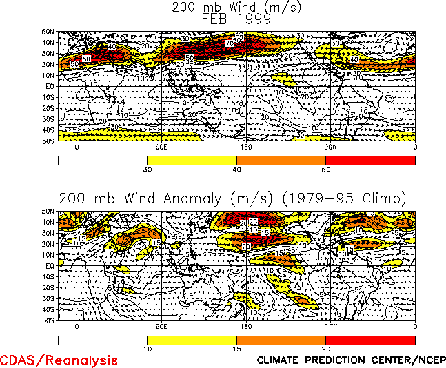
associated with the increase in SSTs east of 120°W. At upper levels, enhanced equatorial
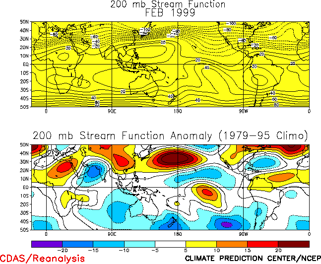
westerly winds were observed over the central Pacific during February (Table T1, Fig T21). This feature was
associated with an enhanced equatorial Walker circulation (Fig.
T29), and with an anomalous subtropical cyclonic circulation couplet
located to the east of the region of suppressed convection (Fig. T21,
T22).
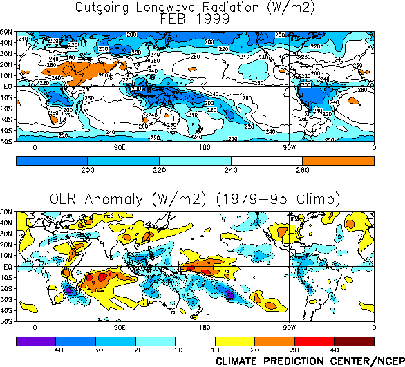
Tropical convection during February [as inferred from anomalous outgoing longwave
radiation (OLR)] was again suppressed across the western and central equatorial Pacific
and enhanced across Indonesia (Fig. T25 ). This pattern has
persisted since June 1998 and is consistent with a continuation of mature cold episode
conditions (Fig. T11).
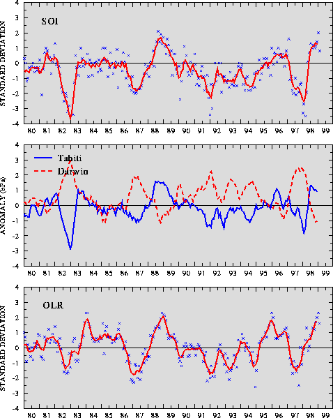
The Southern Oscillation Index (SOI) was 0.8 in February, which is the first time it
has been less than 1.0 since July 1998 (Table T1, Fig. T1). The February value of the equatorial SOI was 1.8, and
has exceeded 1.0 for the past 4 months (Fig. T2). These
index values have been associated with above-normal sea level pressure (SLP) over the
central Pacific and below-normal SLP over Indonesia and the eastern Indian Ocean (Fig. T19 ), and are consistent with ongoing strong cold episode
conditions.
|


