|
Extratropical Highlights - February 1999
1. Northern Hemisphere
a. North Pacific
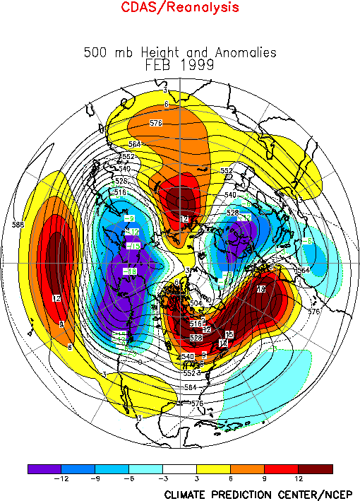
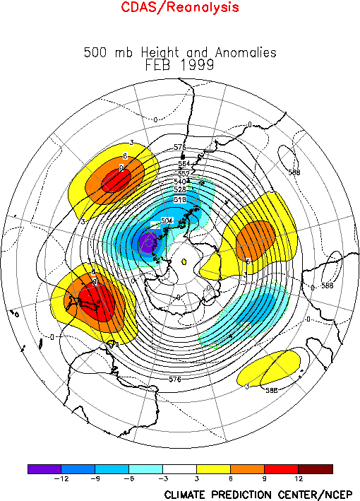
The circulation over the North Pacific during February featured below-normal heights at
high latitudes and above-normal heights in the middle latitudes (Fig.
E9). In the subtropics, an anomalous anticyclonic (cyclonic) circulation covered
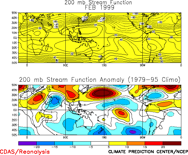
the western (eastern) half of the North Pacific (Fig. T22,
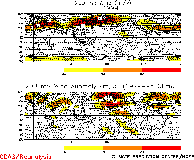
bottom). Overall, these conditions reflected a northward shift of the East Asian jet
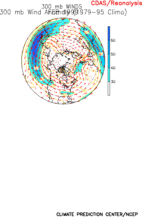
stream to approximately 40°N (Fig. T21 ), well north of
its climatological mean position near 32.5°N. They also reflected a retraction of the
mean subtropical ridge to well west of the date line and a strengthening of the
mid-Pacific trough in the region east of the date line. Accompanying this structure was an
extremely well developed diffluent flow and jet exit region across the eastern subtropical
North Pacific. The conditions in the middle latitudes and subtropics reflected increased
zonal variability of the height, wind and temperature fields, and are linked to the
increased east-west gradient in deep tropical heating associated with ongoing strong La
Niña conditions. Similar circulation features were also evident over the subtropical
South Pacific.
The overall northward shift of the wintertime jet stream across the North Pacific
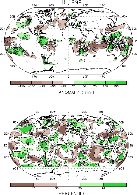
contributed to a continuation of well above-normal precipitation in the Pacific Northwest
of the United States (Figs. E3, E5),
and to a continuation of suppressed rainfall across the southwestern and southern states.
During February, near-record high precipitation totals were observed in the Pacific
Northwest (Fig. E5), while well below-normal rainfall
was recorded in the Gulf Coast states. Below-normal precipitation was also observed in the
Great Plains and Southeast regions during the month (Fig. E5).
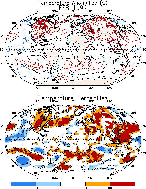
Extremely warm surface temperatures covered North America during February (Fig. E1), with temperatures 4-6°C above normal extending
from northeastern Mexico northward to central Canada. This warmth was linked to broad
zonal flow across the United States and southwesterly flow across western and central
Canada, in association with a pronounced weakening of the Hudson Bay Low and the
establishment of a large-amplitude trough over the Gulf of Alaska (Fig.
E9).
b. North Atlantic and Europe
The circulation during February featured above-normal heights across the middle
latitudes of the North Atlantic (Fig. E9 ) and
below-normal heights across Scandinavia and the eastern half of Europe. This circulation
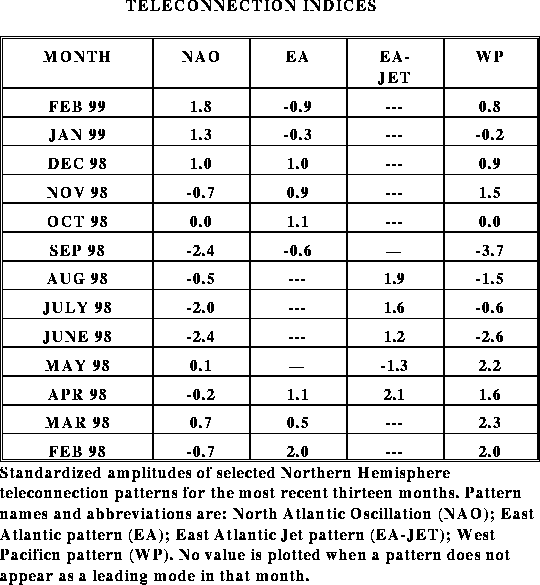
reflected the continuation of a strong positive phase of the North Atlantic Oscillation
(NAO) (Table E1, Figs. E6, E7), which has prevailed for the past three months. It also
reflected a strong negative phase (-1.7) of the Scandinavia teleconnection index. These
conditions were accompanied by an enhanced (20 m s-1 stronger than normal) jet
stream across the high latitudes of the eastern North Atlantic (Fig.
E10), and suppressed upper-level westerlies (15 m s-1 weaker than
normal) across the central North Atlantic.
Accompanying this circulation, significantly below-normal precipitation covered the
eastern North Atlantic in the vicinity of the mean upper-level ridge, and well
above-normal precipitation was observed across eastern Europe and portions of Scandinavia
in the vicinity of the mean upper-level trough. In the Alps, a series of major snowstorms
during the month caused deadly avalanches and cut off entire towns from outside
communications. The persistent of the mean large-scale trough over this region contributed
to this enhanced snowfall by favoring recurring cyclogenesis in essentially the same
geographic region.
Farther east, the combination of a large-scale trough across Europe and a ridge over
central Russia contributed to broad southwesterly flow and abnormally warm surface
temperatures across central Russia and central Siberia. |


