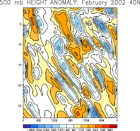
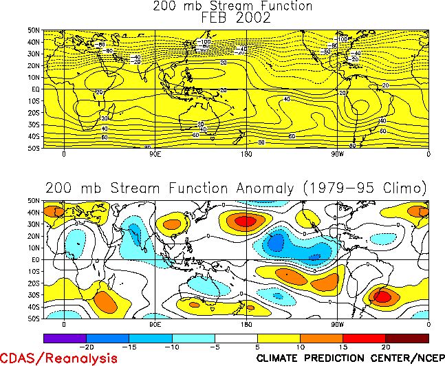
The Northern Hemisphere circulation
during February featured a persistent pattern of above-average 500-hPa heights in the
middle latitudes, and below-average heights at high latitudes (Figs. E10, E12, E13).
The notable zonal symmetry of this anomaly pattern is consistent with the positive phase
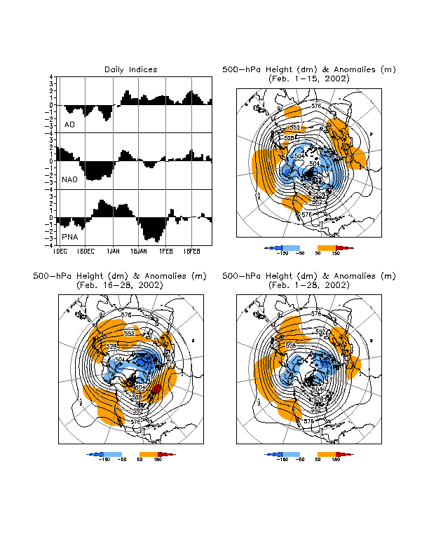
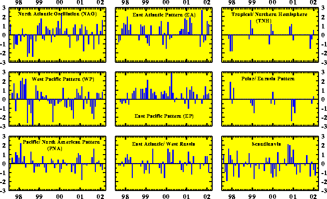
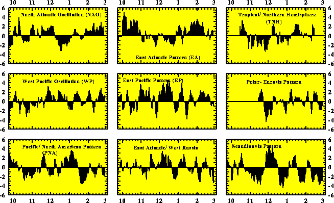
of the Arctic Oscillation (Fig. A2.2, top left). This
circulation was associated with well above-average surface temperatures over central North
America, Europe, and Asia (Fig. E1), which resulted in
hemispheric mean temperatures averaging near 1°C above normal
for a second consecutive month (Fig. E2). It was also
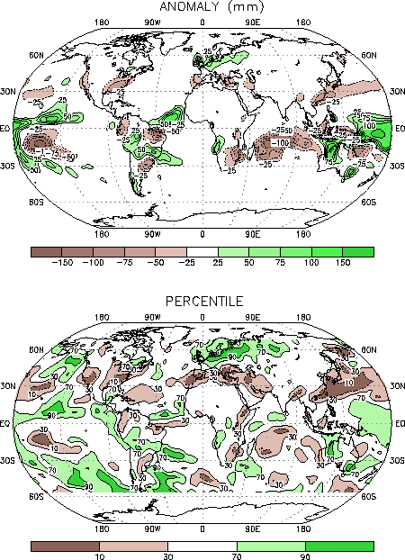
associated with a north-south dipole of precipitation anomalies in the middle latitudes,
which featured below-average rainfall over most of the latitude band between 30°N-40°N, and above-average precipitation
and increased storminess over large portions of the hemisphere between 50°N-60°N (Fig. E3 bottom).a. North America
The circulation over North America featured above-average heights in the western United
States in association with an amplified upper-level ridge, and below-average heights over
western Alaska in association with a very persistent and intense upper-level trough (Fig. E10). This anomaly pattern was associated with an
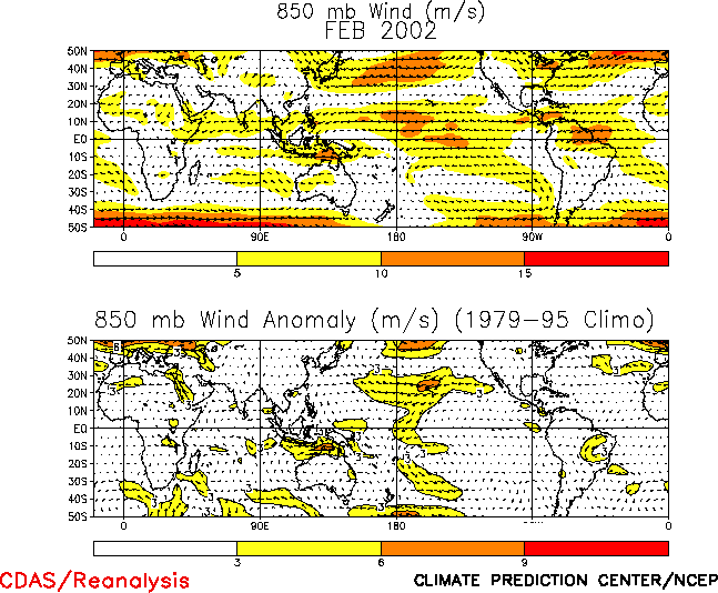
enhanced westerly flow of marine air into western and central Canada (Figs. E11 right, T20), and resulted in
exceptionally warm surface temperatures (3°-4°C above average and exceeding the 90th
percentile) across south-central Canada and both the north-central and northeastern United
States.
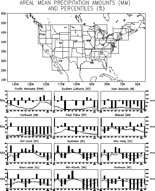
In the United States precipitation totals during February were below average in the
east, the southwest, California, and the inter-mountain region of the west (Figs. E3, E5). Precipitation has been
significantly below average in the Ohio Valley region since August 2001. Precipitation has
also been below average in the Mid-Atlantic region since October 2001, in the Northeast
since April 2001, and in the Southwest and Inter-Mountain regions since May 2001. In the
East the combination of above-average temperatures and below-average precipitation led to
reduced snow cover extent across Ohio and Pennsylvania. In the Northern Plains the
excessive February warmth also led to a reduced snow cover and snow cover extent.
b. Europe and Asia
Over the North Atlantic the 500-hPa circulation during February featured below-average
heights at high latitudes and above-average heights in the middle latitudes (Fig. E10). This anomaly pattern projected strongly onto the
positive phases of both the North Atlantic Oscillation (NAO) and the East Atlantic
teleconnection pattern (Figs. E7, E8, Table E1). This circulation was associated with enhanced jet
stream winds and increased storm activity across northern Europe, southern Scandinavia,
and western Russia (Fig. E11, right), which contributed to
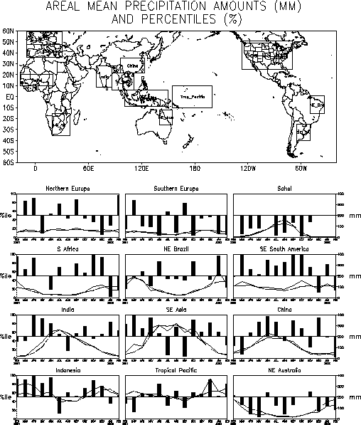
significantly above-average precipitation (Figs. E3, E4) and surface temperatures (Fig. E1).
In each of these regions monthly mean precipitation totals and surface temperatures
exceeded the 90th percentile.
To the south of the main Atlantic jet stream above-average 500-hPa heights and reduced
storm activity led to significantly below-average precipitation across southern Europe and
the Mediterranean Sea during the month, with totals in many locations dropping below the
10th percentile. The corresponding lack of any significant cold-air outbreaks
also contributed to above-average surface temperatures in this area, with monthly mean
values again exceeding the 90th percentile at many locations.
Above-average 500-hPa heights and record/ near-record surface temperatures also covered
most of Asia during February, including almost all of the Middle East, Russia and China.
The largest temperature anomalies averaged +6°C to +8°C and extended from west-central
Russia to Mongolia. In southern Russia this anomalous warmth was accompanied by reduced
snow cover extent and an overall northward retreat of the main winter snow pack.
Accompanying these conditions significantly below-average precipitation was observed
across the Middle East and most of southern and eastern China.
2. Southern Hemisphere
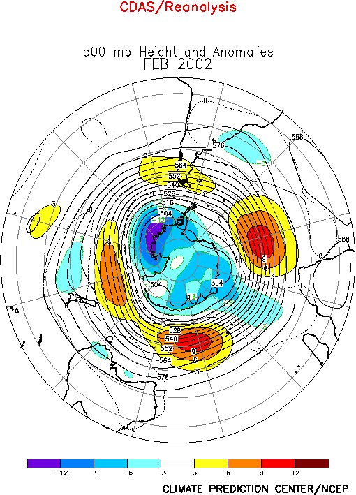
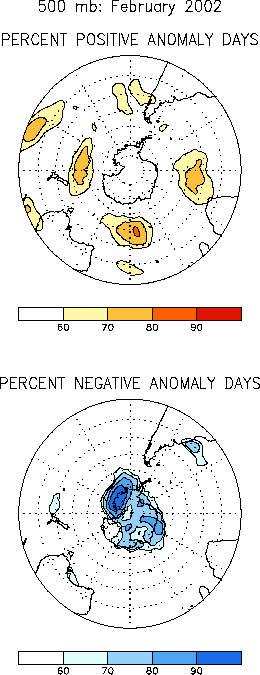
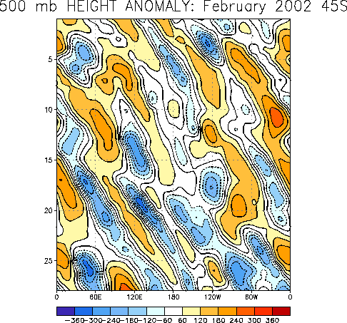
The Southern Hemisphere circulation during February featured positive 500-hPa height
anomalies across the middle latitudes, and negative height anomalies over the high
latitudes of the eastern South Pacific (Fig. E16, E18, E19). This overall anomaly pattern
has persisted since October, and has been associated with below-average surface
temperatures over large portions of southern Australia throughout the period (Fig. E1).
In southern Africa below average rainfall was observed during February, in
association with anticyclonic circulation anomalies at 200-hPa throughout the region (Figs.
T22, E17) and a poleward shift of
the main belt of westerlies to well south of the continent (Fig.
E17). The South African monsoon season typically lasts from November-April. To
date the heavy agricultural region of eastern South Africa recorded above-average rainfall
in both November and December, and below-average rainfall in January and February (Fig. E4).


