Tropical
Highlights - February 2001
Mature cold episode conditions continued across the
tropical Pacific during February 2001, as sea surface temperatures (SSTs) remained more
than 1.0°C below normal across the central equatorial Pacific between 165°E and 165°W (Fig. T18). Significantly, SSTs in this region were again well
below 28°C, which is sufficient to suppress convective activity over the central
equatorial Pacific (Fig. T18, top).
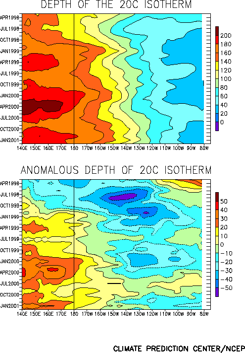
Consistent with the pattern of SST anomalies, the equatorial oceanic thermocline
remained shallower than normal across the eastern Pacific and deeper than normal in the
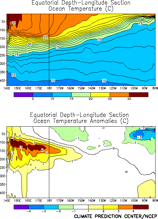
western Pacific (Fig. T15). Also, subsurface oceanic
temperatures remained more than 4°C above normal in the western Pacific, and more than
3°C below normal in the eastern Pacific (Fig. T17).
During February, the thermocline shoaled between the date line and 125°W (Fig. T15), which resulted in a lessening of the
temperature gradient across the central Pacific at thermocline depth.
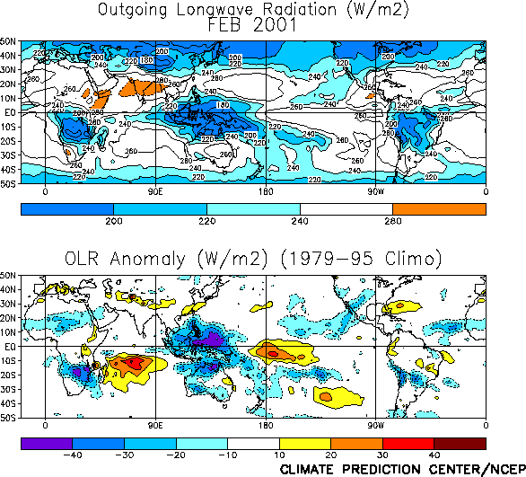
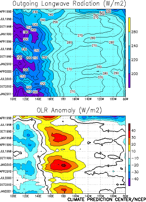
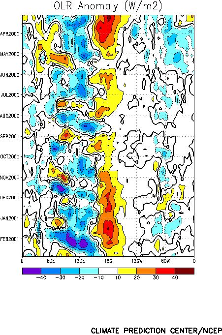
Tropical convection during February remained below normal over the west-central and
central Pacific [as inferred from positive anomalies of outgoing longwave radiation (OLR)]
and well above normal over the extreme western Pacific, Indonesia, and northern Australia
(Fig. T25). This pattern of anomalous convection is
consistent with La Niña conditions and has largely persisted since mid-1998 (Fig. T8). Intraseasonal activity (Madden-Julian
Oscillation-MJO) intensified during February (Fig. T11),
as a strong MJO enhanced convection over the Indian Ocean and Indonsesia.
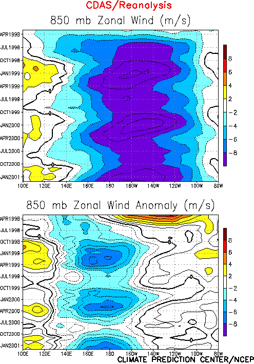
The anomalous tropical convection during February was associated with low-level (850
hPa) easterly wind anomalies over the western equatorial Pacific and westerly wind
anomalies over the eastern Indian Ocean (Figs. T7, T20, and Table T1). Enhanced
equatorial easterlies have persisted across the western and central Pacific since the
onset of cold episode conditions in mid-1998 (Fig. T7). At
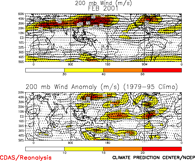
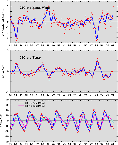
upper levels, large westerly wind anomalies (15 - 20 ms-1) over the central
equatorial Pacific were associated with strong cyclonic circulation anomalies flanking the
region of suppressed convection (Fig. T21, T22). This resulted in a 200-hPa zonal wind index value of 3.0,
equaling the largest value observed (February 1989) in the historical record dating back
to 1979 (Fig. T3). This pattern of upper-level and lower
level wind anomalies is consistent with an increased strength of the equatorial Walker
circulation (Fig. T29).
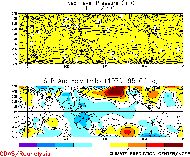
The sea level pressure (SLP) pattern throughout the global Tropics during February
featured negative anomalies throughout most of the Tropics (Fig.
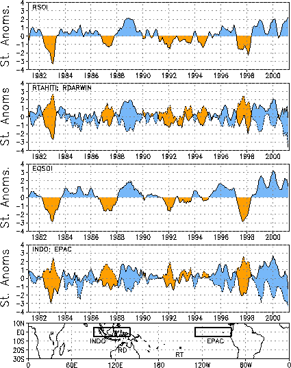
T19). This pattern was associated with positive values of both the Southern
Oscillation Index (SOI) (1.5) and the equatorial SOI (1.4) during the month (Table T1, Fig. T2), with much of the
contribution to these values coming from the large negative values at Darwin (-2.9) and
Indonesia. The value at Darwin is the largest negative value since November 1973. |


