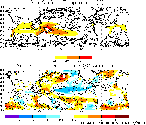
Mature cold episode conditions continued throughout
the tropical Pacific during February, as sea surface temperatures (SST) remained more than
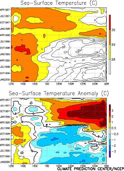
1.0°C below normal across the equatorial Pacific between 165°E and 115°W (Fig. T18). Over the past few months, the region of largest
negative SST anomalies has shifted westward from 120°W to 150°W (Fig.
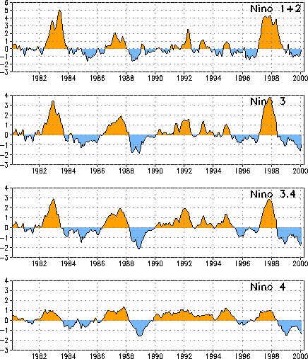
T9). Associated with this shift, the SST indices in the Niño 3 and Niño 3.4
regions increased during February to -0.9 and -1.5, respectively, while the Niño 4 index
decreased to -1.4 (Table T2, Fig.
T5).
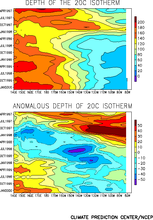
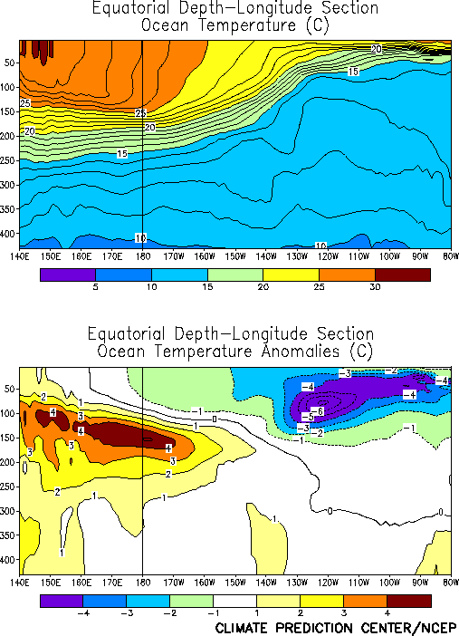
The oceanic thermocline remained shallower than normal across the east-central and
eastern equatorial Pacific during the month, and deeper than normal in the west-central
and western Pacific (Fig. T15). Over the past few months,
the thermocline has deepened in the region between the date line and 150°W. This
evolution is typical of mature cold episode conditions, and is often seen several months
prior to the decay phase of a cold episode. Temperatures at thermocline depth remained
more than 4°C below normal in the east-central Pacific, with the largest negative
anomalies of more than -7°C observed near 120°W. In contrast, subsurface temperatures
were more than 4°C above normal in the western and west-central Pacific (Fig. T17).
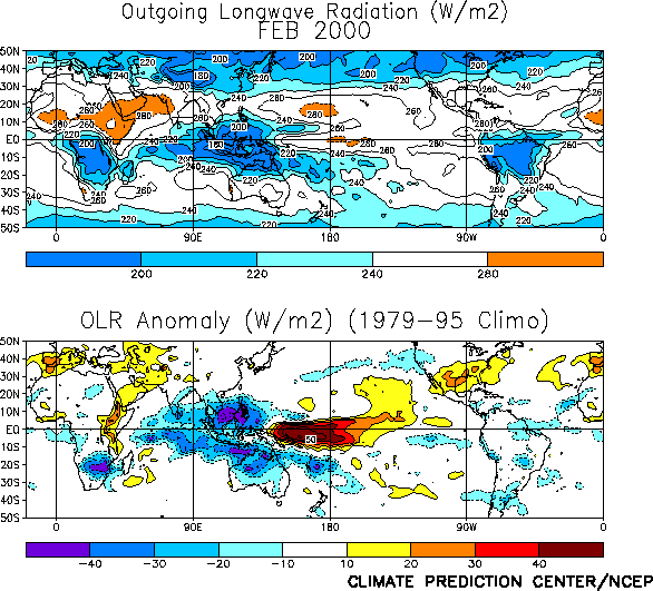
Tropical convection [as inferred from anomalous outgoing longwave radiation (OLR)] was
suppressed over the western and central equatorial Pacific and enhanced over Indonesia and
the Indian Ocean during February(Fig. T25). This pattern
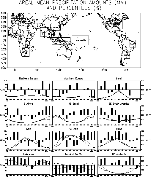
has persisted since the onset of cold episode conditions in late May 1998 (Fig. T8). Elsewhere, convection was enhanced during the month
over southern Africa, which produced torrential rains and devastating floods in Mozambique
(Fig. E3, E4).
The pattern of tropical convection over the central and western Pacific was accompanied
by an enhanced Walker circulation across the equatorial Pacific (Fig.
T29). This enhanced circulation was associated with low-level (850 hPa) easterly
wind anomalies across the central and western tropical Pacific, with anomalies greater
than 9 m s-1 located between 160°E and 175°W (Fig.
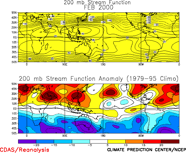
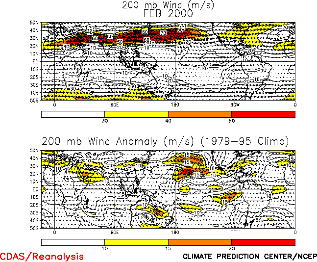
T20). At upper-levels (200-hPa), well-developed troughs were observed over the
low-latitudes of the central Pacific in both hemispheres, while amplified subtropical and
lower mid-latitude ridges were observed across most of the remainder of both hemispheres (Fig. T22). The upper-level troughs were associated with
enhanced equatorial westerlies across the central Pacific (Fig.
T21), which are also a feature common to cold episodes.
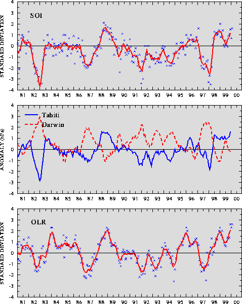
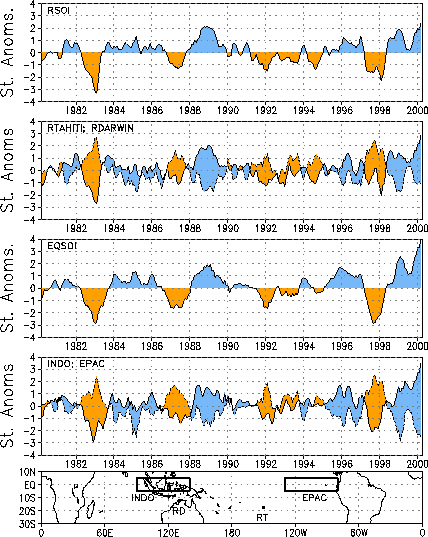
The sea level pressure (SLP) pattern during February featured large positive anomalies
across the tropical central and eastern Pacific and negative anomalies over Indonesia and
the Indian Ocean. This pattern is consistent with the ongoing cold episode (Fig. T19), and was associated with a large positive value
(1.6) of the Southern Oscillation Index (SOI) (Table T1, Fig. T1), and with the largest positive value of the equatorial
SOI (3.9) in the historical record back to 1958 (Fig. T2).
This record value was associated with a record positive standardized SLP anomaly of 3.5 in
the eastern Pacific region.


