|
|
HOME > Climate & Weather Linkage > Southern Hemisphere Storm Track Monitoring
|
| |

|
| |
|
|
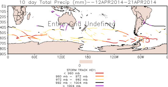
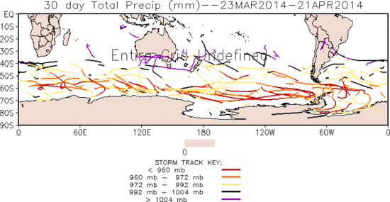
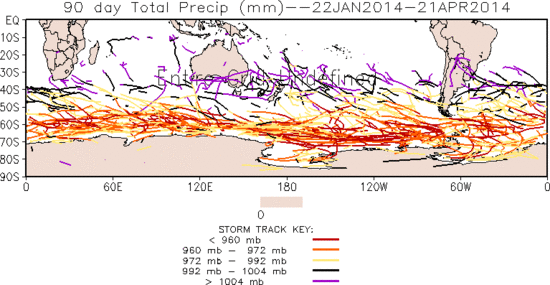
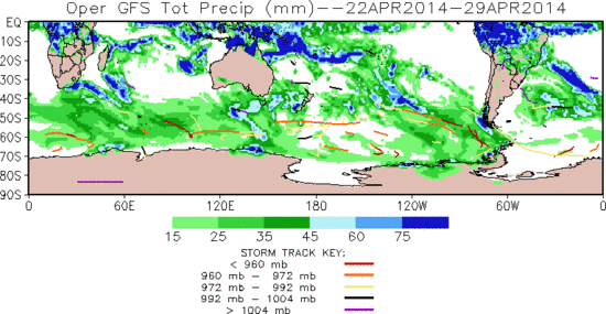
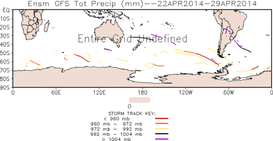
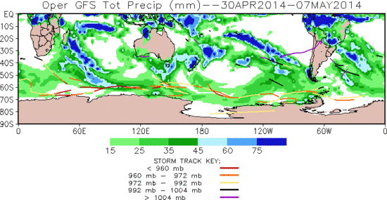
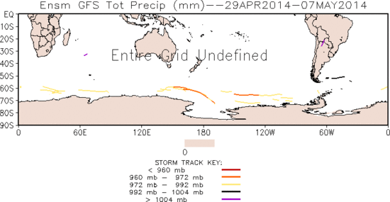
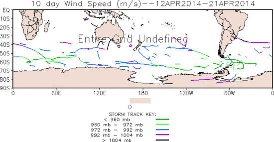
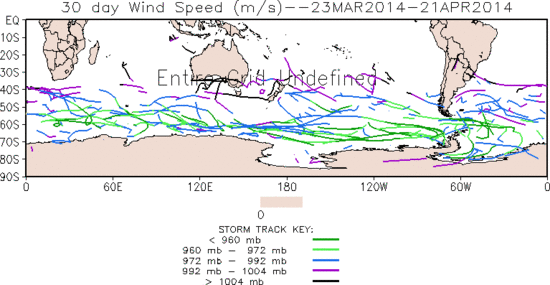
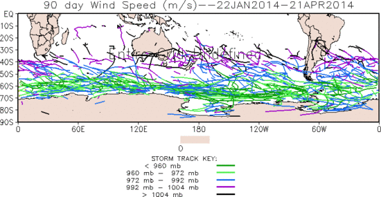
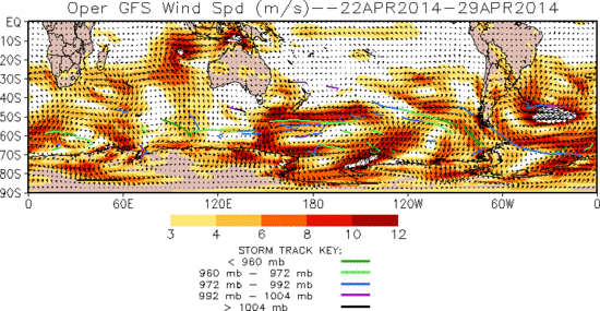
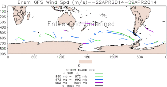
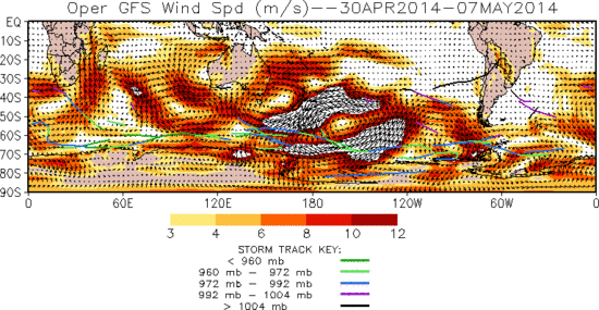
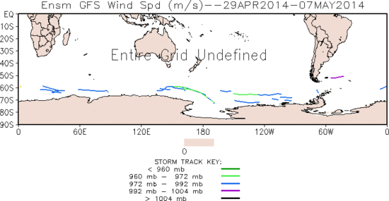
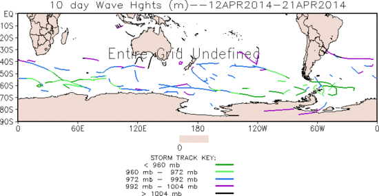
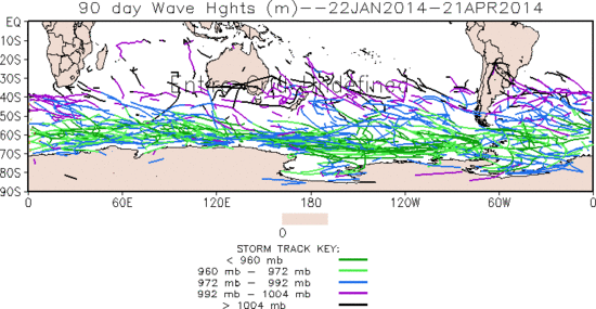
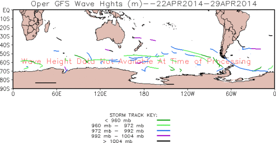
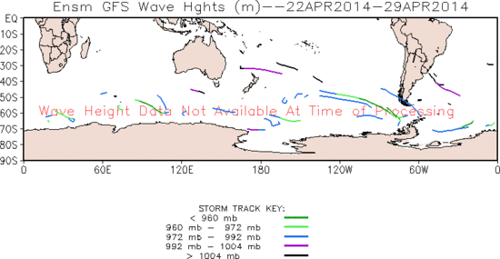
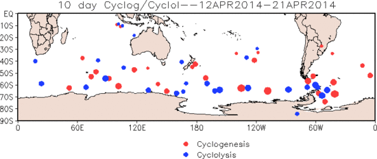
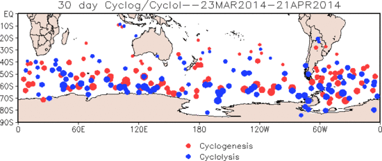
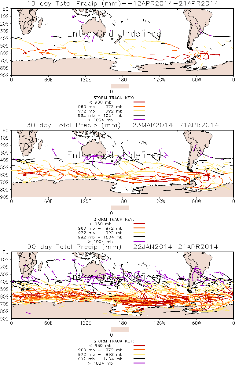
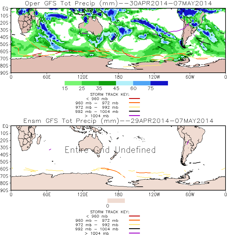
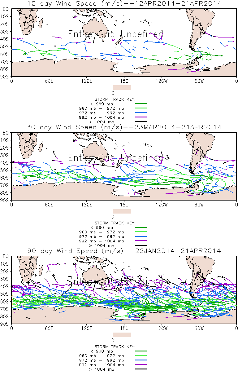
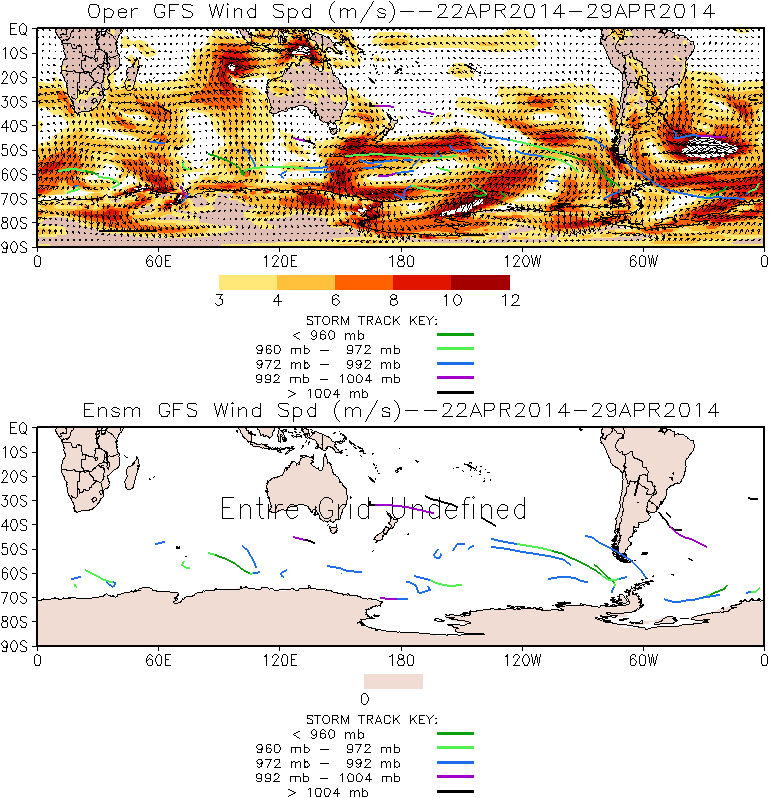
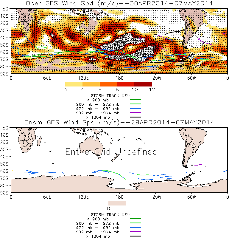
Storm tracks are based on an algorithm developed at the Climate Diagnostics Center (CDC) [Serreze (1995), and Serreze et al. (1997)]. Storm tracks are identified by locating grid points in which the sea level pressure (SLP) is less than its surrounding grid points by at least 1 hPa. The storms are tracked by analyzing the position of systems between time steps and applying a maximum distance threshold between candidate pairings (800 km) and additional other quality control checks. Red/blue dots indicate active storms as of 18 UTC for the respective plot ending date.
|
- Short-term Monitoring, Outlooks, and Assessment
|
|
Note: Move cursor over product name to display the graphic.
|
|
|
|
|
| | |
|
[Back to the Top]
|
| |
|
|
| |
|
[Back to the Top]
|
|
|
|
Eichler, T. and R. W. Higgins, 2006: Climatology and ENSO-Related Variability of North American Extratropical Cyclone Activity, J. Climate, Accepted.
|
| |
|
Serreze, M. C., 1995: Climatological Aspects of Cyclone Development and Decay in the Arctic, Atmos.-Ocean, 33, 1-23.
|
| |
|
Serreze, M. C., F. Carse, R.G. Barry and J.C. Rogers, 1997: Icelandic Low Cyclone Activity: Climatological Features, Linkages with the NAO and Relationships with Recent Changes in the Northern Hemisphere Circulation, J. Climate, 10, 453-464.
|
|
| |
|
[Back to the Top]
|
|


